TopoQuest Logo
Do you find TopoQuest useful?
Help keep TopoQuest running and adding new maps/features by donating!
Bitcoin:  19c7KJd3qBynnjoSw5npx9KScwjBe4ifkT
Litecoin:  LXs6TkuXGGXo1vDsWCkWVdjQX94eUKd6ui
Home View Maps Find Maps Find Places Resources & Links


Buena Vista Lake Bed, California Topographic Map

USGS Map Title: Buena Vista Lake Bed, CA
USGS Map MRC: 35119B3
DRG (GeoTIFF) Download: o35119b3.tif


Neighboring USGS Topographic Map Quads:


  East Elk Hills, CA  
35119C4
 

  Tupman, CA  
35119C3
 

  Stevens, CA  
35119C2
 

  Taft, CA  
35119B4
 

  Buena Vista Lake Bed, CA  
35119B3
 

  Millux, CA  
35119B2
 

  Maricopa, CA  
35119A4
 

  Pentland, CA  
35119A3
 

  Conner SW, CA  
35119A2


Map MRC Location:

N36°
W120°
N36°
W119°
H8 H7 H6 H5 H4 H3 H2 H1
G8 G7 G6 G5 G4 G3 G2 G1
F8 F7 F6 F5 F4 F3 F2 F1
E8 E7 E6 E5 E4 E3 E2 E1
D8 D7 D6 D5 D4 D3 D2 D1
C8 C7 C6 C5 C4 C3 C2 C1
B8 B7 B6 B5 B4 B3 B2 B1
A8 A7 A6 A5 A4 A3 A2 A1
N35°
W120°
N35°
W119°

Buena Vista Lake Bed, CA USGS 1:24K Topographic Map Preview:
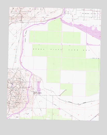
Buena Vista Lake Bed, CA USGS Topographic Map
Click on map above to begin viewing in our Map Viewer.

This topographic map contains these locations and features:
Feature Name Type Latitude Longitude GNIS ID View Map
Buena Vista 732 DamDamN35.2333°W119.3093°1664025View Map
Buena Vista 735-002 DamDamN35.2333°W119.2926°1664029View Map
Buena Vista Aquatic Recreational AreaParkN35.2250°W119.2667°2359830View Map
Buena Vista CreekStreamN35.2033°W119.3573°255379View Map
Buena Vista Lake (historical)LakeN35.1919°W119.2946°1683006View Map
Buena Vista Lake BedFlatN35.1950°W119.2973°239797View Map
Buena Vista ParkParkN35.2386°W119.3276°239798View Map
Buena Vista Pumping PlantLocaleN35.1605°W119.3468°1654570View Map
Buena Vista ValleyValleyN35.2033°W119.3590°255381View Map
Compressor Station Number 40 (historical)LocaleN35.1286°W119.3729°1683005View Map
Dustin Acres Census Designated PlaceCensusN35.2159°W119.3750°2408697View Map
Kyan (historical)Populated PlaceN35.1252°W119.2626°1662032View Map
Lake EvansLakeN35.2333°W119.2986°2359829View Map
Lake WebbLakeN35.2227°W119.2603°2359809View Map
Pelican Island (historical)IslandN35.2108°W119.2676°1662047View Map
Richfield Oil Pumping StationLocaleN35.1547°W119.3362°248170View Map
Sandy CreekStreamN35.1555°W119.3221°249015View Map
West Kern DivisionCivilN35.1254°W119.3645°1935373View Map

Note: Coordinates in the location and feature list above are referenced to NAD83 datum.


Copyright (C) 2008-2024 Ryan Niemi / Sunset Dynamics ... All Rights Reserved