TopoQuest Logo
Do you find TopoQuest useful?
Help keep TopoQuest running and adding new maps/features by donating!
Bitcoin:  19c7KJd3qBynnjoSw5npx9KScwjBe4ifkT
Litecoin:  LXs6TkuXGGXo1vDsWCkWVdjQX94eUKd6ui
Home View Maps Find Maps Find Places Resources & Links


Stevens, California Topographic Map

USGS Map Title: Stevens, CA
USGS Map MRC: 35119C2
DRG (GeoTIFF) Download: o35119c2.tif


Neighboring USGS Topographic Map Quads:


  Rio Bravo, CA  
35119D3
 

  Rosedale, CA  
35119D2
 

  Oildale, CA  
35119D1
 

  Tupman, CA  
35119C3
 

  Stevens, CA  
35119C2
 

  Gosford, CA  
35119C1
 

  Buena Vista Lake Bed, CA  
35119B3
 

  Millux, CA  
35119B2
 

  Conner, CA  
35119B1


Map MRC Location:

N36°
W120°
N36°
W119°
H8 H7 H6 H5 H4 H3 H2 H1
G8 G7 G6 G5 G4 G3 G2 G1
F8 F7 F6 F5 F4 F3 F2 F1
E8 E7 E6 E5 E4 E3 E2 E1
D8 D7 D6 D5 D4 D3 D2 D1
C8 C7 C6 C5 C4 C3 C2 C1
B8 B7 B6 B5 B4 B3 B2 B1
A8 A7 A6 A5 A4 A3 A2 A1
N35°
W120°
N35°
W119°

Stevens, CA USGS 1:24K Topographic Map Preview:
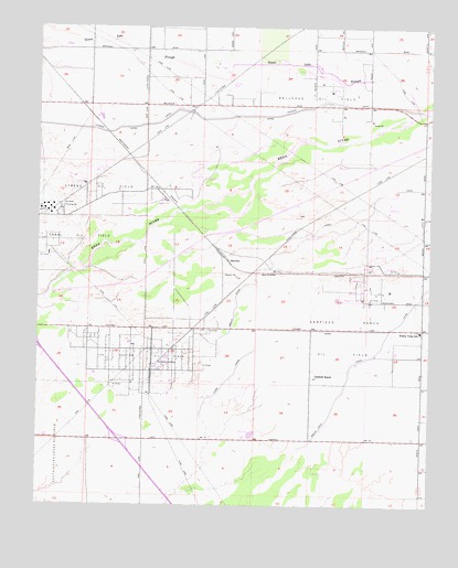
Stevens, CA USGS Topographic Map
Click on map above to begin viewing in our Map Viewer.

This topographic map contains these locations and features:
Feature Name Type Latitude Longitude GNIS ID View Map
Bakersfield Fire Department Station 15BuildingN35.3427°W119.1286°2664921View Map
Bakersfield Police Department West Side SubstationBuildingN35.3433°W119.1285°2756529View Map
Bellevue Oil FieldOilfieldN35.3580°W119.1582°277356View Map
Buena Vista CanalCanalN35.2672°W119.1629°239792View Map
Buena Vista Elementary SchoolSchoolN35.2956°W119.1296°239803View Map
Canal Oil FieldOilfieldN35.3189°W119.2451°277360View Map
Canfield RanchLocaleN35.2836°W119.1623°240201View Map
Canfield Ranch Oil FieldOilfieldN35.2947°W119.1526°277361View Map
City of BakersfieldCivilN35.3199°W119.1422°2409774View Map
Cross Valley CanalCanalN35.3467°W119.1872°2680156View Map
James CanalCanalN35.3280°W119.1473°243994View Map
Joe Gottlieb Field Airport (historical)AirportN35.3680°W119.1948°1653250View Map
Kern County Fire Department Station 67 RosedaleBuildingN35.3687°W119.1614°2665386View Map
Munzer School (historical)LocaleN35.3266°W119.2426°1662040View Map
Pioneer CanalCanalN35.3516°W119.1909°247560View Map
Rio Bravo Pumping StationLocaleN35.3277°W119.2443°1654787View Map
StevensPopulated PlaceN35.3141°W119.1907°1661504View Map
Strand (historical)Populated PlaceN35.3405°W119.2212°1662061View Map
Strand Oil FieldOilfieldN35.3316°W119.2315°277425View Map
Ten Section Oil FieldOilfieldN35.2886°W119.2173°277431View Map
Ten Section RefineryLocaleN35.2864°W119.2121°1654839View Map

Note: Coordinates in the location and feature list above are referenced to NAD83 datum.


Copyright (C) 2008-2025 Ryan Niemi / Sunset Dynamics ... All Rights Reserved