TopoQuest Logo
Do you find TopoQuest useful?
Help keep TopoQuest running and adding new maps/features by donating!
Bitcoin:  19c7KJd3qBynnjoSw5npx9KScwjBe4ifkT
Litecoin:  LXs6TkuXGGXo1vDsWCkWVdjQX94eUKd6ui
Home View Maps Find Maps Find Places Resources & Links


Buhl, Minnesota Topographic Map

USGS Map Title: Buhl, MN
USGS Map MRC: 47092D7
DRG (GeoTIFF) Download: o47092d7.tif


Neighboring USGS Topographic Map Quads:


  Dewey Lake, MN  
47092E8
 

  Dewey Lake SE, MN  
47092E7
 

  Kinney, MN  
47092E6
 

  Hibbing, MN  
47092D8
 

  Buhl, MN  
47092D7
 

  Kirk, MN  
47092D6
 

  Riley, MN  
47092C8
 

  Little Swan, MN  
47092C7
 

  Casco, MN  
47092C6


Map MRC Location:

N48°
W93°
N48°
W92°
H8 H7 H6 H5 H4 H3 H2 H1
G8 G7 G6 G5 G4 G3 G2 G1
F8 F7 F6 F5 F4 F3 F2 F1
E8 E7 E6 E5 E4 E3 E2 E1
D8 D7 D6 D5 D4 D3 D2 D1
C8 C7 C6 C5 C4 C3 C2 C1
B8 B7 B6 B5 B4 B3 B2 B1
A8 A7 A6 A5 A4 A3 A2 A1
N47°
W93°
N47°
W92°

Buhl, MN USGS 1:24K Topographic Map Preview:
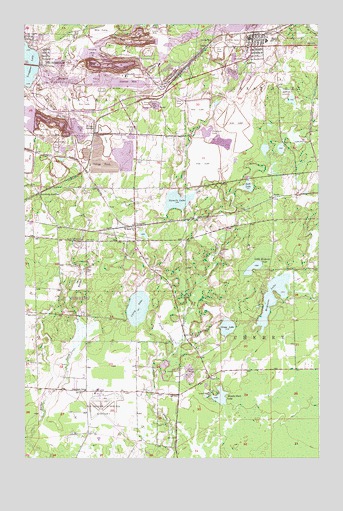
Buhl, MN USGS Topographic Map
Click on map above to begin viewing in our Map Viewer.

This topographic map contains these locations and features:
Feature Name Type Latitude Longitude GNIS ID View Map
Buchanan Nursing HomeHospitalN47.4961°W92.8694°2126548View Map
BuhlPopulated PlaceN47.4935°W92.7780°660903View Map
Buhl ParkParkN47.4888°W92.7807°660905View Map
Buhl Police DepartmentBuildingN47.4955°W92.7778°2126412View Map
Buhl Post OfficePost OfficeN47.4952°W92.7798°2126413View Map
Buhl Public LibraryBuildingN47.4961°W92.7761°2126407View Map
Buhl StationLocaleN47.4972°W92.7750°2126410View Map
Buhl Volunteer Fire Department and Ambulance ServiceBuildingN47.4956°W92.7783°2666130View Map
Buhl Volunteer Fire Department and Ambulance ServiceBuildingN47.4960°W92.7783°2126411View Map
Carey CreekStreamN47.4077°W92.8102°660957View Map
Carey LakeLakeN47.4183°W92.8269°660958View Map
Carey Lake ParkParkN47.4167°W92.8333°2123703View Map
Chisholm - Hibbing Airport Fire DepartmentBuildingN47.3940°W92.8446°2666488View Map
City of BuhlCivilN47.4993°W92.7695°2393459View Map
Croxton MineMineN47.4980°W92.8205°661073View Map
Douglas MineMineN47.4697°W92.8580°661132View Map
Douglas Tailings BasinReservoirN47.4616°W92.8735°1777115View Map
Douglas Tailings DikeDamN47.4616°W92.8735°1777114View Map
Duncan MineMineN47.4694°W92.8507°661150View Map
Dunwoody JunctionPopulated PlaceN47.4519°W92.8674°661153View Map
Dunwoody MineMineN47.4727°W92.8669°661154View Map
Elbern MineMineN47.4769°W92.8194°661190View Map
First Lutheran ChurchChurchN47.4936°W92.7778°2126409View Map
Fraser MineMineN47.4877°W92.8335°661322View Map
Grandview Memorial GardenCemeteryN47.3980°W92.8494°2117757View Map
GrantPopulated PlaceN47.4933°W92.7974°661380View Map
Grant MineMineN47.4991°W92.7849°661381View Map
Grass LakeLakeN47.4128°W92.7890°661383View Map
Hartley Burt MineMineN47.4960°W92.8243°661430View Map
Hartley MineMineN47.4958°W92.8346°661431View Map
Heritage Manor Health Care CenterHospitalN47.4961°W92.8694°2126547View Map
Humphrey MineMineN47.4922°W92.8455°661517View Map
Judson MineMineN47.4866°W92.7868°661599View Map
Lake View CemeteryCemeteryN47.4797°W92.7638°661678View Map
Life Link III Air HibbingBuildingN47.3924°W92.8432°2721309View Map
Little McQuade LakeLakeN47.4299°W92.7779°661759View Map
Longyear LakeLakeN47.4915°W92.8736°661805View Map
McQuade LakeLakeN47.4216°W92.7693°661894View Map
Mesaba Park LakeLakeN47.3927°W92.7918°661913View Map
Mesabi Nursing HomeHospitalN47.4958°W92.7750°2126406View Map
Monroe-Tener MineMineN47.4741°W92.8746°661943View Map
Our Lady of Sacred Heart ChurchChurchN47.4933°W92.7806°2126408View Map
Palmer MineMineN47.4977°W92.8255°662127View Map
Range Regional AirportAirportN47.3918°W92.8423°660609View Map
Saint Clair JunctionPopulated PlaceN47.4705°W92.8446°662322View Map
Saint Clair MineMineN47.4910°W92.8410°662323View Map
Saint Louis County Sheriff's Office BuhlBuildingN47.4956°W92.7777°2758674View Map
ScottPopulated PlaceN47.4497°W92.7696°662395View Map
Scott LakeLakeN47.4533°W92.7801°662396View Map
Shenango MineMineN47.4885°W92.8432°662427View Map
Sherman Group Tailings BasinReservoirN47.4894°W92.8403°1777156View Map
Sherman Group Tailings DikeDamN47.4866°W92.8319°1777155View Map
Sherman MineMineN47.4835°W92.8296°662428View Map
Sherman Mine Waste Water BasinReservoirN47.4866°W92.8319°1777158View Map
Sherman Mine Waste Water DikeDamN47.4866°W92.8319°1777157View Map
Sixmile LakeLakeN47.4493°W92.8100°662461View Map
Spudville ClubhouseBuildingN47.4377°W92.8499°662527View Map
Swandale SchoolSchoolN47.3947°W92.8494°662613View Map
Threemile LakeLakeN47.4689°W92.7978°662642View Map
Vaughn Steffensrud Elementary SchoolSchoolN47.4992°W92.8742°2126393View Map
WilpenPopulated PlaceN47.4405°W92.8280°662805View Map
Wilpen Post Office (historical)Post OfficeN47.4406°W92.8278°2117764View Map
Wilpen StationLocaleN47.4406°W92.8278°2117765View Map
WIRR-FM (Virginia-Hibbing)TowerN47.4960°W92.7849°663129View Map

Note: Coordinates in the location and feature list above are referenced to NAD83 datum.


Copyright (C) 2008-2025 Ryan Niemi / Sunset Dynamics ... All Rights Reserved