TopoQuest Logo
Do you find TopoQuest useful?
Help keep TopoQuest running and adding new maps/features by donating!
Bitcoin:  19c7KJd3qBynnjoSw5npx9KScwjBe4ifkT
Litecoin:  LXs6TkuXGGXo1vDsWCkWVdjQX94eUKd6ui
Home View Maps Find Maps Find Places Resources & Links


Kirk, Minnesota Topographic Map

USGS Map Title: Kirk, MN
USGS Map MRC: 47092D6
DRG (GeoTIFF) Download: o47092d6.tif


Neighboring USGS Topographic Map Quads:


  Dewey Lake SE, MN  
47092E7
 

  Kinney, MN  
47092E6
 

  Virginia, MN  
47092E5
 

  Buhl, MN  
47092D7
 

  Kirk, MN  
47092D6
 

  Eveleth, MN  
47092D5
 

  Little Swan, MN  
47092C7
 

  Casco, MN  
47092C6
 

  Zim, MN  
47092C5


Map MRC Location:

N48°
W93°
N48°
W92°
H8 H7 H6 H5 H4 H3 H2 H1
G8 G7 G6 G5 G4 G3 G2 G1
F8 F7 F6 F5 F4 F3 F2 F1
E8 E7 E6 E5 E4 E3 E2 E1
D8 D7 D6 D5 D4 D3 D2 D1
C8 C7 C6 C5 C4 C3 C2 C1
B8 B7 B6 B5 B4 B3 B2 B1
A8 A7 A6 A5 A4 A3 A2 A1
N47°
W93°
N47°
W92°

Kirk, MN USGS 1:24K Topographic Map Preview:
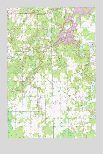
Kirk, MN USGS Topographic Map
Click on map above to begin viewing in our Map Viewer.

This topographic map contains these locations and features:
Feature Name Type Latitude Longitude GNIS ID View Map
Bethel ChurchChurchN47.4155°W92.6863°660781View Map
CherryPopulated PlaceN47.4008°W92.7071°660988View Map
Cherry Post Office (historical)Post OfficeN47.4008°W92.7069°2123683View Map
Cherry Township Fire DepartmentBuildingN47.4017°W92.7210°2666397View Map
Cherry-Clinton CemeteryCemeteryN47.4219°W92.6866°660780View Map
Clinton Volunteer Fire DepartmentBuildingN47.4015°W92.6273°2666550View Map
Doherty LakeLakeN47.4741°W92.6897°661123View Map
Kendall LakeLakeN47.4624°W92.6443°661632View Map
KirkPopulated PlaceN47.4152°W92.6627°661647View Map
Majestic LakeLakeN47.4612°W92.6289°661850View Map
School Number 96SchoolN47.4041°W92.7091°662391View Map
SherwoodPopulated PlaceN47.4516°W92.7410°662430View Map
Silver LakeLakeN47.4541°W92.6435°662448View Map
Stahlberg-Mohr Airport (historical)AirportN47.4328°W92.6464°660612View Map
Town of Great Scott Fire Department Station 3BuildingN47.4645°W92.7271°2666500View Map
Township of CherryCivilN47.4140°W92.7466°663790View Map
West Two River ReservoirReservoirN47.4825°W92.6562°662777View Map
West Two Rivers CampgroundLocaleN47.4889°W92.6661°2126370View Map
West Two Rivers DamDamN47.4649°W92.6868°1777147View Map

Note: Coordinates in the location and feature list above are referenced to NAD83 datum.


Copyright (C) 2008-2025 Ryan Niemi / Sunset Dynamics ... All Rights Reserved