TopoQuest Logo
Do you find TopoQuest useful?
Help keep TopoQuest running and adding new maps/features by donating!
Bitcoin:  19c7KJd3qBynnjoSw5npx9KScwjBe4ifkT
Litecoin:  LXs6TkuXGGXo1vDsWCkWVdjQX94eUKd6ui
Home View Maps Find Maps Find Places Resources & Links


Burlington Junction, Missouri Topographic Map

USGS Map Title: Burlington Junction, MO
USGS Map MRC: 40095D1
DRG (GeoTIFF) Download: o40095d1.tif


Neighboring USGS Topographic Map Quads:


  Blanchard, IA  
40095E2
 

  Clearmont, MO  
40095E1
 

  Hopkins SW, MO  
40094E8
 

  Skidmore NW, MO  
40095D2
 

  Burlington Junction, MO  
40095D1
 

  Wilcox, MO  
40094D8
 

  Dotham, MO  
40095C2
 

  Skidmore, MO  
40095C1
 

  Maryville West, MO  
40094C8


Map MRC Location:

N41°
W96°
N41°
W95°
H8 H7 H6 H5 H4 H3 H2 H1
G8 G7 G6 G5 G4 G3 G2 G1
F8 F7 F6 F5 F4 F3 F2 F1
E8 E7 E6 E5 E4 E3 E2 E1
D8 D7 D6 D5 D4 D3 D2 D1
C8 C7 C6 C5 C4 C3 C2 C1
B8 B7 B6 B5 B4 B3 B2 B1
A8 A7 A6 A5 A4 A3 A2 A1
N40°
W96°
N40°
W95°

Burlington Junction, MO USGS 1:24K Topographic Map Preview:
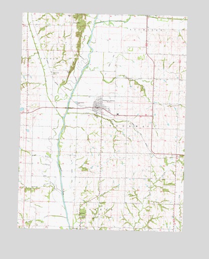
Burlington Junction, MO USGS Topographic Map
Click on map above to begin viewing in our Map Viewer.

This topographic map contains these locations and features:
Feature Name Type Latitude Longitude GNIS ID View Map
Burlington JunctionPopulated PlaceN40.4455°W95.0661°730064View Map
Burlington Junction Post OfficePost OfficeN40.4460°W95.0660°2782659View Map
Carter SchoolSchoolN40.4058°W95.0266°715451View Map
City of Burlington JunctionCivilN40.4470°W95.0679°2393470View Map
Clear CreekStreamN40.4946°W95.0703°715939View Map
Cuyhoga CreekStreamN40.4425°W95.0886°716616View Map
DawsonvillePopulated PlaceN40.4644°W95.0994°730082View Map
Evans SchoolSchoolN40.4625°W95.0250°717674View Map
Hagey BranchStreamN40.4117°W95.0933°718972View Map
Hagey SchoolSchoolN40.4119°W95.1139°718973View Map
Hardesty SchoolSchoolN40.4336°W95.0255°719084View Map
Headrick BranchStreamN40.3967°W95.0911°719312View Map
Hedge College SchoolSchoolN40.4775°W95.0014°719338View Map
Hester AirportAirportN40.4703°W95.0224°758609View Map
Hoover Frankum Watershed B 20 ReservoirReservoirN40.4437°W95.1244°760452View Map
Hoover Frankum Watershed B-23 DamDamN40.4317°W95.1186°760741View Map
Hoover Frankum Watershed B-23 LakeReservoirN40.4316°W95.1193°760742View Map
Hoover Frankum Watershed Structure B-20 DamDamN40.4450°W95.1236°760451View Map
Lamar CemeteryCemeteryN40.3822°W95.0880°743271View Map
Little Brick SchoolSchoolN40.4700°W95.0533°721169View Map
Mill CreekStreamN40.4400°W95.0933°464434View Map
Mount Hope CemeteryCemeteryN40.4667°W95.0891°743272View Map
Muddy CreekStreamN40.4692°W95.0744°723040View Map
Ohio CemeteryCemeteryN40.4408°W95.0689°743273View Map
Old Quitman CemeteryCemeteryN40.3842°W95.0797°743274View Map
Pleasant Valley SchoolSchoolN40.4203°W95.0805°724633View Map
Possum WalkPopulated PlaceN40.4944°W95.0844°741169View Map
Quitman CemeteryCemeteryN40.3825°W95.0775°743275View Map
RoseberryPopulated PlaceN40.4378°W95.0408°759688View Map
Star SchoolSchoolN40.4044°W95.0625°727026View Map
Township of NodawayCivilN40.4357°W95.0208°767094View Map
West Nodaway Elementary SchoolSchoolN40.4422°W95.0514°2545140View Map
West Nodaway Fire Protection DistrictBuildingN40.4447°W95.0698°2621507View Map
West Nodaway High SchoolSchoolN40.4428°W95.0510°2545083View Map

Note: Coordinates in the location and feature list above are referenced to NAD83 datum.


Copyright (C) 2008-2025 Ryan Niemi / Sunset Dynamics ... All Rights Reserved