TopoQuest Logo
Do you find TopoQuest useful?
Help keep TopoQuest running and adding new maps/features by donating!
Bitcoin:  19c7KJd3qBynnjoSw5npx9KScwjBe4ifkT
Litecoin:  LXs6TkuXGGXo1vDsWCkWVdjQX94eUKd6ui
Home View Maps Find Maps Find Places Resources & Links


Wilcox, Missouri Topographic Map

USGS Map Title: Wilcox, MO
USGS Map MRC: 40094D8
DRG (GeoTIFF) Download: o40094d8.tif


Neighboring USGS Topographic Map Quads:


  Clearmont, MO  
40095E1
 

  Hopkins SW, MO  
40094E8
 

  Hopkins, MO  
40094E7
 

  Burlington Junction, MO  
40095D1
 

  Wilcox, MO  
40094D8
 

  Pickering, MO  
40094D7
 

  Skidmore, MO  
40095C1
 

  Maryville West, MO  
40094C8
 

  Maryville East, MO  
40094C7


Map MRC Location:

N41°
W95°
N41°
W94°
H8 H7 H6 H5 H4 H3 H2 H1
G8 G7 G6 G5 G4 G3 G2 G1
F8 F7 F6 F5 F4 F3 F2 F1
E8 E7 E6 E5 E4 E3 E2 E1
D8 D7 D6 D5 D4 D3 D2 D1
C8 C7 C6 C5 C4 C3 C2 C1
B8 B7 B6 B5 B4 B3 B2 B1
A8 A7 A6 A5 A4 A3 A2 A1
N40°
W95°
N40°
W94°

Wilcox, MO USGS 1:24K Topographic Map Preview:
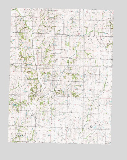
Wilcox, MO USGS Topographic Map
Click on map above to begin viewing in our Map Viewer.

This topographic map contains these locations and features:
Feature Name Type Latitude Longitude GNIS ID View Map
Clyde SchoolSchoolN40.4897°W94.8958°716023View Map
Gray Grove School (historical)SchoolN40.4675°W94.9608°718765View Map
Guthrie School (historical)SchoolN40.4405°W94.9830°718947View Map
Herron School (historical)SchoolN40.3755°W94.9108°719405View Map
Ireland School (historical)SchoolN40.4044°W94.9280°720160View Map
Lone Tree SchoolSchoolN40.4200°W94.9855°721486View Map
Lone Valley School (historical)SchoolN40.4625°W94.9325°721487View Map
Mount Vernon School (historical)SchoolN40.4336°W94.9469°722917View Map
Olwell School (historical)SchoolN40.4039°W94.8875°723817View Map
Prairie View School (historical)SchoolN40.4911°W94.9353°724900View Map
Shell Grove School (historical)SchoolN40.3772°W94.9855°736348View Map
South Fork Clear CreekStreamN40.4983°W94.9953°726736View Map
Sunrise School (historical)SchoolN40.4397°W94.9089°727323View Map
Toad HollowValleyN40.4958°W94.9897°727682View Map
White Cloud SchoolSchoolN40.4967°W94.8772°728731View Map
WilcoxPopulated PlaceN40.3989°W94.9672°728820View Map
Wilcox CemeteryCemeteryN40.4055°W94.9816°728823View Map
Wilcox Census Designated PlaceCensusN40.3975°W94.9665°2587123View Map
Workman Union ChapelChurchN40.4583°W94.9514°729144View Map

Note: Coordinates in the location and feature list above are referenced to NAD83 datum.


Copyright (C) 2008-2025 Ryan Niemi / Sunset Dynamics ... All Rights Reserved