TopoQuest Logo
Do you find TopoQuest useful?
Help keep TopoQuest running and adding new maps/features by donating!
Bitcoin:  19c7KJd3qBynnjoSw5npx9KScwjBe4ifkT
Litecoin:  LXs6TkuXGGXo1vDsWCkWVdjQX94eUKd6ui
Home View Maps Find Maps Find Places Resources & Links


Burney Mountain East, California Topographic Map

USGS Map Title: Burney Mountain East, CA
USGS Map MRC: 40121G5
DRG (GeoTIFF) Download: o40121g5.tif


Neighboring USGS Topographic Map Quads:


  Burney, CA  
40121H6
 

  Cassel, CA  
40121H5
 

  Hogback Ridge, CA  
40121H4
 

  Burney Mountain West, CA  
40121G6
 

  Burney Mountain East, CA  
40121G5
 

  Murken Bench, CA  
40121G4
 

  Jacks Backbone, CA  
40121F6
 

  Thousand Lakes Valley, CA  
40121F5
 

  Old Station, CA  
40121F4


Map MRC Location:

N41°
W122°
N41°
W121°
H8 H7 H6 H5 H4 H3 H2 H1
G8 G7 G6 G5 G4 G3 G2 G1
F8 F7 F6 F5 F4 F3 F2 F1
E8 E7 E6 E5 E4 E3 E2 E1
D8 D7 D6 D5 D4 D3 D2 D1
C8 C7 C6 C5 C4 C3 C2 C1
B8 B7 B6 B5 B4 B3 B2 B1
A8 A7 A6 A5 A4 A3 A2 A1
N40°
W122°
N40°
W121°

Burney Mountain East, CA USGS 1:24K Topographic Map Preview:
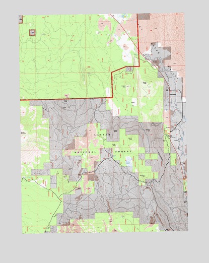
Burney Mountain East, CA USGS Topographic Map
Click on map above to begin viewing in our Map Viewer.

This topographic map contains these locations and features:
Feature Name Type Latitude Longitude GNIS ID View Map
Brown ButteSummitN40.8346°W121.5297°257483View Map
Burney SpringSpringN40.7815°W121.6245°257714View Map
Cinder ButteSummitN40.7993°W121.5533°258366View Map
Cornaz LakeLakeN40.7899°W121.5446°258719View Map
Cornaz PeakSummitN40.8035°W121.5414°1658320View Map
Cornaz SpringSpringN40.7927°W121.5574°258720View Map
Doyle ButteSummitN40.8265°W121.5894°259523View Map
Dudgen ButteSummitN40.8335°W121.5461°259601View Map
Dutch ButteSummitN40.8079°W121.5536°1658450View Map
Dutch FlatFlatN40.8249°W121.5400°259630View Map
Eiler GulchValleyN40.7649°W121.5858°259806View Map
Hat CreekPopulated PlaceN40.8304°W121.5136°1759222View Map
Hat Creek Forest Service StationLocaleN40.8043°W121.5136°261144View Map
Hat Creek Post OfficePost OfficeN40.8317°W121.5138°1662300View Map
Hat Creek Volunteer Fire Company Station 11BuildingN40.8083°W121.5129°2622072View Map
Honn CampgroundLocaleN40.7790°W121.5025°261441View Map
Honn CreekStreamN40.7838°W121.5028°261440View Map
Lincoln SchoolSchoolN40.8302°W121.5119°262487View Map
Opdyke HillSummitN40.8079°W121.5283°264380View Map
Pot SpringSpringN40.7824°W121.5711°1682389View Map
Red Rock HillSummitN40.7818°W121.5328°265324View Map
Twin ButtesSummitN40.7804°W121.5925°1660051View Map

Note: Coordinates in the location and feature list above are referenced to NAD83 datum.


Copyright (C) 2008-2025 Ryan Niemi / Sunset Dynamics ... All Rights Reserved