TopoQuest Logo
Do you find TopoQuest useful?
Help keep TopoQuest running and adding new maps/features by donating!
Bitcoin:  19c7KJd3qBynnjoSw5npx9KScwjBe4ifkT
Litecoin:  LXs6TkuXGGXo1vDsWCkWVdjQX94eUKd6ui
Home View Maps Find Maps Find Places Resources & Links


Cassel, California Topographic Map

USGS Map Title: Cassel, CA
USGS Map MRC: 40121H5
DRG (GeoTIFF) Download: o40121h5.tif


Neighboring USGS Topographic Map Quads:


  Burney Falls, CA  
41121A6
 

  Dana, CA  
41121A5
 

  Fall River Mills, CA  
41121A4
 

  Burney, CA  
40121H6
 

  Cassel, CA  
40121H5
 

  Hogback Ridge, CA  
40121H4
 

  Burney Mountain West, CA  
40121G6
 

  Burney Mountain East, CA  
40121G5
 

  Murken Bench, CA  
40121G4


Map MRC Location:

N41°
W122°
N41°
W121°
H8 H7 H6 H5 H4 H3 H2 H1
G8 G7 G6 G5 G4 G3 G2 G1
F8 F7 F6 F5 F4 F3 F2 F1
E8 E7 E6 E5 E4 E3 E2 E1
D8 D7 D6 D5 D4 D3 D2 D1
C8 C7 C6 C5 C4 C3 C2 C1
B8 B7 B6 B5 B4 B3 B2 B1
A8 A7 A6 A5 A4 A3 A2 A1
N40°
W122°
N40°
W121°

Cassel, CA USGS 1:24K Topographic Map Preview:
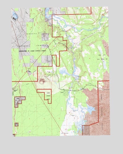
Cassel, CA USGS Topographic Map
Click on map above to begin viewing in our Map Viewer.

This topographic map contains these locations and features:
Feature Name Type Latitude Longitude GNIS ID View Map
Arkright FlatFlatN40.9971°W121.6017°256319View Map
Baum LakeLakeN40.9391°W121.5452°256597View Map
Braden Sand PitMineN40.9743°W121.5828°257426View Map
Brush MountainSummitN40.9282°W121.5858°257534View Map
Brush Mountain QuarryMineN40.9292°W121.5872°2675077View Map
CasselPopulated PlaceN40.9190°W121.5478°258048View Map
Cassel CampgroundLocaleN40.9213°W121.5525°1661781View Map
Cassel Census Designated PlaceCensusN40.9213°W121.5514°2611427View Map
Cassel Post OfficePost OfficeN40.9191°W121.5527°2760070View Map
Cassel Volunteer Fire Company 10BuildingN40.9197°W121.5549°2622076View Map
Castle Post OfficePost OfficeN40.9193°W121.5508°274880View Map
Chalk ReservoirReservoirN40.9984°W121.5384°258184View Map
Cinder Flats State Wildlife AreaParkN40.9485°W121.5105°1661787View Map
Conrad RanchLocaleN40.9460°W121.5055°258648View Map
Crystal LakeLakeN40.9362°W121.5608°258962View Map
Crystal Lake State Fish HatcheryLocaleN40.9321°W121.5441°1661792View Map
Doyles CornerPopulated PlaceN40.8774°W121.5603°259524View Map
East Shasta DivisionCivilN40.9031°W121.5358°1935086View Map
Four CornersPopulated PlaceN40.9382°W121.6067°1661799View Map
Hat CreekStreamN40.9896°W121.5786°261142View Map
Hat Creek Number 2 Diversion 97-109 DamDamN40.9499°W121.5461°1663665View Map
Hat Creek ParkParkN40.9604°W121.5578°1661807View Map
Hat Creek ValleyValleyN40.9852°W121.5644°261146View Map
Hat One PowerhouseLocaleN40.9288°W121.5433°1654352View Map
Hat Two PowerhouseLocaleN40.9607°W121.5483°1654353View Map
Hidden Valley RanchLocaleN40.9371°W121.5755°261309View Map
Rising RiverStreamN40.9077°W121.5544°265433View Map
Rising River LakeLakeN40.9000°W121.5256°265434View Map
Rising River RanchLocaleN40.8954°W121.5455°265435View Map
Rock SpringSpringN40.9204°W121.5341°265514View Map
Rocky LedgeBenchN40.9071°W121.6192°265537View Map
Sam Wolfin SpringSpringN40.9708°W121.5118°265794View Map
Soldier CreekStreamN40.9991°W121.5747°267381View Map
Sucker Springs CreekStreamN40.9845°W121.5127°2729362View Map

Note: Coordinates in the location and feature list above are referenced to NAD83 datum.


Copyright (C) 2008-2025 Ryan Niemi / Sunset Dynamics ... All Rights Reserved