TopoQuest Logo
Do you find TopoQuest useful?
Help keep TopoQuest running and adding new maps/features by donating!
Bitcoin:  19c7KJd3qBynnjoSw5npx9KScwjBe4ifkT
Litecoin:  LXs6TkuXGGXo1vDsWCkWVdjQX94eUKd6ui
Home View Maps Find Maps Find Places Resources & Links


Burnt Cabin Gorge, Utah Topographic Map

USGS Map Title: Burnt Cabin Gorge, UT
USGS Map MRC: 40109F4
DRG (GeoTIFF) Download: o40109f4.tif


Neighboring USGS Topographic Map Quads:


  East Park Reservoir, UT  
40109G5
 

  Mount Lena, UT  
40109G4
 

  Jackson Draw, UT  
40109G3
 

  Dyer Mountain, UT  
40109F5
 

  Burnt Cabin Gorge, UT  
40109F4
 

  Blair Basin, UT  
40109F3
 

  Steinaker Reservoir, UT  
40109E5
 

  Donkey Flat, UT  
40109E4
 

  Jensen Ridge, UT  
40109E3


Map MRC Location:

N41°
W110°
N41°
W109°
H8 H7 H6 H5 H4 H3 H2 H1
G8 G7 G6 G5 G4 G3 G2 G1
F8 F7 F6 F5 F4 F3 F2 F1
E8 E7 E6 E5 E4 E3 E2 E1
D8 D7 D6 D5 D4 D3 D2 D1
C8 C7 C6 C5 C4 C3 C2 C1
B8 B7 B6 B5 B4 B3 B2 B1
A8 A7 A6 A5 A4 A3 A2 A1
N40°
W110°
N40°
W109°

Burnt Cabin Gorge, UT USGS 1:24K Topographic Map Preview:
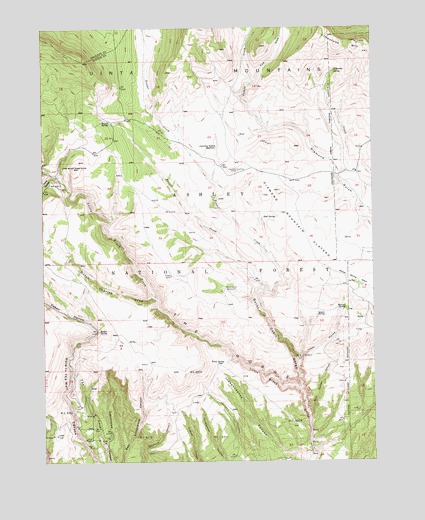
Burnt Cabin Gorge, UT USGS Topographic Map
Click on map above to begin viewing in our Map Viewer.

This topographic map contains these locations and features:
Feature Name Type Latitude Longitude GNIS ID View Map
Aspen SpringSpringN40.6753°W109.4328°1454654View Map
Aspen SpringSpringN40.6672°W109.3969°1438296View Map
Association ReservoirReservoirN40.6747°W109.4319°1438297View Map
Barker SpringSpringN40.6627°W109.4795°1438395View Map
Bassett CreekStreamN40.6741°W109.4157°1438418View Map
Bassett SpringSpringN40.7227°W109.4751°1438419View Map
Boundary SpringSpringN40.6952°W109.3924°1454676View Map
Buckboard SpringSpringN40.6788°W109.4790°1454691View Map
Bull SpringSpringN40.6954°W109.4170°1439286View Map
Burnt Cabin GorgeValleyN40.6466°W109.4035°1439343View Map
Chicken SpringSpringN40.6786°W109.4201°1454703View Map
Counting Station ReservoirReservoirN40.7156°W109.4346°1440061View Map
Diamond Counting CorralLocaleN40.7088°W109.4260°1440444View Map
Drive Through the Ages Geological AreaAreaN40.6666°W109.4876°1448351View Map
Dutch Charles DrawValleyN40.6722°W109.4596°1440735View Map
East DrawValleyN40.7341°W109.4204°1440780View Map
Freestone SpringSpringN40.6883°W109.4735°1454747View Map
Gorge SpringSpringN40.6597°W109.4896°1450109View Map
Grizzly HollowValleyN40.7080°W109.4971°1454757View Map
Indian HollowValleyN40.6536°W109.4049°1442005View Map
Kabell HollowValleyN40.6652°W109.4826°1442261View Map
Kane HollowValleyN40.7077°W109.4962°1442271View Map
Limestone CreekStreamN40.7069°W109.3890°1442617View Map
Limestone MountainSummitN40.7455°W109.3812°1442618View Map
Limestone SpringSpringN40.7379°W109.3889°1442619View Map
Little Brush Creek KnobSummitN40.7097°W109.4885°1442672View Map
Marvin SpringSpringN40.6690°W109.3863°1443211View Map
Mary Cashem CanyonValleyN40.6383°W109.3999°1443213View Map
McKee SpringSpringN40.6844°W109.4382°1454832View Map
Point SpringSpringN40.6535°W109.4349°1444496View Map
Pothole CreekStreamN40.7205°W109.4151°1444607View Map
Reader CreekStreamN40.6741°W109.4157°1444752View Map
The GorgeValleyN40.6458°W109.4043°1446453View Map
The SeepsStreamN40.6291°W109.4774°1446501View Map

Note: Coordinates in the location and feature list above are referenced to NAD83 datum.


Copyright (C) 2008-2024 Ryan Niemi / Sunset Dynamics ... All Rights Reserved