TopoQuest Logo
Do you find TopoQuest useful?
Help keep TopoQuest running and adding new maps/features by donating!
Bitcoin:  19c7KJd3qBynnjoSw5npx9KScwjBe4ifkT
Litecoin:  LXs6TkuXGGXo1vDsWCkWVdjQX94eUKd6ui
Home View Maps Find Maps Find Places Resources & Links


Burr Oak, Michigan Topographic Map

USGS Map Title: Burr Oak, MI
USGS Map MRC: 41085G3
DRG (GeoTIFF) Download: o41085g3.tif


Neighboring USGS Topographic Map Quads:


  Nottawa, MI  
41085H4
 

  Colon, MI  
41085H3
 

  Bronson North, MI  
41085H2
 

  Sturgis, MI  
41085G4
 

  Burr Oak, MI  
41085G3
 

  Bronson South, MI  
41085G2
 

  Lagrange, IN  
41085F4
 

  Mongo, IN  
41085F3
 

  Orland, IN  
41085F2


Map MRC Location:

N42°
W86°
N42°
W85°
H8 H7 H6 H5 H4 H3 H2 H1
G8 G7 G6 G5 G4 G3 G2 G1
F8 F7 F6 F5 F4 F3 F2 F1
E8 E7 E6 E5 E4 E3 E2 E1
D8 D7 D6 D5 D4 D3 D2 D1
C8 C7 C6 C5 C4 C3 C2 C1
B8 B7 B6 B5 B4 B3 B2 B1
A8 A7 A6 A5 A4 A3 A2 A1
N41°
W86°
N41°
W85°

Burr Oak, MI USGS 1:24K Topographic Map Preview:
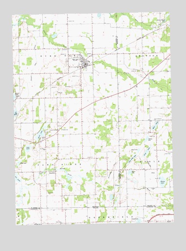
Burr Oak, MI USGS Topographic Map
Click on map above to begin viewing in our Map Viewer.

This topographic map contains these locations and features:
Feature Name Type Latitude Longitude GNIS ID View Map
Adams CemeteryCemeteryN41.8406°W85.2766°619814View Map
Adams LakeLakeN41.8263°W85.3743°1624340View Map
Blair Airport (historical)AirportN41.7501°W85.3047°449114View Map
Bontrager CemeteryCemeteryN41.7503°W85.3552°431330View Map
Bordner FarmsLocaleN41.8003°W85.3417°2743158View Map
Burr OakPopulated PlaceN41.8473°W85.3186°1624428View Map
Burr Oak Community SchoolsSchoolN41.8464°W85.3147°2401158View Map
Burr Oak Fire DepartmentBuildingN41.8444°W85.3187°2401157View Map
Burr Oak Missionary ChurchChurchN41.8503°W85.3208°2401159View Map
Burr Oak Police DepartmentBuildingN41.8454°W85.3178°2401153View Map
Burr Oak Post OfficePost OfficeN41.8453°W85.3219°2401152View Map
Burr Oak Public LibraryBuildingN41.8450°W85.3167°2401154View Map
Burr Oak StationLocaleN41.8439°W85.3172°2401155View Map
Burr Oak Township CemeteryCemeteryN41.8472°W85.3319°2401244View Map
Burr Oak Township HallBuildingN41.8447°W85.3178°2401156View Map
Burrows Post Office (historical)Post OfficeN41.7708°W85.2864°2435386View Map
Cade LakeLakeN41.7957°W85.3642°1624431View Map
Cade Lake County ParkParkN41.7958°W85.3689°2418250View Map
Dark LakeLakeN41.7869°W85.3718°1624780View Map
Dutch Settlement CemeteryCemeteryN41.8106°W85.2633°625034View Map
Farview FarmLocaleN41.7808°W85.3657°2743151View Map
Fawn RiverPopulated PlaceN41.7817°W85.3444°1624524View Map
Fawn River Post Office (historical)Post OfficeN41.7817°W85.3444°2417289View Map
Fawn River SchoolSchoolN41.7948°W85.3508°1624527View Map
Fawn River Village CemeteryCemeteryN41.7819°W85.3475°2401245View Map
Fennell LakeLakeN41.7511°W85.2777°434447View Map
Fish LakeLakeN41.7924°W85.2702°626031View Map
Freedom CemeteryCemeteryN41.8064°W85.3372°1624552View Map
Freedom Hills Golf CourseLocaleN41.8100°W85.3411°2418249View Map
Froh CemeteryCemeteryN41.8081°W85.3375°1624514View Map
Himebaugh DrainCanalN41.7817°W85.2972°1624606View Map
Holmes Hollow PondLakeN41.8692°W85.2548°628453View Map
Honey LakeLakeN41.7741°W85.2583°628527View Map
Honey Lake DrainCanalN41.7814°W85.2683°628528View Map
Lee LakeLakeN41.7783°W85.3735°1624669View Map
Long Noble LakeLakeN41.7882°W85.2822°630988View Map
Mallow LakeLakeN41.7999°W85.2703°631361View Map
Mill PondLakeN41.7798°W85.3346°1624741View Map
Mud LakeLakeN41.8076°W85.2633°632887View Map
Pretty Prairie ChurchChurchN41.7506°W85.3386°441584View Map
Round LakeLakeN41.7804°W85.2840°636274View Map
Royer LakeLakeN41.7931°W85.2768°636355View Map
Saint John's Evangelical Lutheran ChurchChurchN41.8467°W85.3203°2401160View Map
Sanborn CemeteryCemeteryN41.8709°W85.3305°1624909View Map
Stewart LakeLakeN41.8162°W85.3745°1624958View Map
Stewart Lake DrainCanalN41.8425°W85.3591°1624959View Map
Sweet LakeLakeN41.8044°W85.3537°1624975View Map
Sweet Lake Mobile Home ParkPopulated PlaceN41.8011°W85.3528°2418248View Map
Township of Burr OakCivilN41.8544°W85.3505°1626007View Map
Township of Fawn RiverCivilN41.7842°W85.3466°1626271View Map
Trayer CemeteryCemeteryN41.7705°W85.2678°2435446View Map
Trayer SchoolSchoolN41.7706°W85.2669°1615052View Map
Tri Pine FarmLocaleN41.7954°W85.3397°2743160View Map
United Methodist ChurchChurchN41.8467°W85.3192°2401161View Map
Village of Burr OakCivilN41.8472°W85.3212°2397505View Map

Note: Coordinates in the location and feature list above are referenced to NAD83 datum.


Copyright (C) 2008-2025 Ryan Niemi / Sunset Dynamics ... All Rights Reserved