TopoQuest Logo
Do you find TopoQuest useful?
Help keep TopoQuest running and adding new maps/features by donating!
Bitcoin:  19c7KJd3qBynnjoSw5npx9KScwjBe4ifkT
Litecoin:  LXs6TkuXGGXo1vDsWCkWVdjQX94eUKd6ui
Home View Maps Find Maps Find Places Resources & Links


Nottawa, Michigan Topographic Map

USGS Map Title: Nottawa, MI
USGS Map MRC: 41085H4
DRG (GeoTIFF) Download: o41085h4.tif


Neighboring USGS Topographic Map Quads:


  Vicksburg, MI  
42085A5
 

  Mendon, MI  
42085A4
 

  Leonidas, MI  
42085A3
 

  Three Rivers East, MI  
41085H5
 

  Nottawa, MI  
41085H4
 

  Colon, MI  
41085H3
 

  Klinger Lake, MI  
41085G5
 

  Sturgis, MI  
41085G4
 

  Burr Oak, MI  
41085G3


Map MRC Location:

N42°
W86°
N42°
W85°
H8 H7 H6 H5 H4 H3 H2 H1
G8 G7 G6 G5 G4 G3 G2 G1
F8 F7 F6 F5 F4 F3 F2 F1
E8 E7 E6 E5 E4 E3 E2 E1
D8 D7 D6 D5 D4 D3 D2 D1
C8 C7 C6 C5 C4 C3 C2 C1
B8 B7 B6 B5 B4 B3 B2 B1
A8 A7 A6 A5 A4 A3 A2 A1
N41°
W86°
N41°
W85°

Nottawa, MI USGS 1:24K Topographic Map Preview:
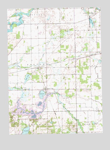
Nottawa, MI USGS Topographic Map
Click on map above to begin viewing in our Map Viewer.

This topographic map contains these locations and features:
Feature Name Type Latitude Longitude GNIS ID View Map
Babcock CemeteryCemeteryN41.9337°W85.4103°1624361View Map
Beaver DrainCanalN41.9342°W85.3822°1624374View Map
Bryant LakeLakeN41.8854°W85.3871°1624423View Map
Camel Lake (historical)LakeN41.8978°W85.4686°1624433View Map
Centreville Seventh Day Adventist ChurchChurchN41.9186°W85.4933°2401058View Map
Demijohn LakeLakeN41.9200°W85.4721°1624489View Map
Evans LakeLakeN41.9309°W85.4750°1624515View Map
Fish LakeLakeN41.8773°W85.4784°1624532View Map
Glen Oaks Community CollegeSchoolN41.8922°W85.4972°2401150View Map
Hidden Pond CampgroundLocaleN41.9147°W85.4489°2401144View Map
Island Hills Golf ClubLocaleN41.9014°W85.4969°2401149View Map
Laird CemeteryCemeteryN41.9842°W85.4358°1624654View Map
Lake Area Christian SchoolSchoolN41.8764°W85.4292°2418241View Map
Lake TempleneReservoirN41.9002°W85.4703°2706040View Map
Leidy LakeLakeN41.9854°W85.3875°1624670View Map
Leidy Lake CampgroundLocaleN41.9817°W85.3758°2401050View Map
Leidy Lake State Game AreaParkN41.9807°W85.3897°1624671View Map
Locust Grove ChurchChurchN41.8970°W85.3800°1624688View Map
Locust Grove Mennonite CemeteryCemeteryN41.8972°W85.3800°2401242View Map
Michiana Mobile Home ParkPopulated PlaceN41.9167°W85.4472°2401148View Map
NottawaPopulated PlaceN41.9189°W85.4489°1624792View Map
Nottawa CemeteryCemeteryN41.9050°W85.4330°1624793View Map
Nottawa Christian Day SchoolSchoolN41.9197°W85.4408°2401145View Map
Nottawa Community SchoolSchoolN41.9194°W85.4406°2418240View Map
Nottawa DitchCanalN41.9631°W85.4464°1624795View Map
Nottawa Fruit FarmLocaleN41.9197°W85.4696°2743167View Map
Nottawa ParkParkN41.9158°W85.4506°2401147View Map
Nottawa Post OfficePost OfficeN41.9189°W85.4489°2401143View Map
Pilgrim Fellowship ChurchChurchN41.9197°W85.4408°2401146View Map
Pioneer CemeteryCemeteryN41.9550°W85.4711°1624830View Map
Prairie River SpeedwayLocaleN41.9212°W85.4850°1624847View Map
Riverside Apple FarmLocaleN41.8752°W85.3968°2743170View Map
Saint Joe Valley Golf CourseLocaleN41.9139°W85.4694°2401151View Map
Sand LakeLakeN41.9145°W85.4554°1624911View Map
Sauger Lake (historical)LakeN41.8925°W85.4667°1624915View Map
Seven Sons RanchLocaleN41.8853°W85.4751°2743173View Map
Sylvan Lake (historical)LakeN41.9061°W85.4537°1624976View Map
Township of NottawaCivilN41.9401°W85.4705°1626827View Map
WasepiPopulated PlaceN41.9409°W85.4617°1625003View Map
Wasepi Mennonite ChapelChurchN41.9408°W85.4567°2401059View Map
Wasepi Post Office (historical)Post OfficeN41.9408°W85.4617°2417249View Map
Wasepi Station (historical)LocaleN41.9411°W85.4617°2417250View Map
Word Fellowship ChurchChurchN41.9333°W85.4161°2401060View Map

Note: Coordinates in the location and feature list above are referenced to NAD83 datum.


Copyright (C) 2008-2025 Ryan Niemi / Sunset Dynamics ... All Rights Reserved