TopoQuest Logo
Do you find TopoQuest useful?
Help keep TopoQuest running and adding new maps/features by donating!
Bitcoin:  19c7KJd3qBynnjoSw5npx9KScwjBe4ifkT
Litecoin:  LXs6TkuXGGXo1vDsWCkWVdjQX94eUKd6ui
Home View Maps Find Maps Find Places Resources & Links


Bush River, South Carolina Topographic Map

USGS Map Title: Bush River, SC
USGS Map MRC: 34081C7
DRG (GeoTIFF) Download: o34081c7.tif


Neighboring USGS Topographic Map Quads:


  Clinton, SC  
34081D8
 

  Joanna, SC  
34081D7
 

  Newberry NW, SC  
34081D6
 

  Cross Hill, SC  
34081C8
 

  Bush River, SC  
34081C7
 

  Newberry West, SC  
34081C6
 

  Dyson, SC  
34081B8
 

  Chappells, SC  
34081B7
 

  Silverstreet, SC  
34081B6


Map MRC Location:

N35°
W82°
N35°
W81°
H8 H7 H6 H5 H4 H3 H2 H1
G8 G7 G6 G5 G4 G3 G2 G1
F8 F7 F6 F5 F4 F3 F2 F1
E8 E7 E6 E5 E4 E3 E2 E1
D8 D7 D6 D5 D4 D3 D2 D1
C8 C7 C6 C5 C4 C3 C2 C1
B8 B7 B6 B5 B4 B3 B2 B1
A8 A7 A6 A5 A4 A3 A2 A1
N34°
W82°
N34°
W81°

Bush River, SC USGS 1:24K Topographic Map Preview:
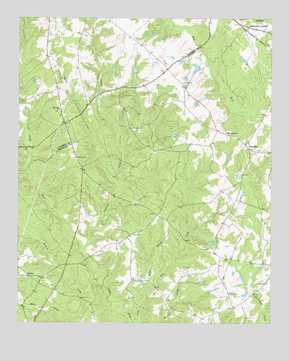
Bush River, SC USGS Topographic Map
Click on map above to begin viewing in our Map Viewer.

This topographic map contains these locations and features:
Feature Name Type Latitude Longitude GNIS ID View Map
Adams Pond D-1467 DamDamN34.2818°W81.7798°1238857View Map
Bedenbaugh Pond Dam Number One D-3003DamN34.3535°W81.8165°1240231View Map
Bedenbaugh Pond Dam Number Two D-3002DamN34.3685°W81.8098°1240229View Map
Bedenbaugh Pond Number OneReservoirN34.3537°W81.8173°1240232View Map
Bedenbaughs Pond Number TwoReservoirN34.3687°W81.8101°1240230View Map
Belfast School (historical)SchoolN34.3368°W81.8543°1234746View Map
Belmont School (historical)SchoolN34.2526°W81.7673°1228367View Map
Boyd Pond Dam D-3004DamN34.3718°W81.8548°1240233View Map
Boyds PondReservoirN34.3722°W81.8531°1240234View Map
Bush RiverPopulated PlaceN34.3218°W81.7607°1229490View Map
Bush River Baptist ChurchChurchN34.3204°W81.7601°1228384View Map
Bush River Quaker CemeteryCemeteryN34.3196°W81.7598°1228385View Map
Bush River SchoolSchoolN34.3285°W81.7712°1229493View Map
Bush River School (historical)SchoolN34.3062°W81.7684°1228387View Map
Connelly Field (historical)AirportN34.2740°W81.7734°1251967View Map
Dominick School (historical)SchoolN34.2874°W81.8173°1228407View Map
Fairview Church (historical)ChurchN34.3418°W81.8679°1234809View Map
Garrison CreekStreamN34.2801°W81.8418°1229725View Map
Harmons Mill (historical)LocaleN34.3335°W81.7540°1228422View Map
Laurens County Fire Department Joanna Station 2BuildingN34.3360°W81.8540°2578817View Map
Little River CemeteryCemeteryN34.3176°W81.8473°1228732View Map
Little River CemeteryCemeteryN34.3371°W81.8551°1234883View Map
Little River ChurchChurchN34.3179°W81.8468°1246422View Map
Little River ChurchChurchN34.3374°W81.8546°1246423View Map
Longshore Number One D-1468 DamDamN34.2618°W81.7632°1238858View Map
Longshore Number Two D-1469 DamDamN34.2668°W81.7615°1238859View Map
Mills CreekStreamN34.2518°W81.8476°1230021View Map
MudlickPopulated PlaceN34.2696°W81.8696°1230079View Map
Mudlick School (historical)SchoolN34.2693°W81.8632°1228766View Map
Quaker CreekStreamN34.3029°W81.8279°1230208View Map
Reeder BranchStreamN34.2601°W81.8115°1250318View Map
Sandhill Farms PondReservoirN34.2706°W81.7683°1237682View Map
Sexton AirportAirportN34.3541°W81.8036°1251944View Map
Silverstreet Lookout TowerTowerN34.2626°W81.7709°1242468View Map
Smiths PondReservoirN34.3501°W81.7832°1237680View Map
Smiths Pond D-1668 DamDamN34.3501°W81.7832°1237679View Map
South Carolina Noname 36012 DamDamN34.2701°W81.7665°1237681View Map

Note: Coordinates in the location and feature list above are referenced to NAD83 datum.


Copyright (C) 2008-2024 Ryan Niemi / Sunset Dynamics ... All Rights Reserved