TopoQuest Logo
Do you find TopoQuest useful?
Help keep TopoQuest running and adding new maps/features by donating!
Bitcoin:  19c7KJd3qBynnjoSw5npx9KScwjBe4ifkT
Litecoin:  LXs6TkuXGGXo1vDsWCkWVdjQX94eUKd6ui
Home View Maps Find Maps Find Places Resources & Links


Bushnell, Florida Topographic Map

USGS Map Title: Bushnell, FL
USGS Map MRC: 28082F1
DRG (GeoTIFF) Download: o28082f1.tif


Neighboring USGS Topographic Map Quads:


  Rutland, FL  
28082G2
 

  Wildwood, FL  
28082G1
 

  Leesburg West, FL  
28081G8
 

  Wahoo, FL  
28082F2
 

  Bushnell, FL  
28082F1
 

  Center Hill, FL  
28081F8
 

  Saint Catherine, FL  
28082E2
 

  Webster, FL  
28082E1
 

  Mascotte, FL  
28081E8


Map MRC Location:

N29°
W83°
N29°
W82°
H8 H7 H6 H5 H4 H3 H2 H1
G8 G7 G6 G5 G4 G3 G2 G1
F8 F7 F6 F5 F4 F3 F2 F1
E8 E7 E6 E5 E4 E3 E2 E1
D8 D7 D6 D5 D4 D3 D2 D1
C8 C7 C6 C5 C4 C3 C2 C1
B8 B7 B6 B5 B4 B3 B2 B1
A8 A7 A6 A5 A4 A3 A2 A1
N28°
W83°
N28°
W82°

Bushnell, FL USGS 1:24K Topographic Map Preview:
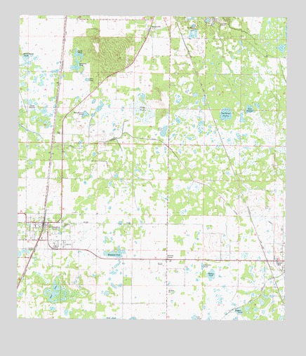
Bushnell, FL USGS Topographic Map
Click on map above to begin viewing in our Map Viewer.

This topographic map contains these locations and features:
Feature Name Type Latitude Longitude GNIS ID View Map
Annie Marsh PondLakeN28.7328°W82.1218°277895View Map
Beville Family CemeteryCemeteryN28.6532°W82.0035°2768098View Map
Bevilles CornerPopulated PlaceN28.6497°W82.0545°278606View Map
BushnellPopulated PlaceN28.6650°W82.1129°279729View Map
Bushnell Army Air Field (historical)MilitaryN28.6778°W82.0950°2091741View Map
Bushnell Elementary SchoolSchoolN28.6625°W82.1157°2060655View Map
Bushnell Elementary SchoolSchoolN28.6631°W82.1162°298883View Map
Bushnell Police DepartmentBuildingN28.6645°W82.1120°2060858View Map
Bushnell Post OfficePost OfficeN28.6745°W82.1125°2060686View Map
Bushnell Presbyterian ChurchChurchN28.6667°W82.1143°2060859View Map
Bushnell Public LibraryBuildingN28.6671°W82.1109°2447923View Map
Bushnell TowerTowerN28.6961°W82.1026°300855View Map
Bushnell Trailer CourtPopulated PlaceN28.6672°W82.1135°2447924View Map
CarverPopulated PlaceN28.6572°W82.1023°280090View Map
Center PondSwampN28.6531°W82.1212°280241View Map
Chandler PondLakeN28.6475°W82.0383°280290View Map
Cheryl-Lane LandingsAirportN28.6722°W82.0865°309302View Map
Church of GodChurchN28.6578°W82.1062°2060550View Map
Church of the NazareneChurchN28.6830°W82.1215°2060646View Map
City of BushnellCivilN28.6853°W82.1166°2403958View Map
Clark PrairieFlatN28.7125°W82.1184°280497View Map
Clear PondLakeN28.7238°W82.0932°280536View Map
Doe PondLakeN28.6257°W82.0418°281641View Map
Dog Fennel PrairieSwampN28.7101°W82.0280°281648View Map
Double SinkBasinN28.7469°W82.0304°281716View Map
Ellis LakeLakeN28.7045°W82.0559°282179View Map
Ellis PondLakeN28.7021°W82.0570°298080View Map
Evergreen CemeteryCemeteryN28.6642°W82.1034°282303View Map
Faith Baptist ChurchChurchN28.6380°W82.0534°2060596View Map
First Assembly of GodChurchN28.7486°W82.0693°2052825View Map
First Baptist Church of BushnellChurchN28.6636°W82.1148°2060649View Map
First Baptist Church of SumtervilleChurchN28.7433°W82.0648°2060542View Map
First United Methodist ChurchChurchN28.6650°W82.1162°2060647View Map
Haywood PondLakeN28.6527°W82.0770°283843View Map
Hughes PondSwampN28.6290°W82.0211°284387View Map
Jumper Creek CanalCanalN28.6986°W82.0823°284971View Map
Lake - Sumter Emergency Medical Services Station 441BuildingN28.6688°W82.1113°2661856View Map
Lincoln ParkPopulated PlaceN28.6536°W82.1081°285549View Map
Love CemeteryCemeteryN28.6514°W82.0029°2768094View Map
Mobley PondLakeN28.6443°W82.0341°287029View Map
Mount Olive AME ChurchChurchN28.6544°W82.1045°2060548View Map
Mount Zion CemeteryCemeteryN28.6380°W82.0526°2060545View Map
Mount Zion Church (historical)ChurchN28.6375°W82.0529°287342View Map
Mount Zion Primitive Baptist ChurchChurchN28.6544°W82.1076°2060551View Map
Mud LakeLakeN28.6355°W82.1066°287408View Map
North Avenue Church of ChristChurchN28.6553°W82.0009°2060544View Map
Panasoffkee CemeteryCemeteryN28.7464°W82.0907°2768097View Map
Rock PrairieSwampN28.7122°W82.0169°289851View Map
Rural - Metro of Sumter CountyBuildingN28.6767°W82.1129°2768104View Map
Saint James Missionary Baptist ChurchChurchN28.6550°W82.1054°2060549View Map
Saint Lawrence Catholic ChurchChurchN28.6678°W82.1073°2060856View Map
Sand PondSwampN28.7342°W82.0975°290557View Map
Sawgrass PondLakeN28.7288°W82.0983°290721View Map
Schoolhouse PondLakeN28.7099°W82.0935°290752View Map
South Sumter Evergreen CemeteryCemeteryN28.6536°W82.0559°2060547View Map
South Sumter High SchoolSchoolN28.6724°W82.1131°2060660View Map
South Sumter High SchoolSchoolN28.6726°W82.1132°298884View Map
South Sumter High School StadiumBuildingN28.6717°W82.1156°2060671View Map
South Sumter PlazaLocaleN28.6575°W82.1137°296031View Map
Sumter CountyCivilN28.7048°W82.0810°295740View Map
Sumter County Fire and Rescue Department Station 11 Bushnell Fire DistrictBuildingN28.6580°W82.1064°2131405View Map
Sumter County Fire and Rescue Station 15 SumtervilleBuildingN28.7369°W82.0624°2644344View Map
Sumter County Judicial BuildingBuildingN28.6642°W82.1087°2060857View Map
Sumter County Public LibraryBuildingN28.7364°W82.0613°2452481View Map
Sumter County Sheriff's OfficeBuildingN28.6637°W82.1099°2333622View Map
Sumter County Sheriff's OfficeBuildingN28.6631°W82.1094°2333708View Map
Sumter County Sheriff's OfficeBuildingN28.6774°W82.1128°2333710View Map
Sumter County Youth CenterBuildingN28.6519°W82.0851°2060546View Map
Sumter Lookout TowerTowerN28.6933°W82.1093°300854View Map
SumtervillePopulated PlaceN28.7450°W82.0634°291811View Map
Sumterville Post OfficePost OfficeN28.7494°W82.0618°2053599View Map
Sumterville United Methodist ChurchChurchN28.7444°W82.0612°2060543View Map
Tema CemeteryCemeteryN28.7017°W82.1048°292099View Map
Towns PrairieFlatN28.7119°W82.0665°292382View Map
Walled SinkBasinN28.7489°W82.0340°292846View Map
West Street SchoolSchoolN28.6732°W82.1204°2060677View Map
York Street Church of GodChurchN28.6633°W82.1187°2060652View Map

Note: Coordinates in the location and feature list above are referenced to NAD83 datum.


Copyright (C) 2008-2024 Ryan Niemi / Sunset Dynamics ... All Rights Reserved