TopoQuest Logo
Do you find TopoQuest useful?
Help keep TopoQuest running and adding new maps/features by donating!
Bitcoin:  19c7KJd3qBynnjoSw5npx9KScwjBe4ifkT
Litecoin:  LXs6TkuXGGXo1vDsWCkWVdjQX94eUKd6ui
Home View Maps Find Maps Find Places Resources & Links


Center Hill, Florida Topographic Map

USGS Map Title: Center Hill, FL
USGS Map MRC: 28081F8
DRG (GeoTIFF) Download: o28081f8.tif


Neighboring USGS Topographic Map Quads:


  Wildwood, FL  
28082G1
 

  Leesburg West, FL  
28081G8
 

  Leesburg East, FL  
28081G7
 

  Bushnell, FL  
28082F1
 

  Center Hill, FL  
28081F8
 

  Howey In The Hills, FL  
28081F7
 

  Webster, FL  
28082E1
 

  Mascotte, FL  
28081E8
 

  Clermont West, FL  
28081E7


Map MRC Location:

N29°
W82°
N29°
W81°
H8 H7 H6 H5 H4 H3 H2 H1
G8 G7 G6 G5 G4 G3 G2 G1
F8 F7 F6 F5 F4 F3 F2 F1
E8 E7 E6 E5 E4 E3 E2 E1
D8 D7 D6 D5 D4 D3 D2 D1
C8 C7 C6 C5 C4 C3 C2 C1
B8 B7 B6 B5 B4 B3 B2 B1
A8 A7 A6 A5 A4 A3 A2 A1
N28°
W82°
N28°
W81°

Center Hill, FL USGS 1:24K Topographic Map Preview:
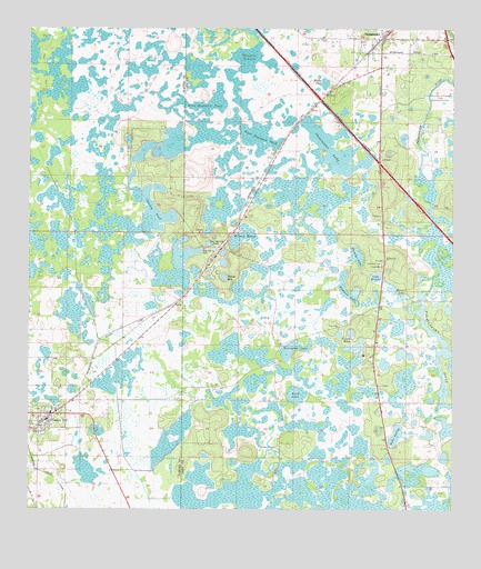
Center Hill, FL USGS Topographic Map
Click on map above to begin viewing in our Map Viewer.

This topographic map contains these locations and features:
Feature Name Type Latitude Longitude GNIS ID View Map
Baptising PondLakeN28.6894°W81.9423°304122View Map
Bigeye HoleLakeN28.6856°W81.9423°278769View Map
Bird LakeLakeN28.6547°W81.9212°278827View Map
Bush StationLocaleN28.6958°W81.9415°304123View Map
CasonLocaleN28.6939°W81.9423°303681View Map
Center HillPopulated PlaceN28.6500°W81.9926°280236View Map
Center Hill CemeteryCemeteryN28.6514°W81.9967°2060588View Map
Center Hill City HallBuildingN28.6483°W81.9969°2453311View Map
Center Hill Police DepartmentBuildingN28.6482°W81.9971°2333634View Map
Center Hill Post OfficePost OfficeN28.6495°W81.9948°2447999View Map
Center Hill Presbyterian ChurchChurchN28.6489°W81.9967°2453310View Map
Center Hill Water TowerTowerN28.6492°W81.9983°2453292View Map
Charley PondLakeN28.7025°W81.9629°280320View Map
Clear Lake CampgroundLocaleN28.7197°W81.9184°303677View Map
Clearwater LakeLakeN28.7191°W81.9101°280550View Map
Cool Spring CemeteryCemeteryN28.6930°W81.9476°280743View Map
Cool Spring PondLakeN28.6943°W81.9469°280744View Map
Corpus Christi Episcopal ChurchChurchN28.7475°W81.8969°2456043View Map
Covenant Holiness ChurchChurchN28.6333°W81.9931°2453330View Map
Crowder HolesLakeN28.6711°W81.9048°281107View Map
First Baptist Church of Center HillChurchN28.6467°W81.9967°2453290View Map
First Baptist Church of OkahumpkaChurchN28.7475°W81.8972°2073313View Map
Grass Roots AirparkAirportN28.6413°W81.8851°2676635View Map
Groveland AcademySchoolN28.6656°W81.8926°303678View Map
Groveland TowerTowerN28.6894°W81.8956°303679View Map
Hampton PrairieSwampN28.7389°W81.9354°283675View Map
Honeycut LakeLakeN28.6668°W81.9220°284228View Map
Howard LakeLakeN28.6814°W81.8913°284345View Map
Independent Free Will Baptist Church of Center HillChurchN28.6519°W81.9967°2060592View Map
Lake BrightLakeN28.6857°W81.8974°279398View Map
Lake Emergency Medical Services Station 231BuildingN28.7412°W81.8924°2661857View Map
Lake Harris SquareLocaleN28.7467°W81.8781°2456130View Map
Lake IndigoLakeN28.6447°W81.8913°284546View Map
Lake Orlando Golf ClubLocaleN28.7128°W81.8773°2450460View Map
Lakes at Sandridge Golf ClubLocaleN28.7075°W81.8755°2450461View Map
Leesburg Fire Department Station 64BuildingN28.7412°W81.8924°2331427View Map
Merritt CemeteryCemeteryN28.6414°W81.9259°286732View Map
New Bethel African Methodist Episcopal ChurchChurchN28.7497°W81.8969°2456044View Map
Numans LakeLakeN28.6815°W81.9037°287910View Map
OkahumpkaPopulated PlaceN28.7478°W81.8959°288068View Map
Okahumpka Census Designated PlaceCensusN28.7459°W81.8962°2403372View Map
Okahumpka Post OfficePost OfficeN28.7481°W81.8967°2073314View Map
Pentecostal Lighthouse FellowshipChurchN28.6481°W81.9956°2453291View Map
Pilaklakha (historical)Populated PlaceN28.6336°W81.9831°294520View Map
Reed Hammock PondSwampN28.7230°W81.9318°289592View Map
Shady Grove Youth CampLocaleN28.6572°W81.9451°303680View Map
Sumter County Fire Department And Rescue Station 14 Center Hill Fire DistrictBuildingN28.6497°W81.9988°2131647View Map
Tex Merritt Private AirstripAirportN28.6685°W81.9196°309616View Map
Thomas LakeLakeN28.6912°W81.9033°292209View Map
University of Florida State Experimental FarmLocaleN28.7325°W81.8776°294183View Map
Wallet PondLakeN28.7360°W81.9127°292847View Map
Wilson MarshSwampN28.6958°W81.9366°293380View Map
Wise Hammock PondLakeN28.7309°W81.9497°293437View Map

Note: Coordinates in the location and feature list above are referenced to NAD83 datum.


Copyright (C) 2008-2024 Ryan Niemi / Sunset Dynamics ... All Rights Reserved