TopoQuest Logo
Do you find TopoQuest useful?
Help keep TopoQuest running and adding new maps/features by donating!
Bitcoin:  19c7KJd3qBynnjoSw5npx9KScwjBe4ifkT
Litecoin:  LXs6TkuXGGXo1vDsWCkWVdjQX94eUKd6ui
Home View Maps Find Maps Find Places Resources & Links


Butte City, California Topographic Map

USGS Map Title: Butte City, CA
USGS Map MRC: 39121D8
DRG (GeoTIFF) Download: o39121d8.tif


Neighboring USGS Topographic Map Quads:


  Glenn, CA  
39122E1
 

  Llano Seco, CA  
39121E8
 

  Nelson, CA  
39121E7
 

  Princeton, CA  
39122D1
 

  Butte City, CA  
39121D8
 

  West of Biggs, CA  
39121D7
 

  Moulton Weir, CA  
39122C1
 

  Sanborn Slough, CA  
39121C8
 

  Pennington, CA  
39121C7


Map MRC Location:

N40°
W122°
N40°
W121°
H8 H7 H6 H5 H4 H3 H2 H1
G8 G7 G6 G5 G4 G3 G2 G1
F8 F7 F6 F5 F4 F3 F2 F1
E8 E7 E6 E5 E4 E3 E2 E1
D8 D7 D6 D5 D4 D3 D2 D1
C8 C7 C6 C5 C4 C3 C2 C1
B8 B7 B6 B5 B4 B3 B2 B1
A8 A7 A6 A5 A4 A3 A2 A1
N39°
W122°
N39°
W121°

Butte City, CA USGS 1:24K Topographic Map Preview:
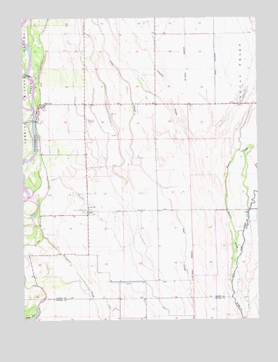
Butte City, CA USGS Topographic Map
Click on map above to begin viewing in our Map Viewer.

This topographic map contains these locations and features:
Feature Name Type Latitude Longitude GNIS ID View Map
AftonPopulated PlaceN39.4199°W121.9664°1657892View Map
Boggs BendBendN39.3782°W121.9972°239532View Map
Butte CityPopulated PlaceN39.4646°W121.9900°1658183View Map
Butte City CemeteryCemeteryN39.4575°W121.9665°220287View Map
Butte City Launch FacilityParkN39.4646°W121.9930°1702518View Map
Butte City Post OfficePost OfficeN39.4642°W121.9895°2760022View Map
Campbell SloughStreamN39.4202°W121.8933°220515View Map
Carson School (historical)SchoolN39.4646°W121.9572°1702522View Map
Glenn Colusa Fire DepartmentBuildingN39.4630°W121.9925°2622003View Map
Hoodoo IslandIslandN39.3954°W121.8894°1703351View Map
Howard SloughStreamN39.3979°W121.8878°225704View Map
Marvin Chapel (historical)ChurchN39.4196°W121.9669°1702562View Map
Marvin Chapel CemeteryCemeteryN39.4199°W121.9677°228189View Map
Oak Leaf IslandIslandN39.4260°W121.8872°1703352View Map
Reilly LandingLocaleN39.4982°W121.9994°1702579View Map
Union SchoolSchoolN39.4210°W121.9661°236848View Map

Note: Coordinates in the location and feature list above are referenced to NAD83 datum.


Copyright (C) 2008-2024 Ryan Niemi / Sunset Dynamics ... All Rights Reserved