TopoQuest Logo
Do you find TopoQuest useful?
Help keep TopoQuest running and adding new maps/features by donating!
Bitcoin:  19c7KJd3qBynnjoSw5npx9KScwjBe4ifkT
Litecoin:  LXs6TkuXGGXo1vDsWCkWVdjQX94eUKd6ui
Home View Maps Find Maps Find Places Resources & Links


West of Biggs, California Topographic Map

USGS Map Title: West of Biggs, CA
USGS Map MRC: 39121D7
DRG (GeoTIFF) Download: o39121d7.tif


Neighboring USGS Topographic Map Quads:


  Llano Seco, CA  
39121E8
 

  Nelson, CA  
39121E7
 

  Shippee, CA  
39121E6
 

  Butte City, CA  
39121D8
 

  West of Biggs, CA  
39121D7
 

  Biggs, CA  
39121D6
 

  Sanborn Slough, CA  
39121C8
 

  Pennington, CA  
39121C7
 

  Gridley, CA  
39121C6


Map MRC Location:

N40°
W122°
N40°
W121°
H8 H7 H6 H5 H4 H3 H2 H1
G8 G7 G6 G5 G4 G3 G2 G1
F8 F7 F6 F5 F4 F3 F2 F1
E8 E7 E6 E5 E4 E3 E2 E1
D8 D7 D6 D5 D4 D3 D2 D1
C8 C7 C6 C5 C4 C3 C2 C1
B8 B7 B6 B5 B4 B3 B2 B1
A8 A7 A6 A5 A4 A3 A2 A1
N39°
W122°
N39°
W121°

West of Biggs, CA USGS 1:24K Topographic Map Preview:
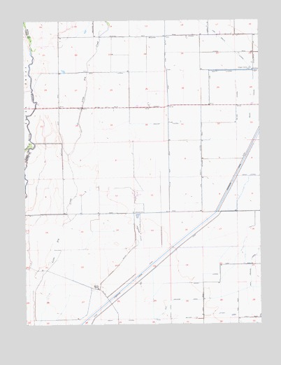
West of Biggs, CA USGS Topographic Map
Click on map above to begin viewing in our Map Viewer.

This topographic map contains these locations and features:
Feature Name Type Latitude Longitude GNIS ID View Map
Ashley LateralCanalN39.3954°W121.7808°218436View Map
Baker LateralCanalN39.4652°W121.7555°218548View Map
Biggs DivisionCivilN39.4531°W121.7747°1935027View Map
Bradford LateralCanalN39.4929°W121.8014°219759View Map
Browning LateralCanalN39.4121°W121.8155°219897View Map
D D 100 Main DrainCanalN39.4410°W121.7991°221963View Map
Gravity LateralCanalN39.4793°W121.7630°224514View Map
Green LateralCanalN39.3768°W121.8247°224548View Map
High Gravity LateralCanalN39.4879°W121.7653°225266View Map
Landlow School (historical)SchoolN39.4204°W121.8178°1666790View Map
Low Gravity Wickman LateralCanalN39.4432°W121.7822°227750View Map
Main Drainage CanalCanalN39.3846°W121.7925°234233View Map
McKee LateralCanalN39.4649°W121.7630°228388View Map
Richvale AirportAirportN39.4952°W121.7714°1653877View Map
Richvale Census Designated PlaceCensusN39.4937°W121.7508°2612486View Map
Schohr RanchLocaleN39.3893°W121.8375°232666View Map
Schwind LateralCanalN39.3802°W121.7991°232705View Map
Watt LateralCanalN39.4782°W121.8325°237355View Map
Williams AG AirportAirportN39.4224°W121.7640°2770485View Map

Note: Coordinates in the location and feature list above are referenced to NAD83 datum.


Copyright (C) 2008-2025 Ryan Niemi / Sunset Dynamics ... All Rights Reserved