TopoQuest Logo
Do you find TopoQuest useful?
Help keep TopoQuest running and adding new maps/features by donating!
Bitcoin:  19c7KJd3qBynnjoSw5npx9KScwjBe4ifkT
Litecoin:  LXs6TkuXGGXo1vDsWCkWVdjQX94eUKd6ui
Home View Maps Find Maps Find Places Resources & Links


Button Mesa South, New Mexico Topographic Map

USGS Map Title: Button Mesa South, NM
USGS Map MRC: 33103E6
DRG (GeoTIFF) Download: o33103e6.tif


Neighboring USGS Topographic Map Quads:


  Lone Wolf, NM  
33103F7
 

  Button Mesa North, NM  
33103F6
 

  Button Mesa NE, NM  
33103F5
 

  Curlew Lake SE, NM  
33103E7
 

  Button Mesa South, NM  
33103E6
 

  Flying M Ranch, NM  
33103E5
 

  Mescalero Point NE, NM  
33103D7
 

  Caprock, NM  
33103D6
 

  Lane Salt Lake, NM  
33103D5


Map MRC Location:

N34°
W104°
N34°
W103°
H8 H7 H6 H5 H4 H3 H2 H1
G8 G7 G6 G5 G4 G3 G2 G1
F8 F7 F6 F5 F4 F3 F2 F1
E8 E7 E6 E5 E4 E3 E2 E1
D8 D7 D6 D5 D4 D3 D2 D1
C8 C7 C6 C5 C4 C3 C2 C1
B8 B7 B6 B5 B4 B3 B2 B1
A8 A7 A6 A5 A4 A3 A2 A1
N33°
W104°
N33°
W103°

Button Mesa South, NM USGS 1:24K Topographic Map Preview:
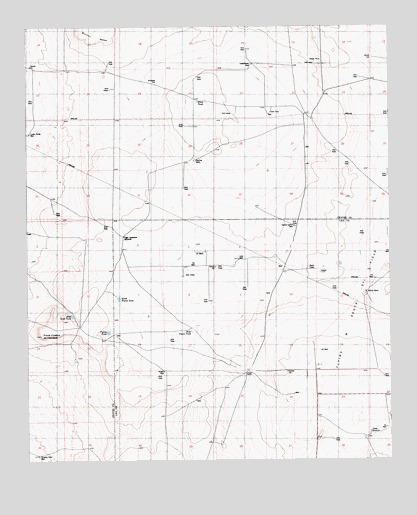
Button Mesa South, NM USGS Topographic Map
Click on map above to begin viewing in our Map Viewer.

This topographic map contains these locations and features:
Feature Name Type Latitude Longitude GNIS ID View Map
12508 Water WellWellN33.5537°W103.6738°924369View Map
12509 Water WellWellN33.5454°W103.6311°927760View Map
12510 Water WellWellN33.5234°W103.6713°924374View Map
12511 Water WellWellN33.5226°W103.6711°924373View Map
12512 Water WellWellN33.5215°W103.6252°925177View Map
12513 Water WellWellN33.5059°W103.6297°927752View Map
13371 Water WellWellN33.5490°W103.6305°924365View Map
Antelope TubWellN33.6093°W103.7050°885799View Map
Belcher WellsWellN33.5868°W103.6919°886176View Map
Bull WellWellN33.5240°W103.6275°886901View Map
Carroll TubWellN33.6162°W103.6313°887229View Map
Cooper RanchLocaleN33.5257°W103.6744°887808View Map
Crowley SandWellN33.5015°W103.7466°888117View Map
Drill Hole Twenty Gallon WellWellN33.5673°W103.6583°888515View Map
East Plains TankReservoirN33.5374°W103.6940°888685View Map
East Sand TankReservoirN33.5418°W103.7351°888691View Map
Fisher WindmillLocaleN33.5082°W103.6325°889054View Map
High Lonesome WindmillLocaleN33.5648°W103.7169°889965View Map
Howell WellWellN33.5257°W103.7033°890227View Map
KENW-TV (Portales)TowerN33.5554°W103.6513°938782View Map
Lost WellWellN33.5582°W103.6772°891394View Map
Lucky Strike WellWellN33.5945°W103.7494°891480View Map
North Plains TankReservoirN33.5467°W103.7189°892644View Map
Plains TankReservoirN33.5371°W103.7227°893352View Map
Punta Culebra de CascadeSummitN33.5362°W103.7455°898410View Map
Sweetwater WellWellN33.6143°W103.6722°895459View Map
U Bar RanchLocaleN33.5240°W103.6744°924814View Map
White TankReservoirN33.6034°W103.6914°896536View Map
Willow WellsWellN33.5482°W103.6336°896675View Map

Note: Coordinates in the location and feature list above are referenced to NAD83 datum.


Copyright (C) 2008-2024 Ryan Niemi / Sunset Dynamics ... All Rights Reserved