TopoQuest Logo
Do you find TopoQuest useful?
Help keep TopoQuest running and adding new maps/features by donating!
Bitcoin:  19c7KJd3qBynnjoSw5npx9KScwjBe4ifkT
Litecoin:  LXs6TkuXGGXo1vDsWCkWVdjQX94eUKd6ui
Home View Maps Find Maps Find Places Resources & Links


Caprock, New Mexico Topographic Map

USGS Map Title: Caprock, NM
USGS Map MRC: 33103D6
DRG (GeoTIFF) Download: o33103d6.tif


Neighboring USGS Topographic Map Quads:


  Curlew Lake SE, NM  
33103E7
 

  Button Mesa South, NM  
33103E6
 

  Flying M Ranch, NM  
33103E5
 

  Mescalero Point NE, NM  
33103D7
 

  Caprock, NM  
33103D6
 

  Lane Salt Lake, NM  
33103D5
 

  Mescalero Point, NM  
33103C7
 

  Soldier Hill, NM  
33103C6
 

  Dallas Store, NM  
33103C5


Map MRC Location:

N34°
W104°
N34°
W103°
H8 H7 H6 H5 H4 H3 H2 H1
G8 G7 G6 G5 G4 G3 G2 G1
F8 F7 F6 F5 F4 F3 F2 F1
E8 E7 E6 E5 E4 E3 E2 E1
D8 D7 D6 D5 D4 D3 D2 D1
C8 C7 C6 C5 C4 C3 C2 C1
B8 B7 B6 B5 B4 B3 B2 B1
A8 A7 A6 A5 A4 A3 A2 A1
N33°
W104°
N33°
W103°

Caprock, NM USGS 1:24K Topographic Map Preview:
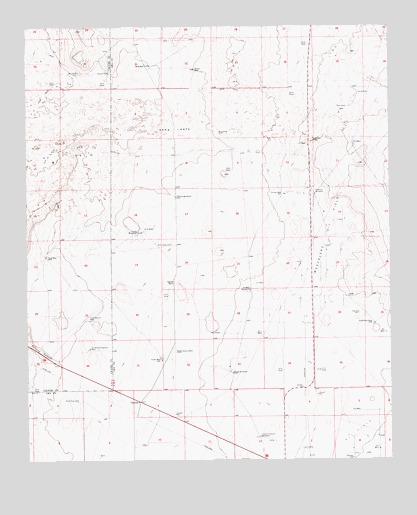
Caprock, NM USGS Topographic Map
Click on map above to begin viewing in our Map Viewer.

This topographic map contains these locations and features:
Feature Name Type Latitude Longitude GNIS ID View Map
10644 Water WellWellN33.3876°W103.7113°927903View Map
10645 Water WellWellN33.3876°W103.7113°927904View Map
10649 Water WellWellN33.3854°W103.7308°928130View Map
10650 Water WellWellN33.3807°W103.6697°928128View Map
10665 Water WellWellN33.3968°W103.6519°927907View Map
10666 Water WellWellN33.3751°W103.6525°928125View Map
12514 Water WellWellN33.4873°W103.7058°927970View Map
12515 Water WellWellN33.4865°W103.6888°928112View Map
12573 Water WellWellN33.4495°W103.6480°927964View Map
12574 Water WellWellN33.4495°W103.6586°927965View Map
12575 Water WellWellN33.4495°W103.6586°927966View Map
12576 Water WellWellN33.4490°W103.6958°928118View Map
12577 Water WellWellN33.4387°W103.7086°928114View Map
12578 Water WellWellN33.4240°W103.6944°927960View Map
12579 Water WellWellN33.4234°W103.6952°927959View Map
12580 Water WellWellN33.4109°W103.6280°928123View Map
12581 Water WellWellN33.4198°W103.6994°928124View Map
12582 Water WellWellN33.4007°W103.7013°928119View Map
12583 Water WellWellN33.3968°W103.6769°927908View Map
13000 Water WellWellN33.3909°W103.7113°927905View Map
13380 Water WellWellN33.3759°W103.6652°928127View Map
Big WellWellN33.4870°W103.7322°886357View Map
Bull Pasture WellWellN33.4065°W103.6994°886886View Map
CaprockPopulated PlaceN33.3921°W103.7125°898528View Map
Caprock Post OfficePost OfficeN33.3921°W103.7125°937991View Map
Caprock RanchLocaleN33.4259°W103.6992°887182View Map
Church Pasture WindmillLocaleN33.3818°W103.6711°887588View Map
Dome WellWellN33.4876°W103.6925°888445View Map
Double WellWellN33.4518°W103.6616°888486View Map
Field WindmillLocaleN33.4407°W103.7125°889017View Map
Four Section WellWellN33.4154°W103.7294°889183View Map
Heifer WellWellN33.4040°W103.7044°889877View Map
Little East Pasture WellWellN33.4073°W103.7294°891133View Map
Mescalero Oil FieldOilfieldN33.4437°W103.6458°928989View Map
New WellWellN33.4890°W103.7094°892488View Map
Oscar WindmillLocaleN33.4001°W103.6802°892952View Map
Pipeline WindmillLocaleN33.4520°W103.6511°893341View Map
Sand GateGapN33.4707°W103.6994°894507View Map
Sand WellWellN33.4340°W103.7441°894534View Map
Section WindmillLocaleN33.4512°W103.6994°894698View Map
Southwest WellWellN33.4146°W103.6308°895208View Map

Note: Coordinates in the location and feature list above are referenced to NAD83 datum.


Copyright (C) 2008-2025 Ryan Niemi / Sunset Dynamics ... All Rights Reserved