TopoQuest Logo
Do you find TopoQuest useful?
Help keep TopoQuest running and adding new maps/features by donating!
Bitcoin:  19c7KJd3qBynnjoSw5npx9KScwjBe4ifkT
Litecoin:  LXs6TkuXGGXo1vDsWCkWVdjQX94eUKd6ui
Home View Maps Find Maps Find Places Resources & Links


Buttonwillow, California Topographic Map

USGS Map Title: Buttonwillow, CA
USGS Map MRC: 35119D4
DRG (GeoTIFF) Download: o35119d4.tif


Neighboring USGS Topographic Map Quads:


  Semitropic, CA  
35119E5
 

  Wasco SW, CA  
35119E4
 

  Wasco, CA  
35119E3
 

  Lokern, CA  
35119D5
 

  Buttonwillow, CA  
35119D4
 

  Rio Bravo, CA  
35119D3
 

  West Elk Hills, CA  
35119C5
 

  East Elk Hills, CA  
35119C4
 

  Tupman, CA  
35119C3


Map MRC Location:

N36°
W120°
N36°
W119°
H8 H7 H6 H5 H4 H3 H2 H1
G8 G7 G6 G5 G4 G3 G2 G1
F8 F7 F6 F5 F4 F3 F2 F1
E8 E7 E6 E5 E4 E3 E2 E1
D8 D7 D6 D5 D4 D3 D2 D1
C8 C7 C6 C5 C4 C3 C2 C1
B8 B7 B6 B5 B4 B3 B2 B1
A8 A7 A6 A5 A4 A3 A2 A1
N35°
W120°
N35°
W119°

Buttonwillow, CA USGS 1:24K Topographic Map Preview:
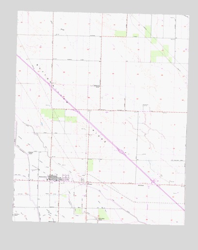
Buttonwillow, CA USGS Topographic Map
Click on map above to begin viewing in our Map Viewer.

This topographic map contains these locations and features:
Feature Name Type Latitude Longitude GNIS ID View Map
BowerbankPopulated PlaceN35.3994°W119.4084°1660365View Map
ButtonwillowPopulated PlaceN35.4005°W119.4696°1652678View Map
Buttonwillow Branch Kern County LibraryBuildingN35.3983°W119.4740°1836033View Map
Buttonwillow Census Designated PlaceCensusN35.4092°W119.4407°2407932View Map
Buttonwillow Community CenterBuildingN35.4002°W119.4679°1836034View Map
Buttonwillow DivisionCivilN35.3961°W119.4190°1935034View Map
Buttonwillow Elementary SchoolSchoolN35.4005°W119.4748°1836035View Map
Buttonwillow Gun Club (historical)LocaleN35.4302°W119.4293°1662018View Map
Buttonwillow ParkParkN35.4002°W119.4596°1836036View Map
Buttonwillow Post OfficePost OfficeN35.4001°W119.4700°1836037View Map
Buttonwillow Union Elementary School District OfficeBuildingN35.3997°W119.4754°1836038View Map
Community Baptist ChurchChurchN35.4008°W119.4673°1836042View Map
Deep Wells RanchLocaleN35.3777°W119.4398°241353View Map
Depot DrainCanalN35.3836°W119.4346°241419View Map
East Side CanalCanalN35.4069°W119.4640°241786View Map
Eightyfoot DitchCanalN35.4036°W119.4896°241864View Map
Elk Grove DrainCanalN35.3783°W119.4926°241964View Map
First Southern Baptist ChurchChurchN35.4019°W119.4626°1836046View Map
Garden DitchCanalN35.4089°W119.4785°242597View Map
Goyenetche DairyLocaleN35.4169°W119.3803°2703894View Map
Kern County Fire Department Station 25 ButtonwillowBuildingN35.4007°W119.4678°2665357View Map
Kern County Sheriff's OfficeBuildingN35.4001°W119.4678°2756340View Map
KilowattPopulated PlaceN35.3989°W119.4473°252914View Map
Maya DairyLocaleN35.4814°W119.4439°2704073View Map
Meadowbrook Gun ClubLocaleN35.4455°W119.4087°1654725View Map
Miller and Lux Headquarters Ranch (historical)LocaleN35.4047°W119.4754°1662038View Map
Mirasol DitchCanalN35.3816°W119.4693°245987View Map
Mirasol RanchLocaleN35.3752°W119.4682°245989View Map
Palomas RanchLocaleN35.4158°W119.4907°247201View Map
Redmen Gun Club (historical)LocaleN35.4825°W119.4568°1662053View Map
Saint Marys Catholic ChurchChurchN35.4005°W119.4723°1836061View Map
Second Community Baptist ChurchChurchN35.4016°W119.4673°1836062View Map
Sudan DitchCanalN35.3914°W119.4723°250003View Map
Whittier DitchCanalN35.3911°W119.4932°251511View Map
Wildwood SchoolSchoolN35.4563°W119.4407°251572View Map

Note: Coordinates in the location and feature list above are referenced to NAD83 datum.


Copyright (C) 2008-2024 Ryan Niemi / Sunset Dynamics ... All Rights Reserved