TopoQuest Logo
Do you find TopoQuest useful?
Help keep TopoQuest running and adding new maps/features by donating!
Bitcoin:  19c7KJd3qBynnjoSw5npx9KScwjBe4ifkT
Litecoin:  LXs6TkuXGGXo1vDsWCkWVdjQX94eUKd6ui
Home View Maps Find Maps Find Places Resources & Links


Rio Bravo, California Topographic Map

USGS Map Title: Rio Bravo, CA
USGS Map MRC: 35119D3
DRG (GeoTIFF) Download: o35119d3.tif


Neighboring USGS Topographic Map Quads:


  Wasco SW, CA  
35119E4
 

  Wasco, CA  
35119E3
 

  Famoso, CA  
35119E2
 

  Buttonwillow, CA  
35119D4
 

  Rio Bravo, CA  
35119D3
 

  Rosedale, CA  
35119D2
 

  East Elk Hills, CA  
35119C4
 

  Tupman, CA  
35119C3
 

  Stevens, CA  
35119C2


Map MRC Location:

N36°
W120°
N36°
W119°
H8 H7 H6 H5 H4 H3 H2 H1
G8 G7 G6 G5 G4 G3 G2 G1
F8 F7 F6 F5 F4 F3 F2 F1
E8 E7 E6 E5 E4 E3 E2 E1
D8 D7 D6 D5 D4 D3 D2 D1
C8 C7 C6 C5 C4 C3 C2 C1
B8 B7 B6 B5 B4 B3 B2 B1
A8 A7 A6 A5 A4 A3 A2 A1
N35°
W120°
N35°
W119°

Rio Bravo, CA USGS 1:24K Topographic Map Preview:
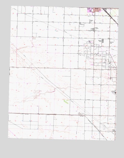
Rio Bravo, CA USGS Topographic Map
Click on map above to begin viewing in our Map Viewer.

This topographic map contains these locations and features:
Feature Name Type Latitude Longitude GNIS ID View Map
Apostolic Assembly ChurchChurchN35.4805°W119.2809°1836032View Map
Aukeman DairyLocaleN35.4892°W119.3736°2703887View Map
Calders CornerPopulated PlaceN35.3836°W119.2512°252863View Map
Cherokee StripPopulated PlaceN35.4672°W119.2607°1660475View Map
Cherokee Strip Census Designated PlaceCensusN35.4696°W119.2615°2629760View Map
First Mexican Baptist ChurchChurchN35.4994°W119.2740°1836045View Map
Iglesia Evangelica EncuentoChurchN35.4777°W119.2801°1836049View Map
Kern Junior AcademySchoolN35.4850°W119.2965°244273View Map
Kirchenmann ParkParkN35.4983°W119.2704°1836050View Map
Mexican ColonyPopulated PlaceN35.4688°W119.2687°1661019View Map
Mexican Colony Census Designated PlaceCensusN35.4689°W119.2687°2629763View Map
Oasis Holsteins DairyLocaleN35.4944°W119.3544°2704076View Map
Poplar School (historical)SchoolN35.4552°W119.2959°1662051View Map
Richland ParkParkN35.4966°W119.2815°1836051View Map
Richland Primary SchoolSchoolN35.4991°W119.2815°1836052View Map
Rio BravoPopulated PlaceN35.3980°W119.2909°252971View Map
Rio Bravo Oil FieldOilfieldN35.4480°W119.2612°277412View Map
Rio Bravo-Greeley Elementary SchoolSchoolN35.4200°W119.2526°248208View Map
Rodriguez ParkParkN35.4938°W119.2801°1836054View Map
Shafter DivisionCivilN35.4949°W119.2647°1935305View Map
Shafter Modified Community Correctional FacilityBuildingN35.4953°W119.2591°2739968View Map
Shafter Pentecostal Church of GodChurchN35.4963°W119.2787°1836064View Map
Smith CornerPopulated PlaceN35.4783°W119.2787°249586View Map
Smith Corner Census Designated PlaceCensusN35.4788°W119.2771°2629764View Map
Thomas LanePopulated PlaceN35.4875°W119.2848°1661563View Map
Tjaarda DairyLocaleN35.4531°W119.3722°2704083View Map

Note: Coordinates in the location and feature list above are referenced to NAD83 datum.


Copyright (C) 2008-2025 Ryan Niemi / Sunset Dynamics ... All Rights Reserved