TopoQuest Logo
Do you find TopoQuest useful?
Help keep TopoQuest running and adding new maps/features by donating!
Bitcoin:  19c7KJd3qBynnjoSw5npx9KScwjBe4ifkT
Litecoin:  LXs6TkuXGGXo1vDsWCkWVdjQX94eUKd6ui
Home View Maps Find Maps Find Places Resources & Links


Buzzard Roost Mesa, Arizona Topographic Map

USGS Map Title: Buzzard Roost Mesa, AZ
USGS Map MRC: 34111A1
DRG (GeoTIFF) Download: o34111a1.tif


Neighboring USGS Topographic Map Quads:


  McDonald Mountain, AZ  
34111B2
 

  Diamond Butte, AZ  
34111B1
 

  Oxbow Mountain, AZ  
34110B8
 

  Sheep Basin Mountain, AZ  
34111A2
 

  Buzzard Roost Mesa, AZ  
34111A1
 

  Young, AZ  
34110A8
 

  Picture Mountain, AZ  
33111H2
 

  Copper Mountain, AZ  
33111H1
 

  McFadden Peak, AZ  
33110H8


Map MRC Location:

N35°
W112°
N35°
W111°
H8 H7 H6 H5 H4 H3 H2 H1
G8 G7 G6 G5 G4 G3 G2 G1
F8 F7 F6 F5 F4 F3 F2 F1
E8 E7 E6 E5 E4 E3 E2 E1
D8 D7 D6 D5 D4 D3 D2 D1
C8 C7 C6 C5 C4 C3 C2 C1
B8 B7 B6 B5 B4 B3 B2 B1
A8 A7 A6 A5 A4 A3 A2 A1
N34°
W112°
N34°
W111°

Buzzard Roost Mesa, AZ USGS 1:24K Topographic Map Preview:
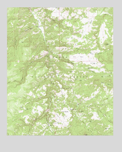
Buzzard Roost Mesa, AZ USGS Topographic Map
Click on map above to begin viewing in our Map Viewer.

This topographic map contains these locations and features:
Feature Name Type Latitude Longitude GNIS ID View Map
Ansel SpringSpringN34.0360°W111.0090°25662View Map
Bench TankReservoirN34.0575°W111.0124°26210View Map
Brady CanyonValleyN34.0800°W111.0765°26712View Map
Breadpan CanyonValleyN34.1081°W111.0896°26727View Map
Breadpan SpringSpringN34.1044°W111.1000°26729View Map
Brushy CanyonValleyN34.0603°W111.0746°26825View Map
Bryant CanyonValleyN34.0820°W111.0754°26848View Map
Bryant Canyon SpringSpringN34.0659°W111.0309°26849View Map
Bryant Canyon TankReservoirN34.0702°W111.0218°26850View Map
Bryant MountainSummitN34.0514°W111.0079°26851View Map
Buzzard Roost CampLocaleN34.0098°W111.0751°27107View Map
Buzzard Roost CanyonValleyN34.0225°W111.0798°27109View Map
Buzzard Roost MesaSummitN34.0339°W111.0582°27110View Map
Buzzard Roost Mesa Tank Number OneReservoirN34.0250°W111.0516°27111View Map
Buzzard Roost Mesa Tank Number TwoReservoirN34.0232°W111.0532°27112View Map
Cabin Trail TankReservoirN34.0372°W111.0250°27156View Map
Clear TankReservoirN34.0612°W111.0021°27703View Map
Cline MesaSummitN34.0787°W111.0457°27719View Map
Clover CanyonValleyN34.0387°W111.0768°27731View Map
Clover SpringSpringN34.0275°W111.1070°27737View Map
Clover Spring TankReservoirN34.0257°W111.1033°3038View Map
Dinner CanyonValleyN34.0175°W111.0426°28478View Map
Dinner CreekStreamN34.0300°W111.0432°28479View Map
El Paso CanyonValleyN34.0409°W111.0768°42955View Map
Flying W RanchLocaleN34.1070°W111.0890°29086View Map
Fred TankReservoirN34.1244°W111.0690°29178View Map
Haught RanchLocaleN34.1123°W111.0257°41937View Map
Hog TankReservoirN34.0620°W111.0476°30030View Map
Houdon CabinLocaleN34.1064°W111.0882°30231View Map
Jerky ButteSummitN34.0009°W111.0340°30519View Map
Jim Sam ButteSummitN34.0237°W111.0396°30542View Map
Jim Sam TankReservoirN34.0209°W111.0257°39547View Map
Juniper TankReservoirN34.0909°W111.1089°30678View Map
Little Walnut CanyonValleyN34.0889°W111.0787°31143View Map
Little Walnut TankReservoirN34.0803°W111.0198°31146View Map
Mailbox MesaSummitN34.0934°W111.0573°31457View Map
Mine CanyonValleyN34.0506°W111.0729°42954View Map
Mine TankReservoirN34.0325°W111.0709°31901View Map
No Name TankReservoirN34.0134°W111.0261°32333View Map
North Buzzard Roost Mesa TankReservoirN34.0460°W111.0625°32351View Map
North Fork Brady CanyonValleyN34.0523°W111.1093°32361View Map
Pasture TankReservoirN34.1068°W111.0663°32710View Map
Peters CorralLocaleN34.0189°W111.0065°32820View Map
Peters Corral CanyonValleyN34.0303°W111.0229°32821View Map
Peters Corral SpringSpringN34.0175°W111.0079°39692View Map
Potato ButteSummitN34.0889°W111.0090°33129View Map
Rock CreekStreamN34.0620°W111.0687°33702View Map
Sevenmile CanyonValleyN34.0353°W111.0429°34285View Map
Shipping Pasture TankReservoirN34.0069°W111.0104°34381View Map
South Buzzard Roost Mesa TankReservoirN34.0129°W111.0643°34649View Map
Spring Creek MineMineN34.0770°W111.0762°34730View Map
Spring Creek RanchLocaleN34.0312°W111.0437°34731View Map
Thomas CanyonValleyN34.0528°W111.0560°35265View Map
Thomas SpringSpringN34.0544°W111.0376°35273View Map
Upper Bryant Canyon TankReservoirN34.0586°W111.0034°35672View Map
Walnut CreekStreamN34.1117°W111.0879°35853View Map
Walnut WellWellN34.1178°W111.0037°39871View Map

Note: Coordinates in the location and feature list above are referenced to NAD83 datum.


Copyright (C) 2008-2024 Ryan Niemi / Sunset Dynamics ... All Rights Reserved