TopoQuest Logo
Do you find TopoQuest useful?
Help keep TopoQuest running and adding new maps/features by donating!
Bitcoin:  19c7KJd3qBynnjoSw5npx9KScwjBe4ifkT
Litecoin:  LXs6TkuXGGXo1vDsWCkWVdjQX94eUKd6ui
Home View Maps Find Maps Find Places Resources & Links


McDonald Mountain, Arizona Topographic Map

USGS Map Title: McDonald Mountain, AZ
USGS Map MRC: 34111B2
DRG (GeoTIFF) Download: o34111b2.tif


Neighboring USGS Topographic Map Quads:


  Payson North, AZ  
34111C3
 

  Diamond Point, AZ  
34111C2
 

  Promontory Butte, AZ  
34111C1
 

  Payson South, AZ  
34111B3
 

  McDonald Mountain, AZ  
34111B2
 

  Diamond Butte, AZ  
34111B1
 

  Gisela, AZ  
34111A3
 

  Sheep Basin Mountain, AZ  
34111A2
 

  Buzzard Roost Mesa, AZ  
34111A1


Map MRC Location:

N35°
W112°
N35°
W111°
H8 H7 H6 H5 H4 H3 H2 H1
G8 G7 G6 G5 G4 G3 G2 G1
F8 F7 F6 F5 F4 F3 F2 F1
E8 E7 E6 E5 E4 E3 E2 E1
D8 D7 D6 D5 D4 D3 D2 D1
C8 C7 C6 C5 C4 C3 C2 C1
B8 B7 B6 B5 B4 B3 B2 B1
A8 A7 A6 A5 A4 A3 A2 A1
N34°
W112°
N34°
W111°

McDonald Mountain, AZ USGS 1:24K Topographic Map Preview:
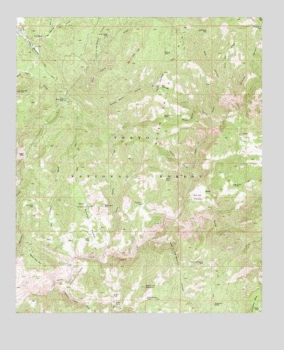
McDonald Mountain, AZ USGS Topographic Map
Click on map above to begin viewing in our Map Viewer.

This topographic map contains these locations and features:
Feature Name Type Latitude Longitude GNIS ID View Map
Agate MountainSummitN34.1920°W111.2462°25532View Map
Big CanyonValleyN34.2139°W111.1479°26247View Map
Blue Dog RidgeRidgeN34.2356°W111.1443°26504View Map
Brush Corral CanyonValleyN34.2086°W111.1512°26809View Map
Brush Corral TankReservoirN34.2084°W111.1758°26811View Map
Brushy Basin CanyonValleyN34.2100°W111.2057°26819View Map
Butte TankReservoirN34.2209°W111.1777°27089View Map
Cottonwood SpringSpringN34.1290°W111.1501°28043View Map
Cottonwood TankLocaleN34.1298°W111.1437°39385View Map
Cypress HillSummitN34.2186°W111.2485°28227View Map
Derrick CanyonValleyN34.1856°W111.1626°28429View Map
Derrick PocketBasinN34.1739°W111.1582°28430View Map
Dry Pocket TankReservoirN34.1702°W111.2416°28641View Map
Dry Pocket WashStreamN34.1461°W111.2226°28642View Map
Goswick CanyonValleyN34.2159°W111.1401°29428View Map
Green Valley CreekStreamN34.1478°W111.2046°29580View Map
Green Valley HillsRangeN34.2300°W111.1704°29581View Map
Green Valley TankReservoirN34.2427°W111.2040°29582View Map
Hellsgate WildernessReserveN34.1566°W111.1337°2035150View Map
Holding TankReservoirN34.2351°W111.1756°30056View Map
Hole in the Ground CanyonValleyN34.1559°W111.1829°30058View Map
Hole in the Ground CanyonValleyN34.2284°W111.2079°30059View Map
Hole in the Ground TankReservoirN34.1464°W111.1554°30060View Map
Houston PocketBasinN34.1625°W111.2132°30246View Map
Lion SpringSpringN34.2417°W111.2372°31019View Map
Lion Spring DrawValleyN34.2386°W111.2432°31021View Map
Lower CorralLocaleN34.1881°W111.1340°31344View Map
Lower Corral TankReservoirN34.2006°W111.1380°31347View Map
Lower Corral Tank Number TwoReservoirN34.1792°W111.1413°31348View Map
Martin TankReservoirN34.1819°W111.1749°31545View Map
McDonald MountainSummitN34.1362°W111.1851°31650View Map
McDonald Mountain TankReservoirN34.1314°W111.1843°31651View Map
McDonald PocketBasinN34.1409°W111.2193°31652View Map
Neal CabinLocaleN34.2209°W111.1771°32253View Map
Needed TankReservoirN34.1269°W111.1271°32263View Map
Number One DamDamN34.1353°W111.1401°39662View Map
Old Rock HouseLocaleN34.1700°W111.2146°32513View Map
Picket Pen TankReservoirN34.1714°W111.1864°32860View Map
Pocket SpringSpringN34.1291°W111.1998°33066View Map
Pocket TankReservoirN34.1326°W111.2012°33067View Map
Pocket TankReservoirN34.1560°W111.2133°33068View Map
Power Line TankReservoirN34.2159°W111.2265°33171View Map
Rim of Green ValleyRidgeN34.2353°W111.1901°33624View Map
Soldier Camp CreekStreamN34.1359°W111.2321°34615View Map
Spring CreekStreamN34.1648°W111.1699°34726View Map
Squaw Nest MountainSummitN34.1450°W111.2365°34776View Map
Star ValleyValleyN34.2373°W111.2432°34799View Map
Stewart CreekStreamN34.2259°W111.2437°34844View Map
Still Canyon TankReservoirN34.2444°W111.1538°34854View Map
Sweetwater TankReservoirN34.2463°W111.1264°35000View Map
The ButtesSummitN34.2267°W111.1751°35212View Map
Wolverton MountainSummitN34.1700°W111.2057°36357View Map

Note: Coordinates in the location and feature list above are referenced to NAD83 datum.


Copyright (C) 2008-2024 Ryan Niemi / Sunset Dynamics ... All Rights Reserved