TopoQuest Logo
Do you find TopoQuest useful?
Help keep TopoQuest running and adding new maps/features by donating!
Bitcoin:  19c7KJd3qBynnjoSw5npx9KScwjBe4ifkT
Litecoin:  LXs6TkuXGGXo1vDsWCkWVdjQX94eUKd6ui
Home View Maps Find Maps Find Places Resources & Links


Alameda, Kansas Topographic Map

USGS Map Title: Alameda, KS
USGS Map MRC: 37098E1
DRG (GeoTIFF) Download: o37098e1.tif


Neighboring USGS Topographic Map Quads:


  Kingman NW, KS  
37098F2
 

  Kingman, KS  
37098F1
 

  Waterloo, KS  
37097F8
 

  Cleveland, KS  
37098E2
 

  Alameda, KS  
37098E1
 

  Murdock, KS  
37097E8
 

  Spivey, KS  
37098D2
 

  Rago, KS  
37098D1
 

  Adams, KS  
37097D8


Map MRC Location:

N38°
W99°
N38°
W98°
H8 H7 H6 H5 H4 H3 H2 H1
G8 G7 G6 G5 G4 G3 G2 G1
F8 F7 F6 F5 F4 F3 F2 F1
E8 E7 E6 E5 E4 E3 E2 E1
D8 D7 D6 D5 D4 D3 D2 D1
C8 C7 C6 C5 C4 C3 C2 C1
B8 B7 B6 B5 B4 B3 B2 B1
A8 A7 A6 A5 A4 A3 A2 A1
N37°
W99°
N37°
W98°

Alameda, KS USGS 1:24K Topographic Map Preview:
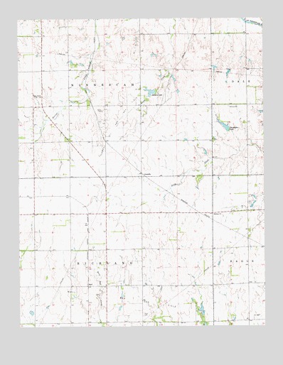
Alameda, KS USGS Topographic Map
Click on map above to begin viewing in our Map Viewer.

This topographic map contains these locations and features:
Feature Name Type Latitude Longitude GNIS ID View Map
AlamedaPopulated PlaceN37.5611°W98.0614°485468View Map
Alameda Oil and Gas FieldOilfieldN37.5833°W98.0753°485469View Map
BasilPopulated PlaceN37.5164°W98.0903°485466View Map
Basil Oil and Gas FieldOilfieldN37.5120°W98.0756°485465View Map
Bethany CemeteryCemeteryN37.5892°W98.0181°485472View Map
Bethany ChurchChurchN37.5453°W98.0262°485470View Map
Christopher LakeReservoirN37.5801°W98.0186°485471View Map
Clearwater School (historical)SchoolN37.5461°W98.0262°485484View Map
Coleman School (historical)SchoolN37.5806°W98.1003°485479View Map
Forest Home Grange HallBuildingN37.5931°W98.1142°485473View Map
Hawk School (historical)SchoolN37.5456°W98.0806°485481View Map
Hunt CemeteryCemeteryN37.5050°W98.0624°485467View Map
Johnson LakeReservoirN37.5951°W98.0569°485474View Map
Kingman Mennonite ChurchChurchN37.6224°W98.1114°2690243View Map
Mann LakeReservoirN37.6017°W98.0470°485485View Map
Rosedale School (historical)SchoolN37.5014°W98.0353°485483View Map
Township of RichlandCivilN37.5164°W98.0812°485459View Map
Trenton School (historical)SchoolN37.5020°W98.0815°485480View Map
Walnut Grove School (historical)SchoolN37.5900°W98.0626°485482View Map

Note: Coordinates in the location and feature list above are referenced to NAD83 datum.


Copyright (C) 2008-2025 Ryan Niemi / Sunset Dynamics ... All Rights Reserved