TopoQuest Logo
Do you find TopoQuest useful?
Help keep TopoQuest running and adding new maps/features by donating!
Bitcoin:  19c7KJd3qBynnjoSw5npx9KScwjBe4ifkT
Litecoin:  LXs6TkuXGGXo1vDsWCkWVdjQX94eUKd6ui
Home View Maps Find Maps Find Places Resources & Links


Calvin East, Oklahoma Topographic Map

USGS Map Title: Calvin East, OK
USGS Map MRC: 34096H2
DRG (GeoTIFF) Download: o34096h2.tif


Neighboring USGS Topographic Map Quads:


  Lake Holdenville, OK  
35096A3
 

  Lamar, OK  
35096A2
 

  Wetumka SE, OK  
35096A1
 

  Calvin West, OK  
34096H3
 

  Calvin East, OK  
34096H2
 

  Stuart, OK  
34096H1
 

  Gerty, OK  
34096G3
 

  Non, OK  
34096G2
 

  Ashland, OK  
34096G1


Map MRC Location:

N35°
W97°
N35°
W96°
H8 H7 H6 H5 H4 H3 H2 H1
G8 G7 G6 G5 G4 G3 G2 G1
F8 F7 F6 F5 F4 F3 F2 F1
E8 E7 E6 E5 E4 E3 E2 E1
D8 D7 D6 D5 D4 D3 D2 D1
C8 C7 C6 C5 C4 C3 C2 C1
B8 B7 B6 B5 B4 B3 B2 B1
A8 A7 A6 A5 A4 A3 A2 A1
N34°
W97°
N34°
W96°

Calvin East, OK USGS 1:24K Topographic Map Preview:
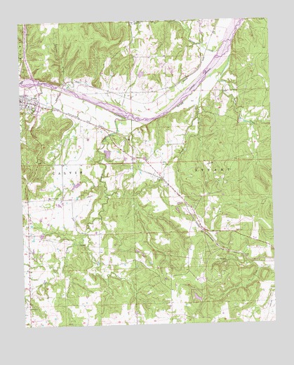
Calvin East, OK USGS Topographic Map
Click on map above to begin viewing in our Map Viewer.

This topographic map contains these locations and features:
Feature Name Type Latitude Longitude GNIS ID View Map
Blue Ridge CemeteryCemeteryN34.9279°W96.2314°1090291View Map
CalvinPopulated PlaceN34.9679°W96.2486°1090824View Map
Calvin Elementary SchoolSchoolN34.9659°W96.2459°1790585View Map
Calvin High SchoolSchoolN34.9661°W96.2466°1790281View Map
Gobbler CreekStreamN34.9851°W96.1444°1093224View Map
Hay CreekStreamN34.9737°W96.2358°1093613View Map
Hill Top CemeteryCemeteryN34.9336°W96.1844°2711585View Map
Hilltop ChurchChurchN34.9348°W96.1817°1093788View Map
Jointer CreekStreamN34.9729°W96.2264°1094253View Map
Lindley Robertson DamDamN34.9734°W96.1986°1754152View Map
Lindley Robertson ReservoirReservoirN34.9734°W96.1986°1754153View Map
Lobo Field (historical)AirportN34.9168°W96.2339°1102391View Map
Peach CreekStreamN34.9737°W96.1594°1096495View Map
Salt CreekStreamN34.9598°W96.1956°1097684View Map
Shawnee CreekStreamN34.9129°W96.2192°1097967View Map
South Hughes DivisionCivilN34.8773°W96.2433°1937863View Map
Spring CreekStreamN34.9937°W96.1442°1098395View Map
Spring Creek ChurchChurchN34.9998°W96.1908°1098432View Map
Stanley Huser DamDamN34.9518°W96.1869°1754170View Map
Stanley Huser ReservoirReservoirN34.9518°W96.1869°1754171View Map
Stony Point ChurchChurchN34.8829°W96.2478°1098566View Map
Stuart Mountain Airpark (historical)AirportN34.9165°W96.1300°1102683View Map
Township of CalvinCivilN34.8806°W96.2475°1824955View Map
Township of StuartCivilN34.8806°W96.1419°1824956View Map

Note: Coordinates in the location and feature list above are referenced to NAD83 datum.


Copyright (C) 2008-2025 Ryan Niemi / Sunset Dynamics ... All Rights Reserved