TopoQuest Logo
Do you find TopoQuest useful?
Help keep TopoQuest running and adding new maps/features by donating!
Bitcoin:  19c7KJd3qBynnjoSw5npx9KScwjBe4ifkT
Litecoin:  LXs6TkuXGGXo1vDsWCkWVdjQX94eUKd6ui
Home View Maps Find Maps Find Places Resources & Links


Cambria, Wyoming Topographic Map

USGS Map Title: Cambria, WY
USGS Map MRC: 43104H2
DRG (GeoTIFF) Download: o43104h2.tif


Neighboring USGS Topographic Map Quads:


  Skull Creek, WY  
44104A3
 

  Four Corners, WY  
44104A2
 

  Parmlee Canyon, WY  
44104A1
 

  Pedro, WY  
43104H3
 

  Cambria, WY  
43104H2
 

  Moon, SD  
43104H1
 

  Osage SE, WY  
43104G3
 

  Newcastle, WY  
43104G2
 

  Fanny Peak, WY  
43104G1


Map MRC Location:

N44°
W105°
N44°
W104°
H8 H7 H6 H5 H4 H3 H2 H1
G8 G7 G6 G5 G4 G3 G2 G1
F8 F7 F6 F5 F4 F3 F2 F1
E8 E7 E6 E5 E4 E3 E2 E1
D8 D7 D6 D5 D4 D3 D2 D1
C8 C7 C6 C5 C4 C3 C2 C1
B8 B7 B6 B5 B4 B3 B2 B1
A8 A7 A6 A5 A4 A3 A2 A1
N43°
W105°
N43°
W104°

Cambria, WY USGS 1:24K Topographic Map Preview:
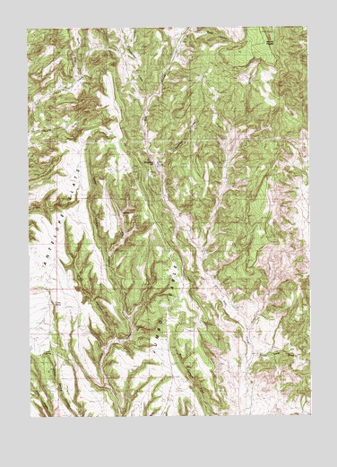
Cambria, WY USGS Topographic Map
Click on map above to begin viewing in our Map Viewer.

This topographic map contains these locations and features:
Feature Name Type Latitude Longitude GNIS ID View Map
Antelope FlatsFlatN43.9391°W104.2313°1584877View Map
Breakneck HillSummitN43.9561°W104.1941°1585891View Map
Cambria (historical)Populated PlaceN43.9404°W104.2091°1597243View Map
Cambria CemeteryCemeteryN43.9544°W104.2138°1586287View Map
Camp CanyonValleyN43.9272°W104.2152°1586297View Map
Cave SpringSpringN43.8953°W104.2435°1586472View Map
Deadman DrawValleyN43.9566°W104.1891°1587435View Map
Dry Gypp CanyonValleyN43.9989°W104.1766°1587851View Map
Feralla DrawValleyN43.9675°W104.2469°1588420View Map
Flying V RanchLocaleN43.9544°W104.1922°1588599View Map
Grant CanyonValleyN43.9000°W104.2136°1589048View Map
Gypsum DrawValleyN43.9028°W104.1533°1589207View Map
Jumbo TableSummitN43.9103°W104.1883°1590248View Map
Mount PisgahSummitN43.9947°W104.1433°1602196View Map
North DrawValleyN43.9850°W104.2283°1601739View Map
Salt SpringSpringN43.9783°W104.1919°1593815View Map
South Table DrawValleyN43.8944°W104.1499°1603202View Map
Sweetwater CreekStreamN43.9775°W104.1958°1603481View Map

Note: Coordinates in the location and feature list above are referenced to NAD83 datum.


Copyright (C) 2008-2025 Ryan Niemi / Sunset Dynamics ... All Rights Reserved