TopoQuest Logo
Do you find TopoQuest useful?
Help keep TopoQuest running and adding new maps/features by donating!
Bitcoin:  19c7KJd3qBynnjoSw5npx9KScwjBe4ifkT
Litecoin:  LXs6TkuXGGXo1vDsWCkWVdjQX94eUKd6ui
Home View Maps Find Maps Find Places Resources & Links


Cameron, Montana Topographic Map

USGS Map Title: Cameron, MT
USGS Map MRC: 45111B6
DRG (GeoTIFF) Download: o45111b6.tif


Neighboring USGS Topographic Map Quads:


  Eightmile Creek, MT  
45111C7
 

  Ennis, MT  
45111C6
 

  Fan Mountain, MT  
45111C5
 

  Varney, MT  
45111B7
 

  Cameron, MT  
45111B6
 

  Lake Cameron, MT  
45111B5
 

  Broomtail Ridge, MT  
45111A7
 

  Bucks Nest, MT  
45111A6
 

  No Man Peak, MT  
45111A5


Map MRC Location:

N46°
W112°
N46°
W111°
H8 H7 H6 H5 H4 H3 H2 H1
G8 G7 G6 G5 G4 G3 G2 G1
F8 F7 F6 F5 F4 F3 F2 F1
E8 E7 E6 E5 E4 E3 E2 E1
D8 D7 D6 D5 D4 D3 D2 D1
C8 C7 C6 C5 C4 C3 C2 C1
B8 B7 B6 B5 B4 B3 B2 B1
A8 A7 A6 A5 A4 A3 A2 A1
N45°
W112°
N45°
W111°

Cameron, MT USGS 1:24K Topographic Map Preview:
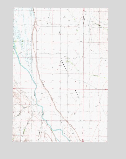
Cameron, MT USGS Topographic Map
Click on map above to begin viewing in our Map Viewer.

This topographic map contains these locations and features:
Feature Name Type Latitude Longitude GNIS ID View Map
07S01W12DBBC01 WellWellN45.2385°W111.6686°808540View Map
07S01W23ABBA01 WellWellN45.2177°W111.6875°808470View Map
07S01W26AAAA01 WellWellN45.2024°W111.6797°808408View Map
07S01W34AAC_01 WellWellN45.1860°W111.7039°808353View Map
Burger DitchCanalN45.2410°W111.6577°780613View Map
CameronPopulated PlaceN45.2033°W111.6786°806907View Map
Cameron BenchBenchN45.1719°W111.6486°780820View Map
Cameron Post OfficePost OfficeN45.2023°W111.6792°1797561View Map
Cameron School (historical)SchoolN45.2033°W111.6786°1797562View Map
Cameron Store and CabinsLocaleN45.2033°W111.6786°1797663View Map
Cherry CreekStreamN45.1455°W111.7100°793853View Map
Cherry GulchValleyN45.1438°W111.7111°781196View Map
Cramer DitchCanalN45.1569°W111.6783°781839View Map
Granger DitchCanalN45.1769°W111.7100°784155View Map
Indian Creek DitchCanalN45.1952°W111.6900°784909View Map
Kremer DitchCanalN45.2038°W111.7002°793864View Map
Mill CreekStreamN45.2416°W111.6716°787357View Map
Morgan GulchValleyN45.1594°W111.7261°787681View Map
Shewmaker DitchCanalN45.1730°W111.7341°790412View Map
Sunrise GulchValleyN45.1485°W111.7278°791704View Map
Varney Bridge Recreation SiteLocaleN45.2285°W111.7494°801856View Map

Note: Coordinates in the location and feature list above are referenced to NAD83 datum.


Copyright (C) 2008-2025 Ryan Niemi / Sunset Dynamics ... All Rights Reserved