TopoQuest Logo
Do you find TopoQuest useful?
Help keep TopoQuest running and adding new maps/features by donating!
Bitcoin:  19c7KJd3qBynnjoSw5npx9KScwjBe4ifkT
Litecoin:  LXs6TkuXGGXo1vDsWCkWVdjQX94eUKd6ui
Home View Maps Find Maps Find Places Resources & Links


Aberdeen Gardens, Washington Topographic Map

USGS Map Title: Aberdeen Gardens, WA
USGS Map MRC: 47123A7
DRG (GeoTIFF) Download: o47123a7.tif


Neighboring USGS Topographic Map Quads:


  Humptulips, WA  
47123B8
 

  Railroad Camp, WA  
47123B7
 

  Wynoochee Valley NW, WA  
47123B6
 

  New London, WA  
47123A8
 

  Aberdeen Gardens, WA  
47123A7
 

  Wynoochee Valley SW, WA  
47123A6
 

  Hoquiam, WA  
46123H8
 

  Aberdeen, WA  
46123H7
 

  Central Park, WA  
46123H6


Map MRC Location:

N48°
W124°
N48°
W123°
H8 H7 H6 H5 H4 H3 H2 H1
G8 G7 G6 G5 G4 G3 G2 G1
F8 F7 F6 F5 F4 F3 F2 F1
E8 E7 E6 E5 E4 E3 E2 E1
D8 D7 D6 D5 D4 D3 D2 D1
C8 C7 C6 C5 C4 C3 C2 C1
B8 B7 B6 B5 B4 B3 B2 B1
A8 A7 A6 A5 A4 A3 A2 A1
N47°
W124°
N47°
W123°

Aberdeen Gardens, WA USGS 1:24K Topographic Map Preview:
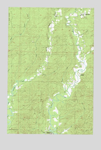
Aberdeen Gardens, WA USGS Topographic Map
Click on map above to begin viewing in our Map Viewer.

This topographic map contains these locations and features:
Feature Name Type Latitude Longitude GNIS ID View Map
Aberdeen GardensLocaleN47.0590°W123.7713°1502927View Map
Aberdeen GardensPopulated PlaceN47.0626°W123.7796°1852935View Map
Aberdeen Gardens Census Designated PlaceCensusN47.0586°W123.7792°2407691View Map
Bear GulchValleyN47.0198°W123.7668°1503235View Map
Berry CreekStreamN47.0065°W123.8329°1503321View Map
Berryman CreekStreamN47.0568°W123.8354°1503325View Map
East Fork Wishkah RiverStreamN47.0726°W123.7677°1519133View Map
Grays Harbor Fire District 10 Station 3 Aberdeen GardensBuildingN47.0497°W123.7919°2619652View Map
Grays Harbor Fire District 10 Wishkah Fire Department Station 1BuildingN47.1185°W123.7688°2643293View Map
Grays Harbor Fire District 10 Wishkah Fire Department Station 2BuildingN47.1077°W123.8129°2619697View Map
Hamilton CanyonValleyN47.0976°W123.7727°1505359View Map
Lytle CreekStreamN47.0529°W123.8541°1506399View Map
Lytle LandingLocaleN47.0523°W123.8596°1509998View Map
NissonPopulated PlaceN47.1159°W123.8091°1513021View Map
West Fork Wishkah RiverStreamN47.1229°W123.7779°1527986View Map
WishkahPopulated PlaceN47.1179°W123.7721°1534112View Map
Wishkah Pipeline (historical)LocaleN47.0912°W123.7660°1533267View Map
Wishkah River Ranch AirportAirportN47.0850°W123.7726°1533653View Map
Wishkah Valley Elementary - High SchoolSchoolN47.1174°W123.7710°1531197View Map
Wyman CreekStreamN47.0429°W123.7891°1509641View Map

Note: Coordinates in the location and feature list above are referenced to NAD83 datum.


Copyright (C) 2008-2025 Ryan Niemi / Sunset Dynamics ... All Rights Reserved