TopoQuest Logo
Do you find TopoQuest useful?
Help keep TopoQuest running and adding new maps/features by donating!
Bitcoin:  19c7KJd3qBynnjoSw5npx9KScwjBe4ifkT
Litecoin:  LXs6TkuXGGXo1vDsWCkWVdjQX94eUKd6ui
Home View Maps Find Maps Find Places Resources & Links


New London, Washington Topographic Map

USGS Map Title: New London, WA
USGS Map MRC: 47123A8
DRG (GeoTIFF) Download: o47123a8.tif


Neighboring USGS Topographic Map Quads:


  Carlisle, WA  
47124B1
 

  Humptulips, WA  
47123B8
 

  Railroad Camp, WA  
47123B7
 

  Copalis Crossing, WA  
47124A1
 

  New London, WA  
47123A8
 

  Aberdeen Gardens, WA  
47123A7
 

  Westport, WA  
46124H1
 

  Hoquiam, WA  
46123H8
 

  Aberdeen, WA  
46123H7


Map MRC Location:

N48°
W124°
N48°
W123°
H8 H7 H6 H5 H4 H3 H2 H1
G8 G7 G6 G5 G4 G3 G2 G1
F8 F7 F6 F5 F4 F3 F2 F1
E8 E7 E6 E5 E4 E3 E2 E1
D8 D7 D6 D5 D4 D3 D2 D1
C8 C7 C6 C5 C4 C3 C2 C1
B8 B7 B6 B5 B4 B3 B2 B1
A8 A7 A6 A5 A4 A3 A2 A1
N47°
W124°
N47°
W123°

New London, WA USGS 1:24K Topographic Map Preview:
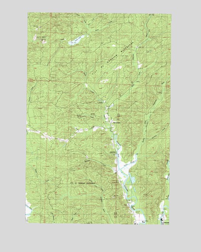
New London, WA USGS Topographic Map
Click on map above to begin viewing in our Map Viewer.

This topographic map contains these locations and features:
Feature Name Type Latitude Longitude GNIS ID View Map
Bernard CreekStreamN47.0323°W123.9196°1503318View Map
Davis CreekStreamN47.0670°W123.9329°1504339View Map
Davis Creek DamDamN47.0715°W123.9329°1532644View Map
Deep Creek LookoutLocaleN47.1170°W123.9752°1504393View Map
Failor LakeReservoirN47.1082°W123.9589°1532078View Map
Failor LakeReservoirN47.0715°W123.9652°1513005View Map
Failor Lake DamDamN47.1065°W123.9629°1532077View Map
Grays Harbor Fire District 6BuildingN47.0066°W123.9081°2643271View Map
Hooner CreekStreamN47.0618°W123.9341°1505594View Map
Hoquiam Water WorksReservoirN47.0729°W123.9368°1513128View Map
Junction CreekStreamN47.0509°W123.8979°1505882View Map
Middle Fork Hoquiam RiverStreamN47.0323°W123.9199°1523070View Map
Nelson CreekStreamN47.1137°W123.9479°1523616View Map
New LondonPopulated PlaceN47.0573°W123.9271°1506964View Map
PolsonLocaleN47.0273°W123.9221°1510608View Map
Polson CreekStreamN47.0573°W123.9271°1507557View Map
Polson SloughStreamN47.0320°W123.9193°1507558View Map
Shaw CreekStreamN47.1143°W123.9474°1525622View Map
West Fork Hoquiam RiverStreamN47.0323°W123.9193°1527951View Map
WoodlawnPopulated PlaceN47.0006°W123.8810°1511439View Map

Note: Coordinates in the location and feature list above are referenced to NAD83 datum.


Copyright (C) 2008-2024 Ryan Niemi / Sunset Dynamics ... All Rights Reserved