TopoQuest Logo
Do you find TopoQuest useful?
Help keep TopoQuest running and adding new maps/features by donating!
Bitcoin:  19c7KJd3qBynnjoSw5npx9KScwjBe4ifkT
Litecoin:  LXs6TkuXGGXo1vDsWCkWVdjQX94eUKd6ui
Home View Maps Find Maps Find Places Resources & Links


Barren Mountain East, Maine Topographic Map

USGS Map Title: Barren Mountain East, ME
USGS Map MRC: 45069D3
DRG (GeoTIFF) Download: o45069d3.tif


Neighboring USGS Topographic Map Quads:


  Number Four Mountain, ME  
45069E4
 

  Hay Mountain, ME  
45069E3
 

  Big Shanty Mountain, ME  
45069E2
 

  Barren Mountain West, ME  
45069D4
 

  Barren Mountain East, ME  
45069D3
 

  Silver Lake, ME  
45069D2
 

  Monson East, ME  
45069C4
 

  Sebec Lake West, ME  
45069C3
 

  Sebec Lake East, ME  
45069C2


Map MRC Location:

N46°
W70°
N46°
W69°
H8 H7 H6 H5 H4 H3 H2 H1
G8 G7 G6 G5 G4 G3 G2 G1
F8 F7 F6 F5 F4 F3 F2 F1
E8 E7 E6 E5 E4 E3 E2 E1
D8 D7 D6 D5 D4 D3 D2 D1
C8 C7 C6 C5 C4 C3 C2 C1
B8 B7 B6 B5 B4 B3 B2 B1
A8 A7 A6 A5 A4 A3 A2 A1
N45°
W70°
N45°
W69°

Barren Mountain East, ME USGS 1:24K Topographic Map Preview:
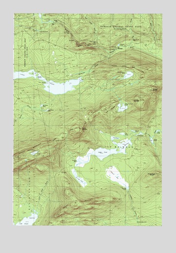
Barren Mountain East, ME USGS Topographic Map
Click on map above to begin viewing in our Map Viewer.

This topographic map contains these locations and features:
Feature Name Type Latitude Longitude GNIS ID View Map
Barren MountainSummitN45.4157°W69.3705°561639View Map
Barren Mountain Lookout TowerTowerN45.4159°W69.3703°1910010View Map
Bear BrookStreamN45.4950°W69.3412°561827View Map
Beaver PondLakeN45.4309°W69.2741°561949View Map
Benson MountainSummitN45.3885°W69.3090°562067View Map
Big Wilder PondLakeN45.4457°W69.3512°562246View Map
Billings FallsFallsN45.4945°W69.3389°578859View Map
Boot PondLakeN45.4266°W69.2891°562754View Map
Buttermilk FallsFallsN45.4889°W69.3259°579005View Map
Camp PondLakeN45.4291°W69.2687°563412View Map
Caribou BogSwampN45.4037°W69.2900°563514View Map
Chairback MountainSummitN45.4564°W69.2561°563796View Map
Cloud PondLakeN45.4178°W69.3572°564112View Map
Cloud Pond BrookStreamN45.3842°W69.3587°564113View Map
Columbus MountainSummitN45.4492°W69.2686°564254View Map
Dam PondLakeN45.4220°W69.2814°564750View Map
Duck CoveBayN45.3795°W69.3598°565333View Map
East Chairback PondLakeN45.4638°W69.2787°565593View Map
First NarrowsChannelN45.4598°W69.3501°566183View Map
Fourth MountainSummitN45.4325°W69.3194°566488View Map
Gulf Hagas BrookStreamN45.4803°W69.3042°567372View Map
Gulf Hagas TrailTrailN45.4925°W69.3317°567374View Map
Hammond Street PitchSlopeN45.4825°W69.3148°579007View Map
Hay BrookStreamN45.4812°W69.2764°567789View Map
Hays Brook FallsFallsN45.4853°W69.2745°579008View Map
Henderson BrookStreamN45.4784°W69.2923°567937View Map
Indian PondLakeN45.4193°W69.2928°568601View Map
Little Wilder PondLakeN45.4426°W69.3475°570102View Map
Lost PondLakeN45.4293°W69.2834°570406View Map
Lower DeadwaterLakeN45.4900°W69.3592°570486View Map
Lucia PondLakeN45.4027°W69.3198°570571View Map
Mud PondLakeN45.4312°W69.2538°571920View Map
Pugwash PondLakeN45.4814°W69.2867°573876View Map
Rays Mill PondLakeN45.3973°W69.2785°574063View Map
Roaring Brook MountainSummitN45.4056°W69.2541°574279View Map
Sampson PondLakeN45.4133°W69.3169°574809View Map
Screw Auger FallsFallsN45.4845°W69.3064°575067View Map
Second NarrowsLakeN45.4560°W69.3330°575205View Map
South PondLakeN45.4256°W69.2585°575890View Map
Stair FallsFallsN45.4942°W69.3445°576231View Map
T7 R9 NWPCivilN45.4287°W69.2870°2748761View Map
The HermitageLocaleN45.4784°W69.2834°576820View Map
The Hermitage PreserveParkN45.4800°W69.2870°1910194View Map
The JawsCliffN45.4834°W69.3226°579006View Map
The NotchGapN45.4070°W69.3370°576875View Map
Third MountainSummitN45.4448°W69.2938°576963View Map
West Chairback PondLakeN45.4446°W69.2836°578119View Map

Note: Coordinates in the location and feature list above are referenced to NAD83 datum.


Copyright (C) 2008-2024 Ryan Niemi / Sunset Dynamics ... All Rights Reserved