TopoQuest Logo
Do you find TopoQuest useful?
Help keep TopoQuest running and adding new maps/features by donating!
Bitcoin:  19c7KJd3qBynnjoSw5npx9KScwjBe4ifkT
Litecoin:  LXs6TkuXGGXo1vDsWCkWVdjQX94eUKd6ui
Home View Maps Find Maps Find Places Resources & Links


Camp Meeker, California Topographic Map

USGS Map Title: Camp Meeker, CA
USGS Map MRC: 38122D8
DRG (GeoTIFF) Download: o38122d8.tif


Neighboring USGS Topographic Map Quads:


  Cazadero, CA  
38123E1
 

  Guerneville, CA  
38122E8
 

  Healdsburg, CA  
38122E7
 

  Duncans Mills, CA  
38123D1
 

  Camp Meeker, CA  
38122D8
 

  Sebastopol, CA  
38122D7
 

  Bodega Head, CA  
38123C1
 

  Valley Ford, CA  
38122C8
 

  Two Rock, CA  
38122C7


Map MRC Location:

N39°
W123°
N39°
W122°
H8 H7 H6 H5 H4 H3 H2 H1
G8 G7 G6 G5 G4 G3 G2 G1
F8 F7 F6 F5 F4 F3 F2 F1
E8 E7 E6 E5 E4 E3 E2 E1
D8 D7 D6 D5 D4 D3 D2 D1
C8 C7 C6 C5 C4 C3 C2 C1
B8 B7 B6 B5 B4 B3 B2 B1
A8 A7 A6 A5 A4 A3 A2 A1
N38°
W123°
N38°
W122°

Camp Meeker, CA USGS 1:24K Topographic Map Preview:
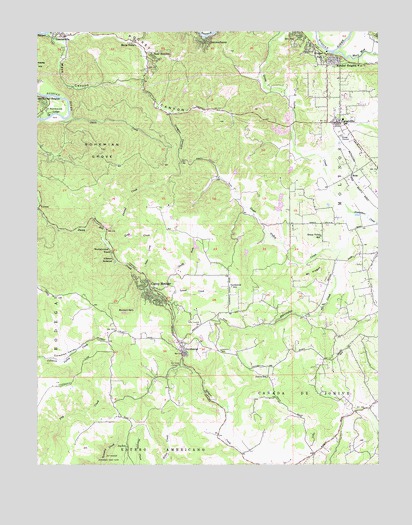
Camp Meeker, CA USGS Topographic Map
Click on map above to begin viewing in our Map Viewer.

This topographic map contains these locations and features:
Feature Name Type Latitude Longitude GNIS ID View Map
Alder CreekStreamN38.4302°W122.9631°218087View Map
Alliance RedwoodPopulated PlaceN38.4338°W122.9731°1657916View Map
Atascadero CreekStreamN38.4482°W122.8869°218443View Map
Azalea 2420 DamDamN38.4366°W122.9444°1664364View Map
Baumert SpringsSpringN38.4193°W122.9658°218745View Map
Blue Rock QuarryMineN38.4717°W122.9139°2675038View Map
Bohemian GroveWoodsN38.4655°W122.9775°219592View Map
Camp MeekerPopulated PlaceN38.4252°W122.9594°1658200View Map
Camp Meeker Post OfficePost OfficeN38.4249°W122.9587°1799296View Map
Camp Meeker Volunteer Fire DepartmentBuildingN38.4247°W122.9576°2624120View Map
Canyon Rock QuarryMineN38.4750°W122.9108°2675140View Map
Coleman ValleyValleyN38.4057°W122.9986°221372View Map
Coleman Valley School (historical)SchoolN38.4102°W122.9836°1701309View Map
Department of Forestry and Fire Protection Occidental StationBuildingN38.4154°W122.9415°2624221View Map
Druids Occidental CemeteryCemeteryN38.4099°W122.9422°1989435View Map
Duvoul CreekStreamN38.4430°W122.9761°222785View Map
El Molino High SchoolSchoolN38.4817°W122.8889°223045View Map
Forestview CemeteryCemeteryN38.4682°W122.8833°1989440View Map
ForestvillePopulated PlaceN38.4735°W122.8903°1658564View Map
Forestville AcademySchoolN38.4732°W122.8878°2517893View Map
Forestville Branch Sonoma County LibraryBuildingN38.4741°W122.8911°1799339View Map
Forestville Census Designated PlaceCensusN38.4825°W122.8899°2408230View Map
Forestville Christian Fellowship Baptist ChurchChurchN38.4744°W122.8903°1799340View Map
Forestville Elementary SchoolSchoolN38.4733°W122.8881°1799341View Map
Forestville Fire Protection DistrictBuildingN38.4752°W122.8954°2624641View Map
Forestville Post OfficePost OfficeN38.4740°W122.8962°1799342View Map
Forestville United Methodist ChurchChurchN38.4744°W122.8897°1799343View Map
Forestville Youth ParkParkN38.4799°W122.8939°1799344View Map
Gabriel FarmsLocaleN38.4378°W122.8803°2708000View Map
Gilliam CemeteryCemeteryN38.4313°W122.8811°1989442View Map
Grab CreekStreamN38.4385°W122.9753°224370View Map
Green Valley CemeteryCemeteryN38.4421°W122.8864°1989443View Map
Green Valley SchoolSchoolN38.4407°W122.8972°224581View Map
Harbine (historical)Populated PlaceN38.4646°W122.8861°1701311View Map
Harmony Elementary SchoolSchoolN38.3898°W122.9310°224947View Map
Ilo FarmLocaleN38.4603°W122.8814°2707999View Map
Jonive SchoolSchoolN38.4002°W122.9169°226345View Map
Joy SchoolSchoolN38.3799°W122.9681°226359View Map
Lacresta (historical)Populated PlaceN38.4557°W122.8842°1701314View Map
Lake Helen 3425 DamDamN38.4466°W122.9128°1664384View Map
Lancel CreekStreamN38.4216°W122.9531°226842View Map
Mark West CreekStreamN38.4938°W122.8930°228118View Map
Mays CanyonValleyN38.4963°W122.9914°228268View Map
Mirabel HeightsPopulated PlaceN38.4905°W122.8905°1659142View Map
Mirabel ParkPopulated PlaceN38.4932°W122.8958°1659143View Map
Monte Rio Post OfficePost OfficeN38.4774°W122.9978°1799307View Map
Mount PisgahSummitN38.4288°W122.9036°1659399View Map
Mountain View School (historical)SchoolN38.4760°W122.9525°1701318View Map
Noel HeightsPopulated PlaceN38.4938°W122.9622°1659241View Map
Nonesuch SchoolSchoolN38.4363°W122.9117°2517997View Map
North Fork Lancel CreekStreamN38.4246°W122.9506°229689View Map
Northwood Golf CourseLocaleN38.4788°W122.9942°1799308View Map
Northwood HeightsPopulated PlaceN38.4796°W122.9994°1659256View Map
Northwood LodgePopulated PlaceN38.4771°W122.9978°1659257View Map
Nuevo Leon High SchoolSchoolN38.4811°W122.8885°2517871View Map
OccidentalPopulated PlaceN38.4074°W122.9483°277568View Map
Occidental Branch Sonoma County LibraryBuildingN38.4063°W122.9475°1799380View Map
Occidental Census Designated PlaceCensusN38.4004°W122.9350°2408971View Map
Occidental Community ChurchChurchN38.4069°W122.9467°1799381View Map
Occidental Fire DepartmentBuildingN38.4095°W122.9482°2624283View Map
Occidental Post OfficePost OfficeN38.4091°W122.9482°1799382View Map
Occidental SchoolSchoolN38.4263°W122.9303°229919View Map
Oregon CanyonValleyN38.4760°W122.9531°230082View Map
Pocket CanyonValleyN38.4988°W122.9889°230836View Map
Purrington CreekStreamN38.4371°W122.8903°231100View Map
Redwood Hill FarmLocaleN38.4547°W122.9017°2708002View Map
Rio DellPopulated PlaceN38.4991°W122.9072°1659789View Map
RossPopulated PlaceN38.4585°W122.8858°1659545View Map
Russian River Christian AcademySchoolN38.4379°W122.9756°2518013View Map
Salmon Creek Middle SchoolSchoolN38.3894°W122.9307°2517980View Map
Santa NellaPopulated PlaceN38.4971°W122.9667°232555View Map
Sebastopol Indian Rancheria (historical)CivilN38.4146°W122.8803°1799404View Map
Smith CreekStreamN38.4746°W122.9917°233315View Map
Summerhome ParkPopulated PlaceN38.4966°W122.9394°1659913View Map
Topolos VineyardsLocaleN38.4646°W122.8825°1799414View Map
Westminster WoodsLocaleN38.4363°W122.9742°237557View Map
Williams (historical)Populated PlaceN38.4505°W122.8789°1701321View Map

Note: Coordinates in the location and feature list above are referenced to NAD83 datum.


Copyright (C) 2008-2025 Ryan Niemi / Sunset Dynamics ... All Rights Reserved