TopoQuest Logo
Do you find TopoQuest useful?
Help keep TopoQuest running and adding new maps/features by donating!
Bitcoin:  19c7KJd3qBynnjoSw5npx9KScwjBe4ifkT
Litecoin:  LXs6TkuXGGXo1vDsWCkWVdjQX94eUKd6ui
Home View Maps Find Maps Find Places Resources & Links


Bonsall, California Topographic Map

USGS Map Title: Bonsall, CA
USGS Map MRC: 33117C2
DRG (GeoTIFF) Download: o33117c2.tif


Neighboring USGS Topographic Map Quads:


  Fallbrook, CA  
33117D3
 

  Temecula, CA  
33117D2
 

  Pechanga, CA  
33117D1
 

  Morro Hill, CA  
33117C3
 

  Bonsall, CA  
33117C2
 

  Pala, CA  
33117C1
 

  San Luis Rey, CA  
33117B3
 

  San Marcos, CA  
33117B2
 

  Valley Center, CA  
33117B1


Map MRC Location:

N34°
W118°
N34°
W117°
H8 H7 H6 H5 H4 H3 H2 H1
G8 G7 G6 G5 G4 G3 G2 G1
F8 F7 F6 F5 F4 F3 F2 F1
E8 E7 E6 E5 E4 E3 E2 E1
D8 D7 D6 D5 D4 D3 D2 D1
C8 C7 C6 C5 C4 C3 C2 C1
B8 B7 B6 B5 B4 B3 B2 B1
A8 A7 A6 A5 A4 A3 A2 A1
N33°
W118°
N33°
W117°

Bonsall, CA USGS 1:24K Topographic Map Preview:
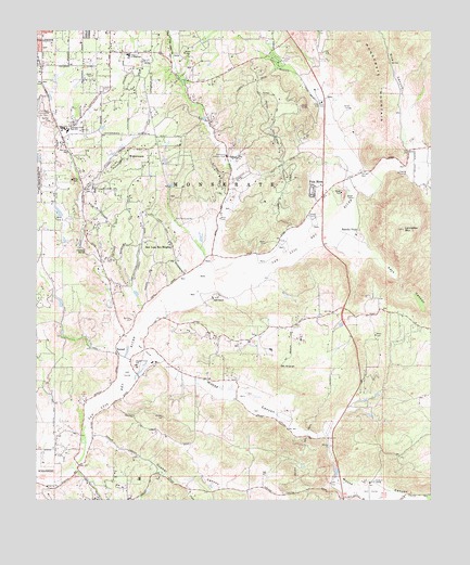
Bonsall, CA USGS Topographic Map
Click on map above to begin viewing in our Map Viewer.

This topographic map contains these locations and features:
Feature Name Type Latitude Longitude GNIS ID View Map
Adler CreekStreamN33.3153°W117.1942°2071417View Map
All Seasons Recreational Vehicle Park and CampgroundLocaleN33.2559°W117.1550°1868354View Map
Beck GroveLocaleN33.3664°W117.1906°2712770View Map
BonsallPopulated PlaceN33.2889°W117.2256°1660358View Map
Bonsall Census Designated PlaceCensusN33.2762°W117.1942°2407884View Map
Bonsall Chamber of CommerceBuildingN33.2964°W117.2203°1868356View Map
Bonsall Middle SchoolSchoolN33.2850°W117.2189°1868358View Map
Bonsall Post OfficePost OfficeN33.2906°W117.2267°2769534View Map
Bonsall PreserveParkN33.2967°W117.2253°1868359View Map
Bonsall Primary Elementary SchoolSchoolN33.2859°W117.2198°239566View Map
CAL FIRE Deer Springs Fire Station 1BuildingN33.2548°W117.1534°2665040View Map
CAL Fire Miller Station #15BuildingN33.2993°W117.1362°2664886View Map
Christ the King Lutheran ChurchChurchN33.3575°W117.2317°1868364View Map
Circle R Golf ResortLocaleN33.2525°W117.1442°1868367View Map
Circle R RanchLocaleN33.2553°W117.1442°240633View Map
Community Baptist ChurchChurchN33.3703°W117.2281°1868369View Map
Couser CanyonValleyN33.3373°W117.1300°270637View Map
Dinwiddie PreserveParkN33.3567°W117.2306°1868373View Map
Duffy Ranch (historical)LocaleN33.3678°W117.1761°1703665View Map
Dulin RanchLocaleN33.3039°W117.1956°241664View Map
Fallbrook Assembly of God ChurchChurchN33.3698°W117.2150°1868374View Map
Fallbrook Census Designated PlaceCensusN33.3693°W117.2259°2408113View Map
Fallbrook Country ClubLocaleN33.3417°W117.1917°1654635View Map
Fallbrook High SchoolSchoolN33.3489°W117.2414°242157View Map
Fallbrook Presbyterian ChurchChurchN33.3745°W117.2292°1868387View Map
Fallbrook Tennis ClubLocaleN33.3525°W117.2475°1868388View Map
Gird Pumping StationLocaleN33.3245°W117.2073°1654648View Map
Gopher CanyonValleyN33.2659°W117.2336°242856View Map
Hellers BendBendN33.3167°W117.2364°243345View Map
Interchange 41CrossingN33.2528°W117.1559°2457026View Map
Interchange 43CrossingN33.2862°W117.1494°2457029View Map
Interchange 46CrossingN33.3311°W117.1592°2457033View Map
Ivy High SchoolSchoolN33.3506°W117.2367°1868394View Map
John Culbertson WineryLocaleN33.3445°W117.2053°1868395View Map
Keys CanyonValleyN33.3192°W117.1603°271887View Map
Keys CreekStreamN33.3189°W117.1656°271888View Map
Lancaster MountainSummitN33.3223°W117.1345°244561View Map
Live Oak Elementary SchoolSchoolN33.3700°W117.2206°1868399View Map
Live Oak ParkParkN33.3609°W117.2067°244969View Map
Los Jilgueros PreserveParkN33.3586°W117.2461°1868401View Map
McManigle GroveLocaleN33.3589°W117.1978°2712772View Map
MonserateCivilN33.3314°W117.1911°246099View Map
Monserate MountainSummitN33.3723°W117.1486°246100View Map
Moosa CanyonValleyN33.2853°W117.2170°272549View Map
Mount AraratSummitN33.2856°W117.1748°238672View Map
North County Fire Protection District Station 2BuildingN33.3449°W117.2132°1868380View Map
North County Fire Protection District Station 4BuildingN33.3408°W117.1607°2664869View Map
North County Fire Protection District Station 5BuildingN33.2898°W117.2272°1868357View Map
Pala MesaPopulated PlaceN33.3323°W117.1636°1661175View Map
Pala Mesa Golf ClubLocaleN33.3561°W117.1609°1654755View Map
Palomar School (historical)SchoolN33.2550°W117.1467°1703674View Map
Palomares House and ParkParkN33.3584°W117.2306°1868410View Map
Potter Junior High SchoolSchoolN33.3684°W117.2220°247746View Map
Rancho Monserate Country ClubLocaleN33.3209°W117.1653°1868414View Map
Rancho ViejoLocaleN33.3211°W117.1498°247976View Map
Rawhide Christian SchoolSchoolN33.2667°W117.2298°1868415View Map
Rice CanyonValleyN33.3436°W117.1328°248160View Map
River Village San Luis Rey Shopping CenterLocaleN33.2948°W117.2225°1868419View Map
San Diego County Sheriff's Department Bonsall Storefront OfficeBuildingN33.2955°W117.2218°2756594View Map
San Luis Rey Down Thoroughbred Training CenterLocaleN33.2889°W117.2081°1868427View Map
San Luis Rey Downs Country ClubLocaleN33.2898°W117.2161°1868425View Map
San Luis Rey Downs Golf ResortLocaleN33.2836°W117.2220°1868426View Map
San Luis Rey HeightsPopulated PlaceN33.3189°W117.2092°1661387View Map
San Luis Rey Race TrackLocaleN33.2889°W117.2092°1868428View Map
South Fork Gopher CanyonValleyN33.2539°W117.2045°249703View Map
Sullivan Middle SchoolSchoolN33.2964°W117.1725°1868431View Map
The Church of Jesus Christ of Latter Day SaintsChurchN33.3717°W117.2275°1868366View Map
United Methodist Church of FallbrookChurchN33.3475°W117.2153°1868432View Map
Vista Paloma Riders Rodeo ArenaLocaleN33.2667°W117.2320°1868435View Map
West Lilac BridgeBridgeN33.3011°W117.1534°1868436View Map
WinterwarmPopulated PlaceN33.3409°W117.2223°1661704View Map

Note: Coordinates in the location and feature list above are referenced to NAD83 datum.


Copyright (C) 2008-2024 Ryan Niemi / Sunset Dynamics ... All Rights Reserved