TopoQuest Logo
Do you find TopoQuest useful?
Help keep TopoQuest running and adding new maps/features by donating!
Bitcoin:  19c7KJd3qBynnjoSw5npx9KScwjBe4ifkT
Litecoin:  LXs6TkuXGGXo1vDsWCkWVdjQX94eUKd6ui
Home View Maps Find Maps Find Places Resources & Links


Buckeye Lake, Michigan Topographic Map

USGS Map Title: Buckeye Lake, MI
USGS Map MRC: 46085D6
DRG (GeoTIFF) Download: o46085d6.tif


Neighboring USGS Topographic Map Quads:


  Grand Marais SE, MI  
46085E7
 

  Muskallonge Lake SW, MI  
46085E6
 

  Muskallonge Lake SE, MI  
46085E5
 

  Tahquamenon Lakes, MI  
46085D7
 

  Buckeye Lake, MI  
46085D6
 

  Auger Lake, MI  
46085D5
 

  Hardwood Island, MI  
46085C7
 

  McMillan, MI  
46085C6
 

  Newberry, MI  
46085C5


Map MRC Location:

N47°
W86°
N47°
W85°
H8 H7 H6 H5 H4 H3 H2 H1
G8 G7 G6 G5 G4 G3 G2 G1
F8 F7 F6 F5 F4 F3 F2 F1
E8 E7 E6 E5 E4 E3 E2 E1
D8 D7 D6 D5 D4 D3 D2 D1
C8 C7 C6 C5 C4 C3 C2 C1
B8 B7 B6 B5 B4 B3 B2 B1
A8 A7 A6 A5 A4 A3 A2 A1
N46°
W86°
N46°
W85°

Buckeye Lake, MI USGS 1:24K Topographic Map Preview:
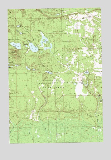
Buckeye Lake, MI USGS Topographic Map
Click on map above to begin viewing in our Map Viewer.

This topographic map contains these locations and features:
Feature Name Type Latitude Longitude GNIS ID View Map
Bass LakeLakeN46.4637°W85.7165°620713View Map
Bass Lake State Forest CampgroundLocaleN46.4639°W85.7222°2360438View Map
Becks LakeLakeN46.4466°W85.7494°620973View Map
Beech Hill Lookout TowerTowerN46.4600°W85.7401°1623231View Map
Brockies PondLakeN46.4183°W85.6300°622017View Map
Buckeye LakeLakeN46.4663°W85.7393°622186View Map
Buckies PondLakeN46.4144°W85.6268°622194View Map
Deadmans LakeLakeN46.4405°W85.6959°624424View Map
Dude LakeLakeN46.4493°W85.7497°624956View Map
Goose LakeLakeN46.4632°W85.6965°626974View Map
Kelly LakeLakeN46.4400°W85.6457°629550View Map
Little Buckeye LakeLakeN46.4654°W85.7258°630582View Map
Murray LakeLakeN46.4692°W85.7019°633153View Map
Peanut LakeLakeN46.4439°W85.7240°634521View Map
Ross LakeLakeN46.4774°W85.7330°636252View Map
Silver Creek PondLakeN46.4283°W85.6480°637931View Map
Syphon LakeLakeN46.4474°W85.7390°1614525View Map
Township of ColumbusCivilN46.4185°W85.7396°1626122View Map
Whorl PondLakeN46.4942°W85.6829°1616412View Map
Wolf LakeLakeN46.4841°W85.7363°1616701View Map
Wolverine LakeLakeN46.4292°W85.6612°1616715View Map
Young LakeLakeN46.4434°W85.7159°1616902View Map

Note: Coordinates in the location and feature list above are referenced to NAD83 datum.


Copyright (C) 2008-2025 Ryan Niemi / Sunset Dynamics ... All Rights Reserved