TopoQuest Logo
Do you find TopoQuest useful?
Help keep TopoQuest running and adding new maps/features by donating!
Bitcoin:  19c7KJd3qBynnjoSw5npx9KScwjBe4ifkT
Litecoin:  LXs6TkuXGGXo1vDsWCkWVdjQX94eUKd6ui
Home View Maps Find Maps Find Places Resources & Links


Cerbat, Arizona Topographic Map

USGS Map Title: Cerbat, AZ
USGS Map MRC: 35114C2
DRG (GeoTIFF) Download: o35114c2.tif


Neighboring USGS Topographic Map Quads:


  Grasshopper Junction, AZ  
35114D3
 

  Chloride, AZ  
35114D2
 

  Elements Canyon, AZ  
35114D1
 

  Grasshopper Junction SE, AZ  
35114C3
 

  Cerbat, AZ  
35114C2
 

  Stockton Hill, AZ  
35114C1
 

  Secret Pass, AZ  
35114B3
 

  Kingman NW, AZ  
35114B2
 

  Kingman, AZ  
35114B1


Map MRC Location:

N36°
W115°
N36°
W114°
H8 H7 H6 H5 H4 H3 H2 H1
G8 G7 G6 G5 G4 G3 G2 G1
F8 F7 F6 F5 F4 F3 F2 F1
E8 E7 E6 E5 E4 E3 E2 E1
D8 D7 D6 D5 D4 D3 D2 D1
C8 C7 C6 C5 C4 C3 C2 C1
B8 B7 B6 B5 B4 B3 B2 B1
A8 A7 A6 A5 A4 A3 A2 A1
N35°
W115°
N35°
W114°

Cerbat, AZ USGS 1:24K Topographic Map Preview:
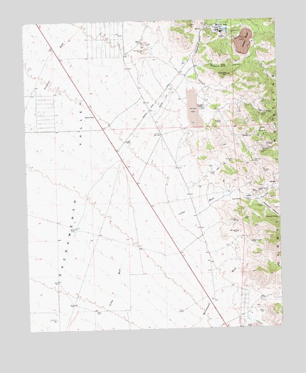
Cerbat, AZ USGS Topographic Map
Click on map above to begin viewing in our Map Viewer.

This topographic map contains these locations and features:
Feature Name Type Latitude Longitude GNIS ID View Map
Big Boy MineMineN35.3336°W114.1538°1292View Map
Bismark CanyonValleyN35.3561°W114.1669°1447View Map
Cashier MineMineN35.3369°W114.1286°2510View Map
CerbatPopulated PlaceN35.3031°W114.1397°24353View Map
Cerbat CanyonValleyN35.3031°W114.1566°2707View Map
Cerbat MineMineN35.3136°W114.1330°2708View Map
Champion MineMineN35.2933°W114.1469°2745View Map
Charcoal CanyonValleyN35.3014°W114.1358°2759View Map
Charcoal SpringSpringN35.2945°W114.1260°2760View Map
Colorado River TunnelTunnelN35.3092°W114.1633°240803View Map
Emerald Isle MineMineN35.3622°W114.1925°4428View Map
Golconda MineMineN35.3242°W114.1286°5091View Map
Golden Gem MineMineN35.3050°W114.1361°5132View Map
Gross SpringSpringN35.3570°W114.1529°5398View Map
Idaho MineMineN35.3050°W114.1372°6170View Map
Ithaca PeakSummitN35.3675°W114.1411°6285View Map
Jamison MineMineN35.3361°W114.1338°6355View Map
Mineral ParkLocaleN35.3708°W114.1530°8104View Map
Mineral Park CemeteryCemeteryN35.3700°W114.1481°8105View Map
Mint MineMineN35.3336°W114.1291°8116View Map
Mohawk MineMineN35.3206°W114.1344°8181View Map
New London MineMineN35.2889°W114.1466°8599View Map
O'Brien MineMineN35.2992°W114.1344°8840View Map
Paymaster MineMineN35.3172°W114.1377°9270View Map
Santa ClausPopulated PlaceN35.3367°W114.2163°24602View Map
So-Hi Census Designated PlaceCensusN35.2527°W114.1415°2582867View Map
Todd BasinBasinN35.3300°W114.1336°12523View Map
Turquoise MountainSummitN35.3528°W114.1502°12897View Map
Twins MineMineN35.2942°W114.1430°12978View Map
White Elephant MineMineN35.2847°W114.1397°13618View Map
Wildhorse MineMineN35.3175°W114.1486°13796View Map

Note: Coordinates in the location and feature list above are referenced to NAD83 datum.


Copyright (C) 2008-2024 Ryan Niemi / Sunset Dynamics ... All Rights Reserved