TopoQuest Logo
Do you find TopoQuest useful?
Help keep TopoQuest running and adding new maps/features by donating!
Bitcoin:  19c7KJd3qBynnjoSw5npx9KScwjBe4ifkT
Litecoin:  LXs6TkuXGGXo1vDsWCkWVdjQX94eUKd6ui
Home View Maps Find Maps Find Places Resources & Links


Chloride, Arizona Topographic Map

USGS Map Title: Chloride, AZ
USGS Map MRC: 35114D2
DRG (GeoTIFF) Download: o35114d2.tif


Neighboring USGS Topographic Map Quads:


  Dolan Springs, AZ  
35114E3
 

  Mount Tipton, AZ  
35114E2
 

  Mount Tipton SE, AZ  
35114E1
 

  Grasshopper Junction, AZ  
35114D3
 

  Chloride, AZ  
35114D2
 

  Elements Canyon, AZ  
35114D1
 

  Grasshopper Junction SE, AZ  
35114C3
 

  Cerbat, AZ  
35114C2
 

  Stockton Hill, AZ  
35114C1


Map MRC Location:

N36°
W115°
N36°
W114°
H8 H7 H6 H5 H4 H3 H2 H1
G8 G7 G6 G5 G4 G3 G2 G1
F8 F7 F6 F5 F4 F3 F2 F1
E8 E7 E6 E5 E4 E3 E2 E1
D8 D7 D6 D5 D4 D3 D2 D1
C8 C7 C6 C5 C4 C3 C2 C1
B8 B7 B6 B5 B4 B3 B2 B1
A8 A7 A6 A5 A4 A3 A2 A1
N35°
W115°
N35°
W114°

Chloride, AZ USGS 1:24K Topographic Map Preview:
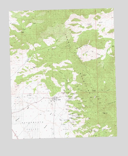
Chloride, AZ USGS Topographic Map
Click on map above to begin viewing in our Map Viewer.

This topographic map contains these locations and features:
Feature Name Type Latitude Longitude GNIS ID View Map
Altata MineMineN35.4028°W114.1841°618View Map
Argyle MineMineN35.4264°W114.1872°762View Map
Arizona Magma MineMineN35.4172°W114.2269°774View Map
Badger MineMineN35.4247°W114.1730°940View Map
Big Wash WellWellN35.4533°W114.2277°22825View Map
Blackfoot MineMineN35.3975°W114.1805°1643View Map
Brighter Days MineMineN35.4119°W114.1480°1967View Map
Bullion MineMineN35.4186°W114.1836°2187View Map
Calico PeakSummitN35.4444°W114.2211°2376View Map
Cedar SpringSpringN35.4630°W114.1261°2651View Map
Cerbat MountainsRangeN35.4311°W114.1677°2709View Map
Cherum PeakSummitN35.3978°W114.1386°2795View Map
ChloridePopulated PlaceN35.4144°W114.1994°2882View Map
Chloride CemeteryCemeteryN35.4114°W114.2069°2576292View Map
Chloride Census Designated PlaceCensusN35.4097°W114.1972°2582754View Map
Chloride Community ParkParkN35.4117°W114.1994°22881View Map
Chloride Elementary SchoolSchoolN35.4314°W114.2069°22882View Map
Chloride First Baptist ChurchChurchN35.4128°W114.1985°2670730View Map
Chloride Post OfficePost OfficeN35.4146°W114.1994°44947View Map
Clyde MineMineN35.4097°W114.1655°3044View Map
Copper Age MineMineN35.3942°W114.1791°3211View Map
Dardanelles MineMineN35.4280°W114.1836°3701View Map
Distaff MineMineN35.4180°W114.1894°3964View Map
Elkhart MineMineN35.4214°W114.1866°4413View Map
Eureka MineMineN35.3933°W114.1600°4510View Map
Fall CanyonValleyN35.4542°W114.1369°4539View Map
Fall SpringSpringN35.4550°W114.1380°22934View Map
Gold Star MineMineN35.3822°W114.1422°5121View Map
Hazel K MineMineN35.3836°W114.1472°5663View Map
Hercules MineMineN35.4219°W114.1716°5732View Map
Hidden Treasure MineMineN35.3972°W114.1722°5777View Map
Johnny Bull MineMineN35.4111°W114.1852°6489View Map
Juno MineMineN35.4230°W114.2069°6555View Map
Jupiter MineMineN35.3947°W114.1741°6560View Map
Keystone MineMineN35.3761°W114.1527°6682View Map
Lone Jack MineMineN35.3964°W114.1788°7295View Map
Lucky Boy MineMineN35.4142°W114.1500°7525View Map
Lucky Boy SpringSpringN35.4200°W114.1498°7526View Map
Manzanita MineMineN35.3983°W114.1788°7669View Map
Metallic Accident MineMineN35.3819°W114.1572°7941View Map
Midnight MineMineN35.3922°W114.1858°8029View Map
Minnesota Conner MineMineN35.4033°W114.1752°8114View Map
New Deal MineMineN35.4128°W114.1680°8593View Map
New Jersey MineMineN35.4175°W114.1750°8597View Map
New Moon MineMineN35.3805°W114.1508°8600View Map
New Tennessee MineMineN35.4128°W114.1827°8621View Map
North Fall CanyonValleyN35.4542°W114.1394°8716View Map
North Georgia MineMineN35.4150°W114.1780°8581View Map
Northern Arizona Consolidated Fire District Station 39BuildingN35.4138°W114.1992°2672632View Map
Old Comanche MineMineN35.3878°W114.1880°8942View Map
Packsaddle CampgroundLocaleN35.4522°W114.1700°9090View Map
Packsaddle MountainSummitN35.4611°W114.1652°9092View Map
Payroll MineMineN35.4144°W114.1744°9273View Map
Pinkham MineMineN35.3900°W114.1816°32998View Map
Putman SpringSpringN35.4789°W114.2333°9823View Map
Rainbow MineMineN35.4133°W114.1566°9920View Map
Samoa MineMineN35.4080°W114.1466°10800View Map
Schenectady MineMineN35.4222°W114.1836°11001View Map
Schuylkill MineMineN35.4192°W114.1866°11017View Map
Silver Age MineMineN35.4064°W114.1852°11311View Map
Silver HillSummitN35.4075°W114.2033°11330View Map
South Georgia MineMineN35.4136°W114.1763°11608View Map
Swicker SpringSpringN35.4700°W114.1841°23239View Map
Tennessee MineMineN35.4155°W114.1855°12258View Map
Towne MineMineN35.3922°W114.1919°12660View Map
Twentieth Century MineMineN35.3875°W114.1791°12918View Map
Uncle Abe MineMineN35.3958°W114.1758°13030View Map
Windy Point CampgroundLocaleN35.4355°W114.1608°13917View Map

Note: Coordinates in the location and feature list above are referenced to NAD83 datum.


Copyright (C) 2008-2025 Ryan Niemi / Sunset Dynamics ... All Rights Reserved