TopoQuest Logo
Do you find TopoQuest useful?
Help keep TopoQuest running and adding new maps/features by donating!
Bitcoin:  19c7KJd3qBynnjoSw5npx9KScwjBe4ifkT
Litecoin:  LXs6TkuXGGXo1vDsWCkWVdjQX94eUKd6ui
Home View Maps Find Maps Find Places Resources & Links


City Point, Wisconsin Topographic Map

USGS Map Title: City Point, WI
USGS Map MRC: 44090C3
DRG (GeoTIFF) Download: o44090c3.tif


Neighboring USGS Topographic Map Quads:


  City Point NW, WI  
44090D4
 

  City Point NE, WI  
44090D3
 

  Pittsville, WI  
44090D2
 

  Spaulding, WI  
44090C4
 

  City Point, WI  
44090C3
 

  Quail Point Flowage, WI  
44090C2
 

  Warrens East, WI  
44090B4
 

  Mather, WI  
44090B3
 

  Finley, WI  
44090B2


Map MRC Location:

N45°
W91°
N45°
W90°
H8 H7 H6 H5 H4 H3 H2 H1
G8 G7 G6 G5 G4 G3 G2 G1
F8 F7 F6 F5 F4 F3 F2 F1
E8 E7 E6 E5 E4 E3 E2 E1
D8 D7 D6 D5 D4 D3 D2 D1
C8 C7 C6 C5 C4 C3 C2 C1
B8 B7 B6 B5 B4 B3 B2 B1
A8 A7 A6 A5 A4 A3 A2 A1
N44°
W91°
N44°
W90°

City Point, WI USGS 1:24K Topographic Map Preview:
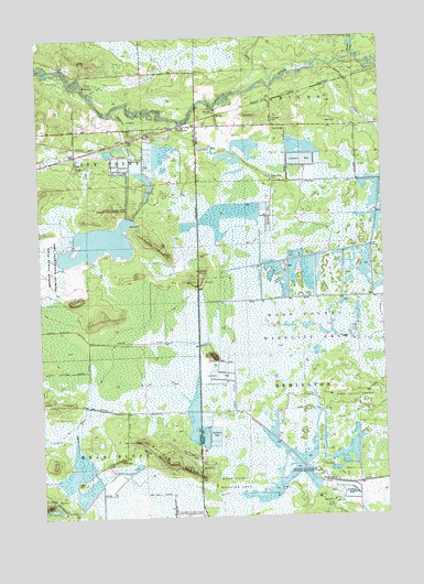
City Point, WI USGS Topographic Map
Click on map above to begin viewing in our Map Viewer.

This topographic map contains these locations and features:
Feature Name Type Latitude Longitude GNIS ID View Map
20 ReservoirReservoirN44.2622°W90.3630°1792696View Map
Beaver Creek 11 DamDamN44.2583°W90.3635°1792695View Map
Birch BluffSummitN44.2919°W90.3115°1561804View Map
Bissig DitchCanalN44.2952°W90.3224°1561833View Map
City PointPopulated PlaceN44.3522°W90.3215°1563096View Map
City Point CemeteryCemeteryN44.3508°W90.3376°1563097View Map
Deer IslandIslandN44.2797°W90.3726°1563832View Map
Hay CreekStreamN44.3636°W90.2904°1566176View Map
Hay Creek DitchCanalN44.2547°W90.3285°1566190View Map
Indian CreekStreamN44.3552°W90.3482°1566912View Map
Kert Creek 2 C-6118 DamDamN44.3250°W90.2518°1793421View Map
Kert Creek 3 C 6118 DamDamN44.3300°W90.2518°1792714View Map
Ketchum IslandIslandN44.2644°W90.3290°1567435View Map
Kurt CreekStreamN44.3666°W90.2737°1567665View Map
Lake 10-6ReservoirN44.3267°W90.2514°1793422View Map
Lake 28-11 8ReservoirN44.2649°W90.2791°1792723View Map
Lake 29-8 9ReservoirN44.2700°W90.2885°1792721View Map
Lake 3-1 16ReservoirN44.3300°W90.2548°1792715View Map
Lake 30-7ReservoirN44.2783°W90.3168°1792729View Map
Martyrs CemeteryCemeteryN44.3513°W90.3398°1569100View Map
Meadow Valley State Wildlife Management AreaParkN44.3161°W90.3712°1569289View Map
Remington 16 C 6118 DamDamN44.2783°W90.3168°1792728View Map
Remington 5 C 6118 DamDamN44.2695°W90.2888°1792720View Map
Remington 9 C 6118 DamDamN44.2633°W90.2801°1792722View Map
Remington DitchCanalN44.2583°W90.2624°1572197View Map
Skunk CreekStreamN44.3702°W90.2599°1574245View Map
Turner CreekStreamN44.3669°W90.2518°1575724View Map
Van Tassle IslandIslandN44.3214°W90.3326°1576041View Map
Weisner DitchCanalN44.3372°W90.2596°1576407View Map

Note: Coordinates in the location and feature list above are referenced to NAD83 datum.


Copyright (C) 2008-2024 Ryan Niemi / Sunset Dynamics ... All Rights Reserved