TopoQuest Logo
Do you find TopoQuest useful?
Help keep TopoQuest running and adding new maps/features by donating!
Bitcoin:  19c7KJd3qBynnjoSw5npx9KScwjBe4ifkT
Litecoin:  LXs6TkuXGGXo1vDsWCkWVdjQX94eUKd6ui
Home View Maps Find Maps Find Places Resources & Links


Clifton, Wyoming Topographic Map

USGS Map Title: Clifton, WY
USGS Map MRC: 43104F1
DRG (GeoTIFF) Download: o43104f1.tif


Neighboring USGS Topographic Map Quads:


  Newcastle, WY  
43104G2
 

  Fanny Peak, WY  
43104G1
 

  Dead Horse Flats, SD  
43103G8
 

  Owens, WY  
43104F2
 

  Clifton, WY  
43104F1
 

  Jewel Cave NW, SD  
43103F8
 

  Dewey SW, WY  
43104E2
 

  Dewey, SD  
43104E1
 

  Jewel Cave SW, SD  
43103E8


Map MRC Location:

N44°
W105°
N44°
W104°
H8 H7 H6 H5 H4 H3 H2 H1
G8 G7 G6 G5 G4 G3 G2 G1
F8 F7 F6 F5 F4 F3 F2 F1
E8 E7 E6 E5 E4 E3 E2 E1
D8 D7 D6 D5 D4 D3 D2 D1
C8 C7 C6 C5 C4 C3 C2 C1
B8 B7 B6 B5 B4 B3 B2 B1
A8 A7 A6 A5 A4 A3 A2 A1
N43°
W105°
N43°
W104°

Clifton, WY USGS 1:24K Topographic Map Preview:
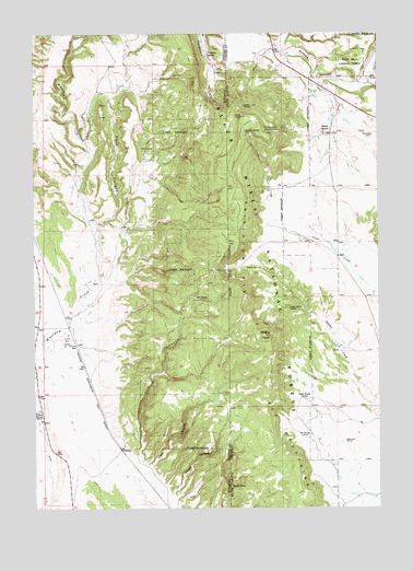
Clifton, WY USGS Topographic Map
Click on map above to begin viewing in our Map Viewer.

This topographic map contains these locations and features:
Feature Name Type Latitude Longitude GNIS ID View Map
Alray ProspectMineN43.6372°W104.0869°1746385View Map
Barrel SpringSpringN43.6308°W104.0541°1261217View Map
Blaine RanchLocaleN43.7244°W104.0210°1261297View Map
Buck Spring CanyonValleyN43.7369°W104.0046°1261359View Map
Carr CanyonValleyN43.6364°W104.0833°1261408View Map
Carr CanyonValleyN43.6369°W104.0830°1586386View Map
CliftonPopulated PlaceN43.6408°W104.0944°1609078View Map
Clifton CanyonValleyN43.6376°W104.0876°1586778View Map
Clifton SchoolLocaleN43.6508°W104.1235°1586780View Map
Dugout SpringSpringN43.6887°W104.0436°1261598View Map
Elk MountainsRangeN43.6547°W104.0424°1261633View Map
Elk Mountains Lookout TowerTowerN43.7241°W104.0413°1261634View Map
Ferguson SpringSpringN43.7446°W104.0619°1588424View Map
Foster MineMineN43.6336°W104.0924°1746383View Map
Gurney SpringSpringN43.7244°W104.0484°1261761View Map
Highlands Volunteer Fire DepartmentBuildingN43.6930°W104.0140°2581010View Map
Kouba CanyonValleyN43.6286°W104.0759°1261924View Map
Kouba CanyonValleyN43.6289°W104.0758°1590416View Map
L. Shuck Property MineMineN43.6336°W104.0577°1746384View Map
Lower Dugout SpringSpringN43.6779°W104.0329°1262002View Map
Mix SpringSpringN43.6802°W104.0651°1591668View Map
North SpringSpringN43.7309°W104.0493°1262153View Map
Rock CanyonValleyN43.6997°W104.1022°1593552View Map
Sheep Wagon SpringSpringN43.6539°W104.0277°1262398View Map
Slate SpringSpringN43.7196°W104.0846°1594446View Map
Wildcat PeakSummitN43.6702°W104.0414°1262720View Map

Note: Coordinates in the location and feature list above are referenced to NAD83 datum.


Copyright (C) 2008-2024 Ryan Niemi / Sunset Dynamics ... All Rights Reserved