TopoQuest Logo
Do you find TopoQuest useful?
Help keep TopoQuest running and adding new maps/features by donating!
Bitcoin:  19c7KJd3qBynnjoSw5npx9KScwjBe4ifkT
Litecoin:  LXs6TkuXGGXo1vDsWCkWVdjQX94eUKd6ui
Home View Maps Find Maps Find Places Resources & Links


Coffin Mountain, Oregon Topographic Map

USGS Map Title: Coffin Mountain, OR
USGS Map MRC: 44122E1
DRG (GeoTIFF) Download: o44122e1.tif


Neighboring USGS Topographic Map Quads:


  Detroit, OR  
44122F2
 

  Idanha, OR  
44122F1
 

  Mount Bruno, OR  
44121F8
 

  Chimney Peak, OR  
44122E2
 

  Coffin Mountain, OR  
44122E1
 

  Marion Forks, OR  
44121E8
 

  Harter Mountain, OR  
44122D2
 

  Echo Mountain, OR  
44122D1
 

  Santiam Junction, OR  
44121D8


Map MRC Location:

N45°
W123°
N45°
W122°
H8 H7 H6 H5 H4 H3 H2 H1
G8 G7 G6 G5 G4 G3 G2 G1
F8 F7 F6 F5 F4 F3 F2 F1
E8 E7 E6 E5 E4 E3 E2 E1
D8 D7 D6 D5 D4 D3 D2 D1
C8 C7 C6 C5 C4 C3 C2 C1
B8 B7 B6 B5 B4 B3 B2 B1
A8 A7 A6 A5 A4 A3 A2 A1
N44°
W123°
N44°
W122°

Coffin Mountain, OR USGS 1:24K Topographic Map Preview:
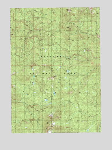
Coffin Mountain, OR USGS Topographic Map
Click on map above to begin viewing in our Map Viewer.

This topographic map contains these locations and features:
Feature Name Type Latitude Longitude GNIS ID View Map
Buck CreekStreamN44.5973°W122.0065°1138763View Map
Buck MountainSummitN44.6037°W122.0426°1138803View Map
Coffin MountainSummitN44.6215°W122.0440°1139901View Map
Coffin Mountain LookoutTowerN44.6214°W122.0443°1167114View Map
Coffin Mountain TrailTrailN44.5982°W122.0556°1139902View Map
Daly LakeLakeN44.5392°W122.0660°1140607View Map
Don LakeLakeN44.5567°W122.0935°1158212View Map
Fawn CreekStreamN44.5151°W122.0095°1153968View Map
Fisher PointSummitN44.5404°W122.0301°1142179View Map
Hawkins CreekStreamN44.6212°W122.1056°1143379View Map
Lost CreekStreamN44.6029°W122.0934°1145515View Map
Lunch CreekStreamN44.6212°W122.1076°1156087View Map
Lynx CreekStreamN44.5657°W122.0003°1145696View Map
North Fork Buck CreekStreamN44.5998°W122.0281°1146913View Map
Parish LakeLakeN44.5325°W122.0767°1147429View Map
Pinnacle PeakSummitN44.5979°W122.1245°1147745View Map
Riggs LakeLakeN44.5495°W122.0943°1158918View Map
Scar CreekStreamN44.5307°W122.1106°1149112View Map
Scar MountainSummitN44.5621°W122.1079°1149113View Map
Single CreekStreamN44.5279°W122.1076°1149536View Map
South Fork Buck CreekStreamN44.6001°W122.0278°1149938View Map
Straight Creek Cat TrailTrailN44.5623°W122.0578°1150467View Map
Three PyramidsSummitN44.5048°W122.0753°1151171View Map
Trappers ButteSummitN44.5568°W122.0670°1151401View Map
Tule LakeLakeN44.5612°W122.0466°1151484View Map

Note: Coordinates in the location and feature list above are referenced to NAD83 datum.


Copyright (C) 2008-2024 Ryan Niemi / Sunset Dynamics ... All Rights Reserved