TopoQuest Logo
Do you find TopoQuest useful?
Help keep TopoQuest running and adding new maps/features by donating!
Bitcoin:  19c7KJd3qBynnjoSw5npx9KScwjBe4ifkT
Litecoin:  LXs6TkuXGGXo1vDsWCkWVdjQX94eUKd6ui
Home View Maps Find Maps Find Places Resources & Links


Coleridge, Nebraska Topographic Map

USGS Map Title: Coleridge, NE
USGS Map MRC: 42097E2
DRG (GeoTIFF) Download: o42097e2.tif


Neighboring USGS Topographic Map Quads:


  Fordyce, NE  
42097F3
 

  Wynot, NE  
42097F2
 

  Obert, NE  
42097F1
 

  Hartington, NE  
42097E3
 

  Coleridge, NE  
42097E2
 

  Coleridge SE, NE  
42097E1
 

  Randolph North, NE  
42097D3
 

  Belden, NE  
42097D2
 

  Laurel, NE  
42097D1


Map MRC Location:

N43°
W98°
N43°
W97°
H8 H7 H6 H5 H4 H3 H2 H1
G8 G7 G6 G5 G4 G3 G2 G1
F8 F7 F6 F5 F4 F3 F2 F1
E8 E7 E6 E5 E4 E3 E2 E1
D8 D7 D6 D5 D4 D3 D2 D1
C8 C7 C6 C5 C4 C3 C2 C1
B8 B7 B6 B5 B4 B3 B2 B1
A8 A7 A6 A5 A4 A3 A2 A1
N42°
W98°
N42°
W97°

Coleridge, NE USGS 1:24K Topographic Map Preview:
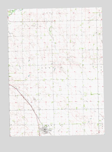
Coleridge, NE USGS Topographic Map
Click on map above to begin viewing in our Map Viewer.

This topographic map contains these locations and features:
Feature Name Type Latitude Longitude GNIS ID View Map
ColeridgePopulated PlaceN42.5061°W97.2037°828259View Map
Coleridge (historical)LocaleN42.5064°W97.2020°1874584View Map
Coleridge Ambulance ServiceBuildingN42.5066°W97.2018°2553697View Map
Coleridge Community SchoolSchoolN42.5042°W97.2042°1874597View Map
Coleridge ElevatorLocaleN42.5075°W97.2037°1874592View Map
Coleridge Medical ClinicHospitalN42.5061°W97.2034°1874589View Map
Coleridge Police DepartmentBuildingN42.5063°W97.2038°1874590View Map
Coleridge Post OfficePost OfficeN42.5061°W97.2030°1874587View Map
Coleridge Village ParkParkN42.5061°W97.2037°1874585View Map
Coleridge Village Park CampgroundLocaleN42.5061°W97.2037°1874586View Map
Coleridge Volunteer Fire DepartmentBuildingN42.5065°W97.2018°1874591View Map
Congregational ChurchChurchN42.5061°W97.2053°1874596View Map
Election Precinct 13CivilN42.5689°W97.1914°1929171View Map
Immanuel CemeteryCemeteryN42.5267°W97.1775°830238View Map
Immanuel Lutheran ChurchChurchN42.5042°W97.2034°1874594View Map
New Life Assembly ChurchChurchN42.5042°W97.2037°1874593View Map
Norris CemeteryCemeteryN42.5011°W97.1337°831650View Map
Norwegian Bow CreekStreamN42.6208°W97.2448°831767View Map
Park View Haven Nursing HomeHospitalN42.5092°W97.2070°1874588View Map
Precinct SixteenCivilN42.5006°W97.1906°1874457View Map
Precinct ThirteenCivilN42.5667°W97.1920°1874455View Map
Saint Michael CemeteryCemeteryN42.5022°W97.2056°833022View Map
Saint Michaels Catholic ChurchChurchN42.5033°W97.2070°1874595View Map
Village of ColeridgeCivilN42.5065°W97.2028°2398596View Map

Note: Coordinates in the location and feature list above are referenced to NAD83 datum.


Copyright (C) 2008-2024 Ryan Niemi / Sunset Dynamics ... All Rights Reserved