TopoQuest Logo
Do you find TopoQuest useful?
Help keep TopoQuest running and adding new maps/features by donating!
Bitcoin:  19c7KJd3qBynnjoSw5npx9KScwjBe4ifkT
Litecoin:  LXs6TkuXGGXo1vDsWCkWVdjQX94eUKd6ui
Home View Maps Find Maps Find Places Resources & Links


Cowles, New Mexico Topographic Map

USGS Map Title: Cowles, NM
USGS Map MRC: 35105G6
DRG (GeoTIFF) Download: o35105g6.tif


Neighboring USGS Topographic Map Quads:


  Sierra Mosca, NM  
35105H7
 

  Truchas Peak, NM  
35105H6
 

  Pecos Falls, NM  
35105H5
 

  Aspen Basin, NM  
35105G7
 

  Cowles, NM  
35105G6
 

  Elk Mountain, NM  
35105G5
 

  McClure Reservoir, NM  
35105F7
 

  Rosilla Peak, NM  
35105F6
 

  Honey Boy Ranch, NM  
35105F5


Map MRC Location:

N36°
W106°
N36°
W105°
H8 H7 H6 H5 H4 H3 H2 H1
G8 G7 G6 G5 G4 G3 G2 G1
F8 F7 F6 F5 F4 F3 F2 F1
E8 E7 E6 E5 E4 E3 E2 E1
D8 D7 D6 D5 D4 D3 D2 D1
C8 C7 C6 C5 C4 C3 C2 C1
B8 B7 B6 B5 B4 B3 B2 B1
A8 A7 A6 A5 A4 A3 A2 A1
N35°
W106°
N35°
W105°

Cowles, NM USGS 1:24K Topographic Map Preview:
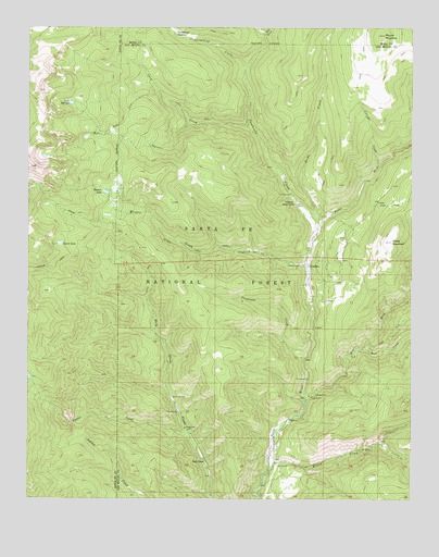
Cowles, NM USGS Topographic Map
Click on map above to begin viewing in our Map Viewer.

This topographic map contains these locations and features:
Feature Name Type Latitude Longitude GNIS ID View Map
Albright CreekStreamN35.8389°W105.6353°903064View Map
Bear CreekStreamN35.7900°W105.6428°903655View Map
Carpenter CreekStreamN35.7873°W105.6603°904785View Map
Cave CreekStreamN35.8484°W105.6781°904848View Map
Connells Cabin Historic SiteBuildingN35.7650°W105.6695°933621View Map
CowlesMineN35.7584°W105.6806°916837View Map
CowlesPopulated PlaceN35.8120°W105.6597°905458View Map
Cowles CampgroundLocaleN35.8120°W105.6625°913698View Map
Cowles Post Office (historical)Post OfficeN35.8120°W105.6597°937972View Map
Cowles Weather StationLocaleN35.8120°W105.6597°932584View Map
Doctor CreekStreamN35.7675°W105.6978°918168View Map
GeronimoPopulated PlaceN35.8225°W105.6447°913691View Map
Grass MountainSummitN35.8184°W105.6322°906707View Map
Grass Mountain Summer Home AreaPopulated PlaceN35.7989°W105.6536°913690View Map
Holy GhostPopulated PlaceN35.7600°W105.6925°907043View Map
Holy Ghost CampgroundLocaleN35.7725°W105.7009°913693View Map
Horsethief CreekStreamN35.8642°W105.6795°915840View Map
Jacks CreekStreamN35.8250°W105.6545°907288View Map
Jacks Creek CampgroundLocaleN35.8478°W105.6500°913694View Map
Lake JohnsonLakeN35.8549°W105.7368°915846View Map
Mora CampgroundLocaleN35.7692°W105.6586°913701View Map
Panchuela CampgroundLocaleN35.8311°W105.6650°913695View Map
Panchuela CreekStreamN35.8214°W105.6559°909464View Map
Panchuela Ranger StationLocaleN35.8286°W105.6631°909467View Map
Pecos MineMineN35.7592°W105.6689°916848View Map
Pecos Mine CemeteryCemeteryN35.7648°W105.6690°931205View Map
Redondo PeakSummitN35.8617°W105.7450°913684View Map
Rio MoraStreamN35.7761°W105.6595°910248View Map
Rito OscuroStreamN35.8492°W105.6970°910308View Map
Rito PerroStreamN35.8728°W105.6728°910311View Map
Round MountainSummitN35.8728°W105.6347°910447View Map
Spirit LakeLakeN35.8176°W105.7402°915904View Map
Stewart LakeLakeN35.8313°W105.7254°911416View Map
Tererro Post Office (historical)Post OfficeN35.7650°W105.6695°937781View Map
Willow CreekStreamN35.7578°W105.6717°912405View Map
Willow Creek CampgroundLocaleN35.7598°W105.6689°913692View Map
Winsor CreekStreamN35.8114°W105.6586°918411View Map
Winsor Creek Recreation SiteLocaleN35.8156°W105.6786°913696View Map
Winsor Creek Summer HomePopulated PlaceN35.8142°W105.6720°913697View Map

Note: Coordinates in the location and feature list above are referenced to NAD83 datum.


Copyright (C) 2008-2025 Ryan Niemi / Sunset Dynamics ... All Rights Reserved