TopoQuest Logo
Do you find TopoQuest useful?
Help keep TopoQuest running and adding new maps/features by donating!
Bitcoin:  19c7KJd3qBynnjoSw5npx9KScwjBe4ifkT
Litecoin:  LXs6TkuXGGXo1vDsWCkWVdjQX94eUKd6ui
Home View Maps Find Maps Find Places Resources & Links


McClure Reservoir, New Mexico Topographic Map

USGS Map Title: McClure Reservoir, NM
USGS Map MRC: 35105F7
DRG (GeoTIFF) Download: o35105f7.tif


Neighboring USGS Topographic Map Quads:


  Tesuque, NM  
35105G8
 

  Aspen Basin, NM  
35105G7
 

  Cowles, NM  
35105G6
 

  Santa Fe, NM  
35105F8
 

  McClure Reservoir, NM  
35105F7
 

  Rosilla Peak, NM  
35105F6
 

  Seton Village, NM  
35105E8
 

  Glorieta, NM  
35105E7
 

  Pecos, NM  
35105E6


Map MRC Location:

N36°
W106°
N36°
W105°
H8 H7 H6 H5 H4 H3 H2 H1
G8 G7 G6 G5 G4 G3 G2 G1
F8 F7 F6 F5 F4 F3 F2 F1
E8 E7 E6 E5 E4 E3 E2 E1
D8 D7 D6 D5 D4 D3 D2 D1
C8 C7 C6 C5 C4 C3 C2 C1
B8 B7 B6 B5 B4 B3 B2 B1
A8 A7 A6 A5 A4 A3 A2 A1
N35°
W106°
N35°
W105°

McClure Reservoir, NM USGS 1:24K Topographic Map Preview:
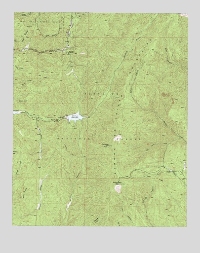
McClure Reservoir, NM USGS Topographic Map
Click on map above to begin viewing in our Map Viewer.

This topographic map contains these locations and features:
Feature Name Type Latitude Longitude GNIS ID View Map
Agua Sarca CreekStreamN35.6884°W105.8586°903020View Map
Atalaya TrailTrailN35.6686°W105.8456°913085View Map
Black Canyon Forest CampLocaleN35.7267°W105.8359°903856View Map
Chamiza TrailTrailN35.7439°W105.8603°905024View Map
Evergreen LodgeLocaleN35.7298°W105.8364°906210View Map
Glorieta BaldySummitN35.6520°W105.7997°918194View Map
Glorieta Baldy Lookout Tower Historic SiteTowerN35.6520°W105.7997°933473View Map
Glorieta Picnic AreaLocaleN35.6520°W105.7986°914136View Map
Granite PointSummitN35.6989°W105.8695°918197View Map
Granite Point ReservoirReservoirN35.6950°W105.8339°924021View Map
Hyde Memorial State ParkParkN35.7370°W105.8361°918201View Map
La Cueva RidgeRidgeN35.6534°W105.7739°918218View Map
Little Tesuque CampLocaleN35.7281°W105.8425°908053View Map
McClure DamDamN35.6950°W105.8339°924020View Map
McClure ReservoirReservoirN35.6887°W105.8310°937185View Map
Monument RockSummitN35.6963°W105.8153°901289View Map
Santa Fe Municipal WatershedReserveN35.7203°W105.7903°937199View Map
Santiago Ramirez GrantCivilN35.6895°W105.8389°918354View Map
Sierra PeladaRidgeN35.6445°W105.8678°918367View Map
Thompson PeakSummitN35.6723°W105.8064°911665View Map
Thompson Peak TrailTrailN35.6661°W105.8309°911666View Map
Wild Horse CreekStreamN35.6770°W105.7550°918409View Map

Note: Coordinates in the location and feature list above are referenced to NAD83 datum.


Copyright (C) 2008-2024 Ryan Niemi / Sunset Dynamics ... All Rights Reserved