TopoQuest Logo
Do you find TopoQuest useful?
Help keep TopoQuest running and adding new maps/features by donating!
Bitcoin:  19c7KJd3qBynnjoSw5npx9KScwjBe4ifkT
Litecoin:  LXs6TkuXGGXo1vDsWCkWVdjQX94eUKd6ui
Home View Maps Find Maps Find Places Resources & Links


Danbury East, Wisconsin Topographic Map

USGS Map Title: Danbury East, WI
USGS Map MRC: 46092A3
DRG (GeoTIFF) Download: o46092a3.tif


Neighboring USGS Topographic Map Quads:


  Ox Creek, MN  
46092B4
 

  Cloverton, MN  
46092B3
 

  Dairyland, WI  
46092B2
 

  Danbury West, WI  
46092A4
 

  Danbury East, WI  
46092A3
 

  Webb Lake, WI  
46092A2
 

  Yellow Lake, WI  
45092H4
 

  Webster, WI  
45092H3
 

  Birch Island Lake, WI  
45092H2


Map MRC Location:

N47°
W93°
N47°
W92°
H8 H7 H6 H5 H4 H3 H2 H1
G8 G7 G6 G5 G4 G3 G2 G1
F8 F7 F6 F5 F4 F3 F2 F1
E8 E7 E6 E5 E4 E3 E2 E1
D8 D7 D6 D5 D4 D3 D2 D1
C8 C7 C6 C5 C4 C3 C2 C1
B8 B7 B6 B5 B4 B3 B2 B1
A8 A7 A6 A5 A4 A3 A2 A1
N46°
W93°
N46°
W92°

Danbury East, WI USGS 1:24K Topographic Map Preview:
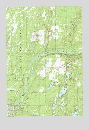
Danbury East, WI USGS Topographic Map
Click on map above to begin viewing in our Map Viewer.

This topographic map contains these locations and features:
Feature Name Type Latitude Longitude GNIS ID View Map
Bass LakeLakeN46.0348°W92.3024°1561283View Map
Berg LakeLakeN46.0144°W92.2829°1561583View Map
Big Island State Natural AreaParkN46.0722°W92.2582°2061895View Map
Briggs LakeLakeN46.0028°W92.2631°1562199View Map
Burlingame LakeLakeN46.0109°W92.2976°1562426View Map
Chases BrookStreamN46.0708°W92.2613°1560654View Map
Crystal CreekStreamN46.0413°W92.3444°642522View Map
DanburyPopulated PlaceN46.0066°W92.3713°1563691View Map
Danbury Volunteer Fire DepartmentBuildingN46.0063°W92.3715°2696752View Map
Duxbury Fire Department Markville StationBuildingN46.0921°W92.3266°2666653View Map
Island LakeLakeN46.0578°W92.2733°1567022View Map
Loon CreekStreamN46.0091°W92.3549°1568617View Map
MarkvillePopulated PlaceN46.0919°W92.3307°647545View Map
Markville CemeteryCemeteryN46.0920°W92.3173°2069863View Map
Meekers CreekStreamN46.0933°W92.3666°647744View Map
Robie LakeLakeN46.0177°W92.2953°1572407View Map
Staples LakeLakeN46.0458°W92.2733°1574798View Map
Stone LakeLakeN46.0101°W92.2591°1574927View Map
Tabor LakeLakeN46.0284°W92.2819°1575220View Map
Town of SwissCivilN46.0209°W92.2887°1584262View Map
Township of ArnaCivilN46.1136°W92.3597°663459View Map
Trout BrookStreamN46.0658°W92.3299°653341View Map
Upper Tamarack RiverStreamN46.0702°W92.3191°1815030View Map
Yellow RiverStreamN46.0122°W92.3577°1577087View Map

Note: Coordinates in the location and feature list above are referenced to NAD83 datum.


Copyright (C) 2008-2025 Ryan Niemi / Sunset Dynamics ... All Rights Reserved