TopoQuest Logo
Do you find TopoQuest useful?
Help keep TopoQuest running and adding new maps/features by donating!
Bitcoin:  19c7KJd3qBynnjoSw5npx9KScwjBe4ifkT
Litecoin:  LXs6TkuXGGXo1vDsWCkWVdjQX94eUKd6ui
Home View Maps Find Maps Find Places Resources & Links


Webster, Wisconsin Topographic Map

USGS Map Title: Webster, WI
USGS Map MRC: 45092H3
DRG (GeoTIFF) Download: o45092h3.tif


Neighboring USGS Topographic Map Quads:


  Danbury West, WI  
46092A4
 

  Danbury East, WI  
46092A3
 

  Webb Lake, WI  
46092A2
 

  Yellow Lake, WI  
45092H4
 

  Webster, WI  
45092H3
 

  Birch Island Lake, WI  
45092H2
 

  Siren West, WI  
45092G4
 

  Siren East, WI  
45092G3
 

  Hertel, WI  
45092G2


Map MRC Location:

N46°
W93°
N46°
W92°
H8 H7 H6 H5 H4 H3 H2 H1
G8 G7 G6 G5 G4 G3 G2 G1
F8 F7 F6 F5 F4 F3 F2 F1
E8 E7 E6 E5 E4 E3 E2 E1
D8 D7 D6 D5 D4 D3 D2 D1
C8 C7 C6 C5 C4 C3 C2 C1
B8 B7 B6 B5 B4 B3 B2 B1
A8 A7 A6 A5 A4 A3 A2 A1
N45°
W93°
N45°
W92°

Webster, WI USGS 1:24K Topographic Map Preview:
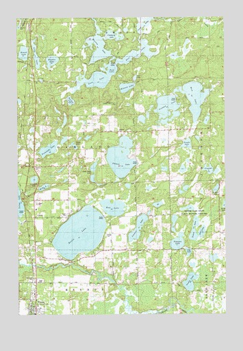
Webster, WI USGS Topographic Map
Click on map above to begin viewing in our Map Viewer.

This topographic map contains these locations and features:
Feature Name Type Latitude Longitude GNIS ID View Map
Ann LakeLakeN45.9095°W92.2643°1843093View Map
Austin LakeLakeN45.8885°W92.2717°1561028View Map
Benach LakeLakeN45.9277°W92.2557°1561554View Map
Bricher LakeLakeN45.9650°W92.3432°1843100View Map
Conners LakeLakeN45.9113°W92.3030°1563323View Map
Connor's Lake LandingAirportN45.9140°W92.2927°2444107View Map
Cranberry LakeLakeN45.9923°W92.3173°1563493View Map
Crooked LakeLakeN45.9616°W92.2847°1563548View Map
Crystal LakeLakeN45.9358°W92.2602°1563594View Map
Dahlberg LakeLakeN45.9280°W92.2739°2547918View Map
Danbury 2WP696 DamDamN45.9966°W92.3735°1791666View Map
Danbury CemeteryCemeteryN45.9949°W92.3721°1563692View Map
Danbury Lookout TowerTowerN45.9638°W92.3213°1581202View Map
Devils LakeLakeN45.9093°W92.3378°1563942View Map
Echo LakeLakeN45.9287°W92.3595°1564428View Map
Falk LakeLakeN45.9785°W92.3185°1564836View Map
Fremstadt LakeLakeN45.9446°W92.3564°1565302View Map
Gull LakeLakeN45.9839°W92.3031°1565938View Map
Ham LakeLakeN45.9662°W92.2684°1566007View Map
Hayden LakeLakeN45.9818°W92.3540°1566214View Map
Jackson SchoolLocaleN45.9236°W92.2555°1567079View Map
Johnson LakeLakeN45.9409°W92.3127°1567240View Map
Kiezer LakeLakeN45.9194°W92.2722°2771561View Map
Kiezer Lake State Public Hunting GroundsParkN45.9166°W92.2696°1843138View Map
Lily LakeLakeN45.9013°W92.2726°1568052View Map
Little Bass LakeLakeN45.9320°W92.3295°1568171View Map
Lone Pine SchoolSchoolN45.9249°W92.3716°1568509View Map
Lone Star LakeLakeN45.9319°W92.3653°1568515View Map
Long LakeLakeN45.9848°W92.3640°1568571View Map
Love LakeLakeN45.9733°W92.3289°1568704View Map
Minerva 2WP503 DamDamN45.9999°W92.3319°1792120View Map
Minerva LakeReservoirN45.9881°W92.3263°1569553View Map
Mingo LakeLakeN45.9460°W92.3414°1569555View Map
Minnow LakeLakeN45.9706°W92.3092°1569579View Map
Mud LakeLakeN45.9200°W92.3178°1569988View Map
North Memorial Ambulance Burnett CountyBuildingN45.8789°W92.3660°2698349View Map
Oak Grove CemeteryCemeteryN45.8910°W92.3655°1843157View Map
OaklandPopulated PlaceN45.9374°W92.3688°1570700View Map
Oakland CemeteryCemeteryN45.9522°W92.3166°1570703View Map
Orange CemeteryCemeteryN45.9083°W92.3246°1570846View Map
Orange SchoolSchoolN45.9019°W92.3205°1570848View Map
Our LakeLakeN45.9744°W92.3042°1570937View Map
Peterson LakeLakeN45.9051°W92.2790°1571272View Map
Round LakeLakeN45.9850°W92.3711°1572672View Map
Tanda LakeLakeN45.9466°W92.2731°1575249View Map
Tomoe LakeLakeN45.9103°W92.2690°1575503View Map
Town of OaklandCivilN45.9428°W92.3447°1583843View Map
Village of WebsterCivilN45.8800°W92.3631°1584391View Map
WebsterPopulated PlaceN45.8774°W92.3674°1576381View Map
Webster High SchoolSchoolN45.8757°W92.3738°2713302View Map
Webster Middle SchoolSchoolN45.8757°W92.3738°2713372View Map
Webster Police DepartmentBuildingN45.8778°W92.3698°2759792View Map
Webster Volunteer Fire DepartmentBuildingN45.8777°W92.3660°2696887View Map

Note: Coordinates in the location and feature list above are referenced to NAD83 datum.


Copyright (C) 2008-2024 Ryan Niemi / Sunset Dynamics ... All Rights Reserved