TopoQuest Logo
Do you find TopoQuest useful?
Help keep TopoQuest running and adding new maps/features by donating!
Bitcoin:  19c7KJd3qBynnjoSw5npx9KScwjBe4ifkT
Litecoin:  LXs6TkuXGGXo1vDsWCkWVdjQX94eUKd6ui
Home View Maps Find Maps Find Places Resources & Links


Difficulty, Wyoming Topographic Map

USGS Map Title: Difficulty, WY
USGS Map MRC: 42106A4
DRG (GeoTIFF) Download: o42106a4.tif


Neighboring USGS Topographic Map Quads:


  The Q Ranch, WY  
42106B5
 

  Pine Hill, WY  
42106B4
 

  Cameron Creek, WY  
42106B3
 

  T E Ranch, WY  
42106A5
 

  Difficulty, WY  
42106A4
 

  Windy Hill, WY  
42106A3
 

  Elmo, WY  
41106H5
 

  Como West, WY  
41106H4
 

  Como East, WY  
41106H3


Map MRC Location:

N43°
W107°
N43°
W106°
H8 H7 H6 H5 H4 H3 H2 H1
G8 G7 G6 G5 G4 G3 G2 G1
F8 F7 F6 F5 F4 F3 F2 F1
E8 E7 E6 E5 E4 E3 E2 E1
D8 D7 D6 D5 D4 D3 D2 D1
C8 C7 C6 C5 C4 C3 C2 C1
B8 B7 B6 B5 B4 B3 B2 B1
A8 A7 A6 A5 A4 A3 A2 A1
N42°
W107°
N42°
W106°

Difficulty, WY USGS 1:24K Topographic Map Preview:
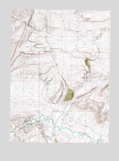
Difficulty, WY USGS Topographic Map
Click on map above to begin viewing in our Map Viewer.

This topographic map contains these locations and features:
Feature Name Type Latitude Longitude GNIS ID View Map
Beer Mug MountainSummitN42.0458°W106.4245°1585357View Map
Beer Mug RanchLocaleN42.0275°W106.4284°1585358View Map
Cold SpringSpringN42.1099°W106.4806°1586875View Map
Coulter MineMineN42.0069°W106.4920°1746800View Map
DifficultyLocaleN42.0614°W106.4050°1587614View Map
Difficulty CanyonValleyN42.0589°W106.4028°1587615View Map
Difficulty CreekStreamN42.0147°W106.4350°1587616View Map
Dry CreekStreamN42.0244°W106.4522°1587794View Map
Ellis RanchLocaleN42.0616°W106.4042°1588268View Map
Ellis Ranch AirportAirportN42.0222°W106.4258°1605615View Map
Freezeout Hills Number Four MineMineN42.0533°W106.3945°1746802View Map
Freezeout Hills Number Three MineMineN42.0533°W106.4136°1746801View Map
Freezeout MountainsRangeN42.0358°W106.3906°1597182View Map
Indian SpringSpringN42.0371°W106.4431°1589918View Map
Little BasinBasinN42.1002°W106.4009°1590734View Map
ParadisePopulated PlaceN42.0908°W106.4495°1597452View Map
Red DrawValleyN42.0564°W106.3972°1593282View Map
Rock CreekStreamN42.1208°W106.4197°1593561View Map
Schmale RanchLocaleN42.1050°W106.4156°1593991View Map
Sheep SpringSpringN42.1159°W106.4580°1594214View Map
Sledge CreekStreamN42.0025°W106.3864°1594449View Map
Smith CreekStreamN42.0919°W106.3892°1594475View Map
Walsh DrawValleyN42.0875°W106.4859°1596017View Map

Note: Coordinates in the location and feature list above are referenced to NAD83 datum.


Copyright (C) 2008-2025 Ryan Niemi / Sunset Dynamics ... All Rights Reserved