TopoQuest Logo
Do you find TopoQuest useful?
Help keep TopoQuest running and adding new maps/features by donating!
Bitcoin:  19c7KJd3qBynnjoSw5npx9KScwjBe4ifkT
Litecoin:  LXs6TkuXGGXo1vDsWCkWVdjQX94eUKd6ui
Home View Maps Find Maps Find Places Resources & Links


Globe, North Carolina Topographic Map

USGS Map Title: Globe, NC
USGS Map MRC: 36081A6
DRG (GeoTIFF) Download: o36081a6.tif


Neighboring USGS Topographic Map Quads:


  Valle Crucis, NC  
36081B7
 

  Boone, NC  
36081B6
 

  Deep Gap, NC  
36081B5
 

  Grandfather Mountain, NC  
36081A7
 

  Globe, NC  
36081A6
 

  Buffalo Cove, NC  
36081A5
 

  Chestnut Mountain, NC  
35081H7
 

  Collettsville, NC  
35081H6
 

  Lenoir, NC  
35081H5


Map MRC Location:

N37°
W82°
N37°
W81°
H8 H7 H6 H5 H4 H3 H2 H1
G8 G7 G6 G5 G4 G3 G2 G1
F8 F7 F6 F5 F4 F3 F2 F1
E8 E7 E6 E5 E4 E3 E2 E1
D8 D7 D6 D5 D4 D3 D2 D1
C8 C7 C6 C5 C4 C3 C2 C1
B8 B7 B6 B5 B4 B3 B2 B1
A8 A7 A6 A5 A4 A3 A2 A1
N36°
W82°
N36°
W81°

Globe, NC USGS 1:24K Topographic Map Preview:
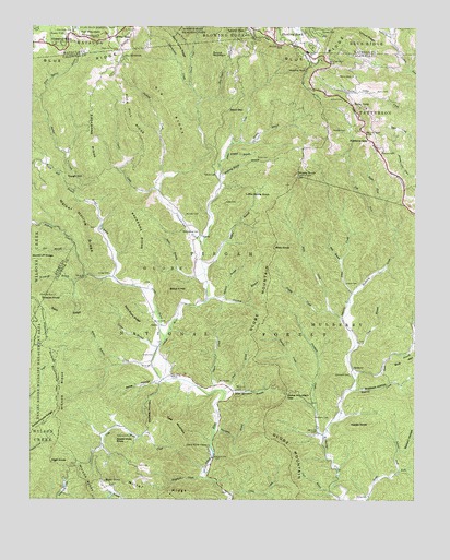
Globe, NC USGS Topographic Map
Click on map above to begin viewing in our Map Viewer.

This topographic map contains these locations and features:
Feature Name Type Latitude Longitude GNIS ID View Map
Amos CreekStreamN36.0549°W81.6454°1008712View Map
Anthony Bolick BranchStreamN36.0857°W81.6887°1008743View Map
Anthony CreekStreamN36.0585°W81.7226°1008745View Map
Apple Hole KnobSummitN36.0157°W81.7218°1018836View Map
Apple RidgePopulated PlaceN36.1101°W81.6426°1017894View Map
Backbone RidgeRidgeN36.0960°W81.7321°1008835View Map
Bailey CampPopulated PlaceN36.1046°W81.6459°1018901View Map
Bailey Camp ChurchChurchN36.1118°W81.6448°1008850View Map
Ballew CreekStreamN36.1060°W81.7473°1008903View Map
Barn RidgeRidgeN36.0485°W81.7404°1008926View Map
Benson HollowValleyN36.0128°W81.6301°1009185View Map
Big BranchStreamN36.0657°W81.7351°1009273View Map
Big RidgeRidgeN36.1035°W81.7062°1009367View Map
Bills BranchStreamN36.0635°W81.6493°1009399View Map
Billys KnobSummitN36.0551°W81.7054°1019178View Map
Blowing RockSummitN36.1137°W81.6612°1019225View Map
Blowing Rock EstatesPopulated PlaceN36.1129°W81.6595°1017896View Map
Blue Ridge ChurchChurchN36.1237°W81.7376°1009492View Map
Bolick CemeteryCemeteryN36.0904°W81.6729°1009532View Map
Bolick CemeteryCemeteryN36.1079°W81.6382°1009533View Map
Boone ForkPopulated PlaceN36.1224°W81.7384°1019256View Map
Boone Fork School (historical)SchoolN36.1235°W81.7379°1805950View Map
Boones Fork Baptist ChurchChurchN36.1221°W81.7384°1805951View Map
Boyd GapGapN36.1035°W81.6862°1009561View Map
Buckeye HollowValleyN36.0292°W81.6437°1009770View Map
Burnfield BranchStreamN36.0176°W81.6901°1009841View Map
Cane BranchStreamN36.0412°W81.6445°1009999View Map
Chestnut KnobSummitN36.1210°W81.7407°1019635View Map
China CreekStreamN36.1099°W81.6990°1010277View Map
Clark BranchStreamN36.0004°W81.6476°1010287View Map
Cline CreekStreamN36.0012°W81.6843°1010330View Map
Coffey GapGapN36.1218°W81.7251°1010364View Map
Cold Water CreekStreamN36.0074°W81.6926°1010391View Map
Cooper BranchStreamN36.0401°W81.7084°1010469View Map
Crooked BranchStreamN36.0537°W81.6873°1010587View Map
Curtis CreekStreamN36.0818°W81.7084°1010621View Map
Dixon CreekStreamN36.1060°W81.7473°1010836View Map
Dyson CreekStreamN36.0287°W81.6904°1010958View Map
Edmisten CemeteryCemeteryN36.0332°W81.6459°1011020View Map
Estes CemeteryCemeteryN36.0787°W81.6873°1011106View Map
Fair MountainSummitN36.1232°W81.7276°1020189View Map
Falcon CrestPopulated PlaceN36.0879°W81.6337°1017895View Map
Frankum CreekStreamN36.0176°W81.6543°1011385View Map
Friddle CreekStreamN36.0501°W81.6526°1011394View Map
Gay MountainSummitN36.1174°W81.7187°1020407View Map
Georges CreekStreamN36.0304°W81.6579°1011469View Map
Gilbert BranchStreamN36.0610°W81.6934°1011489View Map
GlobePopulated PlaceN36.0462°W81.7082°1020453View Map
Globe CemeteryCemeteryN36.0382°W81.7134°1018119View Map
Globe ChurchChurchN36.0357°W81.7107°1011537View Map
Globe MountainSummitN36.0540°W81.6751°1020454View Map
Globe Mountain BranchStreamN36.0282°W81.6868°1011538View Map
Globe Mountain GapGapN36.0279°W81.6668°1011539View Map
Gragg CemeteryCemeteryN36.0596°W81.7243°1011583View Map
Gragg ProngStreamN36.0424°W81.7062°1011589View Map
Grassy KnobSummitN36.0037°W81.7312°1018120View Map
Green HillPopulated PlaceN36.1235°W81.6579°1020538View Map
Greene CemeteryCemeteryN36.0168°W81.7176°1011721View Map
Greene CemeteryCemeteryN36.0573°W81.6479°1011722View Map
Greene CemeteryCemeteryN36.1060°W81.6490°1011724View Map
Harrison CemeteryCemeteryN36.0923°W81.6365°1011884View Map
Hayes KnobSummitN36.0199°W81.6454°1020654View Map
Herman CemeteryCemeteryN36.0973°W81.6526°1011990View Map
High KnobSummitN36.0101°W81.7429°1020743View Map
Honey BranchStreamN36.0946°W81.6826°1012149View Map
Johns River CampLocaleN36.0135°W81.6918°1012516View Map
Johns River ChurchChurchN36.0710°W81.6962°1012517View Map
KelseyPopulated PlaceN36.1224°W81.7248°1023427View Map
Laurel ForkStreamN36.0079°W81.6298°1012735View Map
Laurel ParkPopulated PlaceN36.1246°W81.6809°1021115View Map
Left Fork Mulberry CreekStreamN36.0760°W81.6351°988322View Map
Little Rocky KnobSummitN36.0801°W81.6815°1021235View Map
Locust RidgeRidgeN36.1221°W81.6426°1013069View Map
Long BranchStreamN36.1179°W81.6984°1013142View Map
Maple GrovePopulated PlaceN36.0054°W81.7265°1021341View Map
Maple Grove Baptist ChurchChurchN36.0101°W81.7298°1017890View Map
Martin BranchStreamN36.1226°W81.6326°1013336View Map
McLean CemeteryCemeteryN36.0754°W81.7001°1013447View Map
Miller RidgeRidgeN36.0018°W81.7062°1013592View Map
Mills CreekStreamN36.0482°W81.6484°1013597View Map
Mills KnobSummitN36.0668°W81.6712°1021473View Map
Moore CemeteryCemeteryN36.0315°W81.6887°1013679View Map
Moore CemeteryCemeteryN36.0473°W81.7059°1013680View Map
MulberryPopulated PlaceN36.0346°W81.6451°1021581View Map
Mulberry Baptist ChurchChurchN36.0346°W81.6448°1017383View Map
Mulberry CampgroundLocaleN36.0060°W81.6490°1018117View Map
Mulberry CemeteryCemeteryN36.0215°W81.6532°1013824View Map
New Years CreekStreamN36.1060°W81.6951°1013936View Map
Orchard BranchStreamN36.0526°W81.6926°1014129View Map
Pack Hill RidgeRidgeN36.1007°W81.7196°1014169View Map
Phillips CreekStreamN36.0854°W81.7071°1014372View Map
Pinchgut CreekStreamN36.0062°W81.6926°1014408View Map
Polecat KnobSummitN36.0524°W81.7468°1022022View Map
Potts HollowValleyN36.0313°W81.7089°1014619View Map
Racket CreekStreamN36.0826°W81.7334°1014707View Map
Rich CemeteryCemeteryN36.0090°W81.7145°1014852View Map
Rightfork Mulberry CreekStreamN36.0760°W81.6351°1014910View Map
Roaring CreekStreamN36.0293°W81.6440°1014937View Map
Robbins GapGapN36.0954°W81.6401°1014952View Map
Rocky KnobSummitN36.0857°W81.6634°1017384View Map
Round MountainSummitN36.1174°W81.6921°1022419View Map
Rufus Baptist ChurchChurchN36.0174°W81.6390°1017385View Map
Rufus CemeteryCemeteryN36.0010°W81.6437°1015125View Map
Rush BranchStreamN36.0479°W81.6329°1015131View Map
Sauls Camp RidgeRidgeN36.1196°W81.7032°1015289View Map
Shop BranchStreamN36.0290°W81.6876°1015474View Map
Split Rock RidgeRidgeN36.0474°W81.7179°1015731View Map
Staircase MountainSummitN36.0185°W81.7118°1022766View Map
Stein BranchStreamN36.0593°W81.6934°1015812View Map
Tate MountainSummitN36.0190°W81.7015°1022890View Map
The Forest at Blowing RockPopulated PlaceN36.1182°W81.7201°1017897View Map
Thunderhole CreekStreamN36.0682°W81.6948°1016141View Map
Tolbert CemeteryCemeteryN36.0862°W81.6901°1016168View Map
Tough HillSummitN36.0849°W81.7379°1022970View Map
Tough Hill BranchStreamN36.0812°W81.7357°1016196View Map
Township of GlobeCivilN36.0646°W81.7133°1026482View Map
Township of MulberryCivilN36.0079°W81.6321°1026490View Map
UptonPopulated PlaceN36.0701°W81.6954°1023054View Map
Walker Hollow RidgeRidgeN36.0718°W81.7334°1016403View Map
Walnut Bottom CreekStreamN36.0357°W81.7098°1016414View Map
White Spring BranchStreamN36.1060°W81.7473°1016604View Map
White Spring CemeteryCemeteryN36.1190°W81.7220°1016605View Map
Wildcat BranchStreamN36.0912°W81.6868°1016666View Map
Wilson RidgeRidgeN36.0299°W81.7404°997458View Map
Woodruff BranchStreamN36.0593°W81.7323°1016816View Map
Woodruff RidgeRidgeN36.0635°W81.7465°1016817View Map

Note: Coordinates in the location and feature list above are referenced to NAD83 datum.


Copyright (C) 2008-2024 Ryan Niemi / Sunset Dynamics ... All Rights Reserved