TopoQuest Logo
Do you find TopoQuest useful?
Help keep TopoQuest running and adding new maps/features by donating!
Bitcoin:  19c7KJd3qBynnjoSw5npx9KScwjBe4ifkT
Litecoin:  LXs6TkuXGGXo1vDsWCkWVdjQX94eUKd6ui
Home View Maps Find Maps Find Places Resources & Links


Grizzly Point, Montana Topographic Map

USGS Map Title: Grizzly Point, MT
USGS Map MRC: 46113E6
DRG (GeoTIFF) Download: o46113e6.tif


Neighboring USGS Topographic Map Quads:


  Elk Mountain, MT  
46113F7
 

  Iris Point, MT  
46113F6
 

  Ravenna, MT  
46113F5
 

  Cleveland Mountain, MT  
46113E7
 

  Grizzly Point, MT  
46113E6
 

  Spink Point, MT  
46113E5
 

  Sawmill Saddle, MT  
46113D7
 

  Quigg Peak, MT  
46113D6
 

  Alder Gulch, MT  
46113D5


Map MRC Location:

N47°
W114°
N47°
W113°
H8 H7 H6 H5 H4 H3 H2 H1
G8 G7 G6 G5 G4 G3 G2 G1
F8 F7 F6 F5 F4 F3 F2 F1
E8 E7 E6 E5 E4 E3 E2 E1
D8 D7 D6 D5 D4 D3 D2 D1
C8 C7 C6 C5 C4 C3 C2 C1
B8 B7 B6 B5 B4 B3 B2 B1
A8 A7 A6 A5 A4 A3 A2 A1
N46°
W114°
N46°
W113°

Grizzly Point, MT USGS 1:24K Topographic Map Preview:
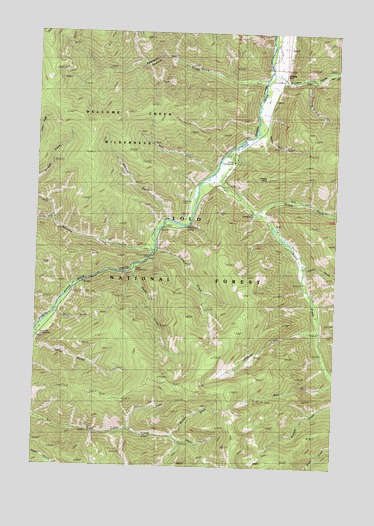
Grizzly Point, MT USGS Topographic Map
Click on map above to begin viewing in our Map Viewer.

This topographic map contains these locations and features:
Feature Name Type Latitude Longitude GNIS ID View Map
Ammon GulchValleyN46.5102°W113.7104°779011View Map
Bear GulchValleyN46.5852°W113.6787°779528View Map
Bobcat CreekStreamN46.5630°W113.7009°780181View Map
Brewster CreekStreamN46.6113°W113.6481°780383View Map
Butte Cabin Ridge TrailTrailN46.5216°W113.6790°793881View Map
Cinnabar CreekStreamN46.5713°W113.7429°781281View Map
Colusa GulchValleyN46.5571°W113.6387°781530View Map
Dalles CampgroundLocaleN46.5563°W113.7106°801865View Map
Dalles CreekStreamN46.5566°W113.7120°782062View Map
Elkhorn CreekStreamN46.5399°W113.6318°783130View Map
Fourth of July CreekStreamN46.6119°W113.6379°783657View Map
Gratton GulchValleyN46.5716°W113.6962°784218View Map
Grizzly CampgroundLocaleN46.5724°W113.6606°784348View Map
Grizzly CreekStreamN46.5727°W113.6598°784352View Map
Grizzly PointRidgeN46.5835°W113.6548°801762View Map
Gunbarrel SpringSpringN46.5689°W113.6883°784409View Map
Hamm GulchValleyN46.6041°W113.6543°784504View Map
Norton CampgroundLocaleN46.5877°W113.6687°806883View Map
Oasis GulchValleyN46.5066°W113.6887°788375View Map
QuigleyPopulated PlaceN46.6121°W113.6484°789299View Map
Quigley Post Office (historical)Post OfficeN46.6121°W113.6484°1781799View Map
Quigley School (historical)SchoolN46.6121°W113.6484°1781822View Map
Ranch CreekStreamN46.5816°W113.6737°789376View Map
Sawmill CreekStreamN46.6105°W113.6565°801870View Map
Sawmill GulchValleyN46.6105°W113.6579°790069View Map
Sawmill Sportsmans AccessLocaleN46.6208°W113.6523°794323View Map
Waho GulchValleyN46.5433°W113.7418°792751View Map
Wapato GulchValleyN46.5088°W113.6923°792797View Map
Welcome CreekStreamN46.5655°W113.7012°792931View Map
Welcome Creek CampgroundLocaleN46.5655°W113.7026°794325View Map
Welcome Creek Fishing Access SiteLocaleN46.5663°W113.6987°1744425View Map
Welcome Creek WildernessReserveN46.6029°W113.7352°801873View Map
Welcome Sawmill SaddleGapN46.6121°W113.7468°794324View Map
West Fork Ranch CreekStreamN46.5249°W113.6251°793063View Map

Note: Coordinates in the location and feature list above are referenced to NAD83 datum.


Copyright (C) 2008-2025 Ryan Niemi / Sunset Dynamics ... All Rights Reserved