TopoQuest Logo
Do you find TopoQuest useful?
Help keep TopoQuest running and adding new maps/features by donating!
Bitcoin:  19c7KJd3qBynnjoSw5npx9KScwjBe4ifkT
Litecoin:  LXs6TkuXGGXo1vDsWCkWVdjQX94eUKd6ui
Home View Maps Find Maps Find Places Resources & Links


Harrisburg, Illinois Topographic Map

USGS Map Title: Harrisburg, IL
USGS Map MRC: 37088F5
DRG (GeoTIFF) Download: o37088f5.tif


Neighboring USGS Topographic Map Quads:


  Harco, IL  
37088G6
 

  Galatia, IL  
37088G5
 

  Eldorado, IL  
37088G4
 

  Carrier Mills, IL  
37088F6
 

  Harrisburg, IL  
37088F5
 

  Rudement, IL  
37088F4
 

  Stonefort, IL  
37088E6
 

  Eddyville, IL  
37088E5
 

  Herod, IL  
37088E4


Map MRC Location:

N38°
W89°
N38°
W88°
H8 H7 H6 H5 H4 H3 H2 H1
G8 G7 G6 G5 G4 G3 G2 G1
F8 F7 F6 F5 F4 F3 F2 F1
E8 E7 E6 E5 E4 E3 E2 E1
D8 D7 D6 D5 D4 D3 D2 D1
C8 C7 C6 C5 C4 C3 C2 C1
B8 B7 B6 B5 B4 B3 B2 B1
A8 A7 A6 A5 A4 A3 A2 A1
N37°
W89°
N37°
W88°

Harrisburg, IL USGS 1:24K Topographic Map Preview:
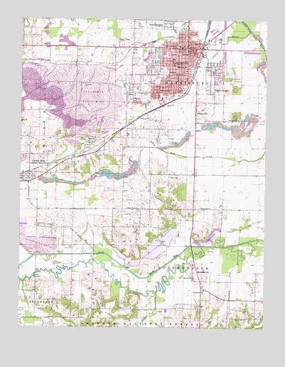
Harrisburg, IL USGS Topographic Map
Click on map above to begin viewing in our Map Viewer.

This topographic map contains these locations and features:
Feature Name Type Latitude Longitude GNIS ID View Map
Battle Ford CreekStreamN37.6389°W88.5548°424605View Map
Blackman CreekStreamN37.6570°W88.5134°424653View Map
Blackman Family CemeteryCemeteryN37.6365°W88.5204°2061887View Map
Buena VistaPopulated PlaceN37.7384°W88.5762°405151View Map
Butler Family CemeteryCemeteryN37.6864°W88.5489°405293View Map
Cain SchoolSchoolN37.7239°W88.6112°405340View Map
Cain School (historical)SchoolN37.7245°W88.6109°1820947View Map
City of HarrisburgCivilN37.7374°W88.5457°2394304View Map
Cochran HollowValleyN37.6255°W88.5251°424760View Map
Dorris HeightsPopulated PlaceN37.7495°W88.5531°407325View Map
DorrisvillePopulated PlaceN37.7187°W88.5439°1820956View Map
Dorrisville SchoolSchoolN37.7212°W88.5545°407326View Map
Duncan School (historical)SchoolN37.6289°W88.5789°1820957View Map
East Ingram Hill School (historical)SchoolN37.7095°W88.5131°1820960View Map
East Side Grade SchoolSchoolN37.7367°W88.5367°1820961View Map
Garden HeightsPopulated PlaceN37.7203°W88.5270°408877View Map
Gaskins CityPopulated PlaceN37.7306°W88.5264°1820976View Map
Gulley CemeteryCemeteryN37.6600°W88.5528°409560View Map
HarrisburgPopulated PlaceN37.7384°W88.5406°409850View Map
Harrisburg Fire DepartmentBuildingN37.7368°W88.5399°2681702View Map
Harrisburg High SchoolSchoolN37.7281°W88.5462°1820994View Map
Harrisburg Medical CenterHospitalN37.7311°W88.5231°2662349View Map
Harrisburg Medical Center HeliportAirportN37.7306°W88.5237°427352View Map
Harrisburg Post OfficePost OfficeN37.7368°W88.5422°2788583View Map
Illinois Youth Center - HarrisburgBuildingN37.7368°W88.5592°2740112View Map
Independence SchoolSchoolN37.6403°W88.5309°410812View Map
Ingram Hill ChurchChurchN37.7098°W88.5145°410901View Map
Lake View School (historical)SchoolN37.6650°W88.6126°1820986View Map
Lakeview ChurchChurchN37.6662°W88.6126°411759View Map
LedfordPopulated PlaceN37.7000°W88.5901°411904View Map
Ledford Family CemeteryCemeteryN37.7042°W88.5845°411905View Map
LibertyPopulated PlaceN37.7200°W88.5717°411981View Map
Liberty SchoolSchoolN37.7237°W88.5714°1820987View Map
Lightner HospitalHospitalN37.7395°W88.5470°412076View Map
Lincoln SchoolSchoolN37.7406°W88.5339°412139View Map
Little Saline RiverStreamN37.6434°W88.6242°425119View Map
Logan SchoolSchoolN37.7367°W88.5367°412515View Map
Macedonia ChurchChurchN37.6456°W88.5362°412793View Map
Macedonia School (historical)SchoolN37.6403°W88.5314°1820989View Map
Malan Junior High SchoolSchoolN37.7364°W88.5431°1820990View Map
McKinley SchoolSchoolN37.7309°W88.5459°413299View Map
Miller Emergency Medical ServicesBuildingN37.7295°W88.5399°2674041View Map
MitchellsvillePopulated PlaceN37.6506°W88.5378°413689View Map
Moore-Vinson Family CemeteryCemeteryN37.7434°W88.6214°413789View Map
Mount Pleasant CemeteryCemeteryN37.7239°W88.5934°414042View Map
Mount Zion ChurchChurchN37.6659°W88.6078°414119View Map
North Walnut School (historical)SchoolN37.6800°W88.5728°1820995View Map
Old ChannelStreamN37.6578°W88.5317°415000View Map
Pankey BranchStreamN37.7450°W88.5081°415342View Map
PankeyvillePopulated PlaceN37.7084°W88.5362°415344View Map
Pierson School (historical)SchoolN37.6737°W88.5359°1820998View Map
Sahara Mine Number 16MineN37.7328°W88.6137°425431View Map
Salem ChurchChurchN37.7081°W88.6245°417864View Map
Salem School (historical)SchoolN37.7023°W88.6201°1821007View Map
Saline County Ambulance ServiceBuildingN37.7357°W88.5572°2673964View Map
Saline County CourthouseBuildingN37.7345°W88.5398°1821009View Map
Saline County Sheriff's OfficeBuildingN37.7387°W88.5408°2758888View Map
Saline Ridge ChurchChurchN37.6737°W88.5328°417890View Map
South Walnut School (historical)SchoolN37.6587°W88.5639°1821016View Map
Spring Valley ChurchChurchN37.6289°W88.5084°418991View Map
Sunset HillCemeteryCemeteryN37.7298°W88.5612°419413View Map
Township of HarrisburgCivilN37.7315°W88.5411°429114View Map
Township of IndependenceCivilN37.6434°W88.5421°429164View Map
Walnut Grove ChurchChurchN37.6728°W88.5648°420456View Map
WEBQ-AM (Harrisburg)TowerN37.7175°W88.5437°428006View Map
West Side Grade SchoolSchoolN37.7339°W88.5476°1821025View Map

Note: Coordinates in the location and feature list above are referenced to NAD83 datum.


Copyright (C) 2008-2025 Ryan Niemi / Sunset Dynamics ... All Rights Reserved