TopoQuest Logo
Do you find TopoQuest useful?
Help keep TopoQuest running and adding new maps/features by donating!
Bitcoin:  19c7KJd3qBynnjoSw5npx9KScwjBe4ifkT
Litecoin:  LXs6TkuXGGXo1vDsWCkWVdjQX94eUKd6ui
Home View Maps Find Maps Find Places Resources & Links


Herod, Illinois Topographic Map

USGS Map Title: Herod, IL
USGS Map MRC: 37088E4
DRG (GeoTIFF) Download: o37088e4.tif


Neighboring USGS Topographic Map Quads:


  Harrisburg, IL  
37088F5
 

  Rudement, IL  
37088F4
 

  Equality, IL  
37088F3
 

  Eddyville, IL  
37088E5
 

  Herod, IL  
37088E4
 

  Karbers Ridge, IL  
37088E3
 

  Waltersburg, IL  
37088D5
 

  Shetlerville, IL  
37088D4
 

  Rosiclare, IL  
37088D3


Map MRC Location:

N38°
W89°
N38°
W88°
H8 H7 H6 H5 H4 H3 H2 H1
G8 G7 G6 G5 G4 G3 G2 G1
F8 F7 F6 F5 F4 F3 F2 F1
E8 E7 E6 E5 E4 E3 E2 E1
D8 D7 D6 D5 D4 D3 D2 D1
C8 C7 C6 C5 C4 C3 C2 C1
B8 B7 B6 B5 B4 B3 B2 B1
A8 A7 A6 A5 A4 A3 A2 A1
N37°
W89°
N37°
W88°

Herod, IL USGS 1:24K Topographic Map Preview:
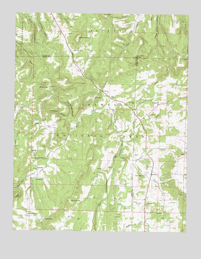
Herod, IL USGS Topographic Map
Click on map above to begin viewing in our Map Viewer.

This topographic map contains these locations and features:
Feature Name Type Latitude Longitude GNIS ID View Map
Asbell CemeteryCemeteryN37.5370°W88.4317°424580View Map
Baldwin CemeteryCemeteryN37.5442°W88.4128°424591View Map
Baldwin MineMineN37.5345°W88.4173°1955207View Map
Beartrack HollowValleyN37.5644°W88.4614°424611View Map
Beecher Williams MineMineN37.5434°W88.4170°1955208View Map
Benham HillSummitN37.5067°W88.4787°424626View Map
Bethany ChurchChurchN37.5331°W88.4006°424635View Map
Bethesda CemeteryCemeteryN37.5459°W88.4881°1820635View Map
Bethesda ChurchChurchN37.5453°W88.4878°424637View Map
Blackman CemeteryCemeteryN37.5431°W88.4275°424651View Map
Buck CreekStreamN37.5156°W88.4364°424684View Map
Collier CemeteryCemeteryN37.5073°W88.4539°424766View Map
Concord CemeteryCemeteryN37.5298°W88.4837°423620View Map
Concord ChurchChurchN37.5295°W88.4842°424770View Map
Crossroads SchoolSchoolN37.5739°W88.4134°424798View Map
Douglas MineMineN37.5184°W88.4234°1955209View Map
Drumms Mill (historical)LocaleN37.5403°W88.4270°1820642View Map
Empire MineMineN37.5275°W88.4223°424876View Map
Fulkerson CemeteryCemeteryN37.5070°W88.4970°424908View Map
Garden of the Gods Recreation AreaLocaleN37.6034°W88.3845°423618View Map
Garden of the Gods WildernessReserveN37.6037°W88.3970°2035129View Map
Gibbons CreekStreamN37.5706°W88.4284°424916View Map
Grand Pierre LakeLakeN37.5467°W88.4222°424942View Map
Grand Pierre School (historical)SchoolN37.5087°W88.4895°1725763View Map
Grand Pierre School (historical)SchoolN37.5320°W88.4417°1725764View Map
Gyp Williams HollowValleyN37.5653°W88.4598°424955View Map
Hart CreekStreamN37.5706°W88.4284°424968View Map
Harts Store (historical)LocaleN37.5512°W88.4637°1725768View Map
HartsvillePopulated PlaceN37.5359°W88.4828°424969View Map
Hartsville School (historical)SchoolN37.5414°W88.4759°1725769View Map
HerodPopulated PlaceN37.5803°W88.4362°424976View Map
Herod Post OfficePost OfficeN37.5803°W88.4359°2788677View Map
HicksPopulated PlaceN37.5431°W88.3756°424981View Map
Hicks BranchStreamN37.5434°W88.4237°424982View Map
Hicks Branch SchoolSchoolN37.5323°W88.4045°424983View Map
Hogg CemeteryCemeteryN37.5359°W88.4361°425001View Map
Honeycomb ChurchChurchN37.5734°W88.3956°425010View Map
Horton HillSummitN37.6248°W88.4370°425013View Map
Hubbards Mill (historical)LocaleN37.5209°W88.3798°1808768View Map
Hubbards Store (historical)LocaleN37.5300°W88.4017°1808769View Map
Hubbs CemeteryCemeteryN37.5109°W88.3920°425016View Map
Illinois No Name Number 82 DamDamN37.5417°W88.4067°1691013View Map
Knox Shaft Rose Creek MineMineN37.5737°W88.4095°1955230View Map
Lambert Family CemeteryCemeteryN37.6145°W88.4453°425094View Map
Lavender CemeteryCemeteryN37.5378°W88.4042°425992View Map
Mount Grove ChurchChurchN37.6037°W88.4575°425216View Map
New Baldwin MineMineN37.5398°W88.4181°1955210View Map
New Hope CemeteryCemeteryN37.5417°W88.4831°1820654View Map
New Hope ChurchChurchN37.5414°W88.4825°425239View Map
Old Grand Pierre ChurchChurchN37.5095°W88.4895°425273View Map
Old Grandpierre CemeteryCemeteryN37.5089°W88.4898°1820658View Map
One Horse GapGapN37.5175°W88.4587°425287View Map
One Horse Gap LakeLakeN37.5170°W88.4467°423625View Map
One Horse Gap Point of InterestLocaleN37.5162°W88.4587°423624View Map
Paris CemeteryCemeteryN37.5170°W88.3820°425306View Map
Partain CemeteryCemeteryN37.5770°W88.4273°425314View Map
Pharaoh Camp and Picnic AreaLocaleN37.6020°W88.3798°423619View Map
Pierce MinesMineN37.5295°W88.4217°1725784View Map
Pinhook CreekStreamN37.5564°W88.4134°425334View Map
Potato HillSummitN37.5614°W88.4856°425349View Map
Rainey MineMineN37.5425°W88.4173°1955215View Map
Red MineMineN37.5267°W88.4239°425366View Map
River to River TrailTrailN37.6028°W88.3870°423622View Map
River to River TrailTrailN37.6078°W88.3850°423623View Map
Rock Candy Mountain MineMineN37.5295°W88.4973°1955216View Map
Rose CemeteryCemeteryN37.5162°W88.4078°425415View Map
Rose CemeteryCemeteryN37.5164°W88.4034°425416View Map
Rose CreekStreamN37.5623°W88.4148°425418View Map
Rose Creek School (historical)SchoolN37.5750°W88.4142°1725788View Map
Sadler School (historical)SchoolN37.6225°W88.4556°1821003View Map
Shelby CemeteryCemeteryN37.5020°W88.4284°423626View Map
Sheldon CemeteryCemeteryN37.5134°W88.4148°425475View Map
Slapout MineMineN37.5184°W88.4253°1955218View Map
Stuby CemeteryCemeteryN37.5673°W88.4014°425529View Map
Sturgill CemeteryCemeteryN37.5084°W88.4264°425530View Map
Wallace CemeteryCemeteryN37.5595°W88.4739°425612View Map
Wallace Family CemeteryCemeteryN37.6134°W88.4625°425613View Map
Wamble MountainSummitN37.6112°W88.4545°425618View Map
Williams HillSummitN37.5823°W88.4756°425641View Map
Williams SchoolSchoolN37.5767°W88.4367°425642View Map
Yingling Shaft Rose Creek MineMineN37.5742°W88.4078°1955243View Map

Note: Coordinates in the location and feature list above are referenced to NAD83 datum.


Copyright (C) 2008-2024 Ryan Niemi / Sunset Dynamics ... All Rights Reserved