TopoQuest Logo
Do you find TopoQuest useful?
Help keep TopoQuest running and adding new maps/features by donating!
Bitcoin:  19c7KJd3qBynnjoSw5npx9KScwjBe4ifkT
Litecoin:  LXs6TkuXGGXo1vDsWCkWVdjQX94eUKd6ui
Home View Maps Find Maps Find Places Resources & Links


Jewell Ridge, Virginia Topographic Map

USGS Map Title: Jewell Ridge, VA
USGS Map MRC: 37081B7
DRG (GeoTIFF) Download: o37081b7.tif


Neighboring USGS Topographic Map Quads:


  Patterson, VA  
37081C8
 

  Bradshaw, WV  
37081C7
 

  War, WV  
37081C6
 

  Keen Mountain, VA  
37081B8
 

  Jewell Ridge, VA  
37081B7
 

  Amonate, VA  
37081B6
 

  Honaker, VA  
37081A8
 

  Richlands, VA  
37081A7
 

  Pounding Mill, VA  
37081A6


Map MRC Location:

N38°
W82°
N38°
W81°
H8 H7 H6 H5 H4 H3 H2 H1
G8 G7 G6 G5 G4 G3 G2 G1
F8 F7 F6 F5 F4 F3 F2 F1
E8 E7 E6 E5 E4 E3 E2 E1
D8 D7 D6 D5 D4 D3 D2 D1
C8 C7 C6 C5 C4 C3 C2 C1
B8 B7 B6 B5 B4 B3 B2 B1
A8 A7 A6 A5 A4 A3 A2 A1
N37°
W82°
N37°
W81°

Jewell Ridge, VA USGS 1:24K Topographic Map Preview:
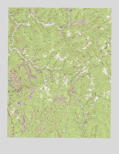
Jewell Ridge, VA USGS Topographic Map
Click on map above to begin viewing in our Map Viewer.

This topographic map contains these locations and features:
Feature Name Type Latitude Longitude GNIS ID View Map
AfredtonPopulated PlaceN37.1307°W81.7832°1497593View Map
Baldwin HollowValleyN37.1432°W81.7803°1462719View Map
Bear Pin RidgeRidgeN37.1584°W81.8621°1497600View Map
Bearwallow BranchStreamN37.2240°W81.7715°1462911View Map
Bearwallow Lookout TowerTowerN37.2207°W81.7507°1491099View Map
Beaver HollowValleyN37.1467°W81.7811°1462936View Map
Benny BranchStreamN37.1998°W81.8487°1463077View Map
Betsey BranchStreamN37.2426°W81.8490°1463254View Map
Big BranchStreamN37.2134°W81.7998°1463318View Map
Boyd CemeteryCemeteryN37.1748°W81.8573°1463729View Map
Brown School (historical)SchoolN37.2009°W81.8107°1497428View Map
Browns RidgeRidgeN37.2168°W81.8271°1463931View Map
Brushytop ForkStreamN37.2482°W81.8012°1463956View Map
Buck BranchStreamN37.2071°W81.8615°1463977View Map
Calf HollowValleyN37.1913°W81.8373°1464246View Map
Carter BranchStreamN37.1968°W81.8535°1464468View Map
Carter HollowValleyN37.1509°W81.8571°1497615View Map
Chicken Coop HollowValleyN37.1609°W81.8582°1497618View Map
Chicken RidgeRidgeN37.2268°W81.7909°1464841View Map
CoaldanPopulated PlaceN37.1615°W81.7898°1495402View Map
Cole ChapelChurchN37.2240°W81.8701°1465074View Map
Cole ChurchChurchN37.2337°W81.8196°1465075View Map
Company CemeteryCemeteryN37.1893°W81.7837°1465142View Map
Dismal River Volunteer Rescue SquadBuildingN37.2337°W81.8630°2721145View Map
Dry BranchStreamN37.2387°W81.8398°1465971View Map
Fed HollowValleyN37.1916°W81.7724°1466515View Map
Glen BurkePopulated PlaceN37.1487°W81.8290°1497645View Map
Goodwin HollowValleyN37.1376°W81.7861°1467235View Map
Goss HollowValleyN37.1921°W81.8187°1467287View Map
Goss RidgeRidgeN37.2362°W81.7626°1467288View Map
Hickory GapGapN37.1309°W81.7662°1497655View Map
Hurricane BranchStreamN37.2093°W81.8721°1468419View Map
Indian BranchStreamN37.2334°W81.8257°1468459View Map
Jewell BranchStreamN37.2184°W81.8034°1468737View Map
Jewell Camp ChapelChurchN37.2393°W81.8393°1468738View Map
Jewell ChapelChurchN37.2201°W81.7821°1468739View Map
Jewell RidgePopulated PlaceN37.1848°W81.7884°1495760View Map
Jewell Ridge Elementary SchoolSchoolN37.1857°W81.7879°1497663View Map
Jewell Ridge Post OfficePost OfficeN37.1860°W81.7860°2766231View Map
Jewell Ridge Presbyterian ChurchChurchN37.1854°W81.7882°1497664View Map
Jewell Ridge Volunteer Fire DepartmentBuildingN37.1852°W81.7878°2085873View Map
Jewell ValleyPopulated PlaceN37.2473°W81.8015°1495761View Map
Jewell Valley SchoolSchoolN37.2290°W81.8123°1468742View Map
Jones ForkStreamN37.2346°W81.8018°1468842View Map
Kinder BranchStreamN37.1915°W81.8221°1468999View Map
Lairds Chapel School (historical)SchoolN37.2021°W81.7615°1497669View Map
Lauders BranchStreamN37.2226°W81.8698°1469154View Map
Laurel ForkStreamN37.2343°W81.8623°1469176View Map
Laurel School (historical)SchoolN37.1926°W81.8312°1497463View Map
Lick BranchStreamN37.2326°W81.8268°1469383View Map
Linn Camp BranchStreamN37.2432°W81.8726°1469445View Map
Little Brushy RidgeRidgeN37.2437°W81.7698°1469484View Map
Little Hurricane BranchStreamN37.2051°W81.8729°1469566View Map
Long BranchStreamN37.1254°W81.7509°1497682View Map
Long HollowValleyN37.1252°W81.7517°1469815View Map
Low GapGapN37.1504°W81.8362°1469889View Map
Lowe CemeteryCemeteryN37.1562°W81.7712°1469903View Map
Matney School (historical)SchoolN37.1565°W81.8654°1497686View Map
Mill BranchStreamN37.2421°W81.8460°1470467View Map
Muddy HollowValleyN37.1572°W81.8553°1497695View Map
Murry HollowValleyN37.1609°W81.7898°1471280View Map
Northwestern DistrictCivilN37.1368°W81.8120°1927430View Map
Old House HollowValleyN37.1911°W81.8079°1471848View Map
Orchard HollowValleyN37.2335°W81.8194°1471943View Map
Osborne HollowValleyN37.2030°W81.8576°1471962View Map
Peak BranchStreamN37.2343°W81.7876°1472150View Map
Pendleton RidgeRidgeN37.1859°W81.8637°1472184View Map
Polecat BranchStreamN37.1976°W81.8460°1472580View Map
Raikes BranchStreamN37.2254°W81.7737°1472942View Map
Red Root RidgeRidgeN37.1271°W81.8590°1473064View Map
Reedy School (historical)SchoolN37.1676°W81.7562°1497716View Map
Reynolds RidgeRidgeN37.1929°W81.7579°1473169View Map
Sam King HollowValleyN37.1310°W81.8051°1473981View Map
Sawyer CemeteryCemeteryN37.1723°W81.8329°1474083View Map
SeaboardPopulated PlaceN37.1404°W81.7823°1496192View Map
Seaboard School (historical)SchoolN37.1382°W81.7859°1497730View Map
Seng Camp ForkStreamN37.2287°W81.8115°1474169View Map
Shortt GapPopulated PlaceN37.1573°W81.8729°1496224View Map
Smith BranchStreamN37.1507°W81.7540°1474719View Map
Smith CemeteryCemeteryN37.1784°W81.8032°1474738View Map
Smith ChurchChurchN37.1804°W81.8265°1474742View Map
Smith RidgeRidgeN37.1862°W81.7990°1474771View Map
Smith School (historical)SchoolN37.1773°W81.8293°1497736View Map
Spring BranchStreamN37.1929°W81.8273°1474975View Map
Stagger BranchStreamN37.2207°W81.8076°1475053View Map
Stevenson CemeteryCemeteryN37.1807°W81.8282°1475127View Map
Stinson RidgeRidgeN37.1779°W81.7726°1475164View Map
Stinson School (historical)SchoolN37.1723°W81.7707°1497741View Map
Stone Cove RidgeRidgeN37.1484°W81.8346°1475176View Map
Sugar Cove BranchStreamN37.2351°W81.8510°1475279View Map
Sugar Cove MountainSummitN37.2187°W81.8485°1496275View Map
Sulphur Spring (historical)Populated PlaceN37.1276°W81.7821°1497743View Map
Thompson RidgeRidgeN37.2459°W81.8109°1475661View Map
Trace ForkStreamN37.1987°W81.8518°1475825View Map
Trace RidgeRidgeN37.1548°W81.8201°1475829View Map
Ward RidgeRidgeN37.2329°W81.7571°1476311View Map
WGTH-FM (Richlands)TowerN37.1557°W81.7696°1502692View Map
Whiteplace RidgeRidgeN37.2446°W81.8176°1476659View Map
WhitewoodPopulated PlaceN37.2357°W81.8571°1496415View Map
Whitewood Elementary School (historical)SchoolN37.2421°W81.8717°1476680View Map
Whitewood Post OfficePost OfficeN37.2283°W81.8664°2766434View Map
Whitewood School (historical)SchoolN37.2243°W81.8698°1497488View Map
Whitewood Volunteer Fire DepartmentBuildingN37.2438°W81.8688°2086351View Map
Wildcat HollowValleyN37.1545°W81.7834°1476716View Map
WJHT-FM (Cedar Bluff)TowerN37.1637°W81.7682°1502611View Map
Wolfpen BranchStreamN37.2351°W81.7937°1476911View Map
Wolfpen KnobSummitN37.1654°W81.8718°1496431View Map

Note: Coordinates in the location and feature list above are referenced to NAD83 datum.


Copyright (C) 2008-2024 Ryan Niemi / Sunset Dynamics ... All Rights Reserved