TopoQuest Logo
Do you find TopoQuest useful?
Help keep TopoQuest running and adding new maps/features by donating!
Bitcoin:  19c7KJd3qBynnjoSw5npx9KScwjBe4ifkT
Litecoin:  LXs6TkuXGGXo1vDsWCkWVdjQX94eUKd6ui
Home View Maps Find Maps Find Places Resources & Links


Keaton Beach, Florida Topographic Map

USGS Map Title: Keaton Beach, FL
USGS Map MRC: 29083G5
DRG (GeoTIFF) Download: o29083g5.tif


Neighboring USGS Topographic Map Quads:


  Okefenokee Slough, FL  
29083H6
 

  Warrior Swamp, FL  
29083H5
 

  Salem, FL  
29083H4


  Keaton Beach, FL  
29083G5
 

  Salem SW, FL  
29083G4


  Crooked Point, FL  
29083F5
 

  Steinhatchee, FL  
29083F4


Map MRC Location:

N30°
W84°
N30°
W83°
H8 H7 H6 H5 H4 H3 H2 H1
G8 G7 G6 G5 G4 G3 G2 G1
F8 F7 F6 F5 F4 F3 F2 F1
E8 E7 E6 E5 E4 E3 E2 E1
D8 D7 D6 D5 D4 D3 D2 D1
C8 C7 C6 C5 C4 C3 C2 C1
B8 B7 B6 B5 B4 B3 B2 B1
A8 A7 A6 A5 A4 A3 A2 A1
N29°
W84°
N29°
W83°

Keaton Beach, FL USGS 1:24K Topographic Map Preview:
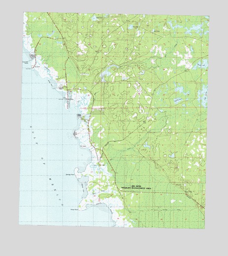
Keaton Beach, FL USGS Topographic Map
Click on map above to begin viewing in our Map Viewer.

This topographic map contains these locations and features:
Feature Name Type Latitude Longitude GNIS ID View Map
Bird IslandLocaleN29.7963°W83.5835°278805View Map
Blue CreekStreamN29.8216°W83.5804°279012View Map
Boggy BayBayN29.8330°W83.6063°279139View Map
Cedar IslandLocaleN29.8147°W83.5868°280207View Map
Coker SogSwampN29.8285°W83.5017°280635View Map
Dark IslandIslandN29.8047°W83.5896°281294View Map
Dekle BeachPopulated PlaceN29.8491°W83.6193°281470View Map
Fish CreekStreamN29.7836°W83.5688°282478View Map
Fish CreekPopulated PlaceN29.7863°W83.5721°295279View Map
Hagens CoveBayN29.7738°W83.5817°283586View Map
Horse PondLakeN29.8724°W83.5772°284282View Map
Howell PlacePopulated PlaceN29.7716°W83.5082°295362View Map
Jack Lee IslandLocaleN29.8313°W83.6001°284660View Map
Jug IslandLocaleN29.8436°W83.6168°284961View Map
Keaton BeachPopulated PlaceN29.8244°W83.5949°294218View Map
Live Oak PointCapeN29.8455°W83.6207°285879View Map
Minom SogLakeN29.8470°W83.5024°286968View Map
Oyster CreekStreamN29.7691°W83.5785°288341View Map
Piney PointCapeN29.7594°W83.5849°288958View Map
Rock PondLakeN29.8659°W83.5373°289848View Map
Salt CreekStreamN29.8205°W83.5885°290428View Map
Shaw PondLakeN29.8678°W83.5524°290945View Map
Sponge PointCapeN29.7802°W83.5876°291507View Map
Stanley BridgeBridgeN29.8061°W83.5393°291614View Map
Stanley SogLakeN29.8253°W83.5199°291618View Map
Sweetwater CreekStreamN29.8363°W83.6046°291952View Map
Sylvanmir Farms AirportAirportN29.8207°W83.5723°309547View Map

Note: Coordinates in the location and feature list above are referenced to NAD83 datum.


Copyright (C) 2008-2025 Ryan Niemi / Sunset Dynamics ... All Rights Reserved