TopoQuest Logo
Do you find TopoQuest useful?
Help keep TopoQuest running and adding new maps/features by donating!
Bitcoin:  19c7KJd3qBynnjoSw5npx9KScwjBe4ifkT
Litecoin:  LXs6TkuXGGXo1vDsWCkWVdjQX94eUKd6ui
Home View Maps Find Maps Find Places Resources & Links


Kouts, Indiana Topographic Map

USGS Map Title: Kouts, IN
USGS Map MRC: 41087C1
DRG (GeoTIFF) Download: o41087c1.tif


Neighboring USGS Topographic Map Quads:


  Palmer, IN  
41087D2
 

  Valparaiso, IN  
41087D1
 

  Wanatah, IN  
41086D8
 

  Hebron, IN  
41087C2
 

  Kouts, IN  
41087C1
 

  La Crosse, IN  
41086C8
 

  DeMotte, IN  
41087B2
 

  Wheatfield, IN  
41087B1
 

  San Pierre, IN  
41086B8


Map MRC Location:

N42°
W88°
N42°
W87°
H8 H7 H6 H5 H4 H3 H2 H1
G8 G7 G6 G5 G4 G3 G2 G1
F8 F7 F6 F5 F4 F3 F2 F1
E8 E7 E6 E5 E4 E3 E2 E1
D8 D7 D6 D5 D4 D3 D2 D1
C8 C7 C6 C5 C4 C3 C2 C1
B8 B7 B6 B5 B4 B3 B2 B1
A8 A7 A6 A5 A4 A3 A2 A1
N41°
W88°
N41°
W87°

Kouts, IN USGS 1:24K Topographic Map Preview:
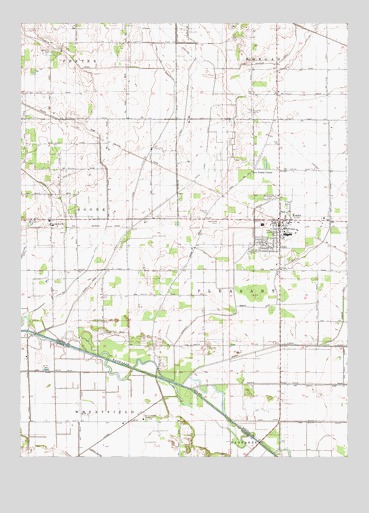
Kouts, IN USGS Topographic Map
Click on map above to begin viewing in our Map Viewer.

This topographic map contains these locations and features:
Feature Name Type Latitude Longitude GNIS ID View Map
Abundant Life Family ChurchChurchN41.2603°W87.0775°450236View Map
AylesworthPopulated PlaceN41.3184°W87.1134°430366View Map
Breyfogel DitchCanalN41.3098°W87.1234°431501View Map
Chester BranchStreamN41.3692°W87.0584°432450View Map
Crooked CreekCanalN41.2800°W87.0364°452916View Map
Five Points CornerPopulated PlaceN41.3328°W87.0359°434551View Map
Graceland CemeteryCemeteryN41.3175°W87.0489°435269View Map
Hopewell Mennonite CemeteryCemeteryN41.3206°W87.0528°452942View Map
James DitchCanalN41.2511°W87.0961°436925View Map
Jones DitchCanalN41.3517°W87.0620°437097View Map
KoutsPopulated PlaceN41.3167°W87.0259°437448View Map
Kouts Elementary SchoolSchoolN41.3145°W87.0225°447173View Map
Kouts Junior-Senior High SchoolSchoolN41.3145°W87.0225°447172View Map
Kouts Village Police departmentBuildingN41.3157°W87.0281°2758428View Map
Kouts Volunteer Fire DepartmentBuildingN41.3155°W87.0248°2626362View Map
Martin DitchCanalN41.3137°W87.0084°438667View Map
Merriman CemeteryCemeteryN41.3661°W87.1134°439030View Map
Phillips DitchCanalN41.3234°W87.0917°441089View Map
Pleasant Township DitchCanalN41.2973°W87.0434°441317View Map
Sandy Hook DitchCanalN41.3225°W87.0720°443013View Map
Town of KoutsCivilN41.3172°W87.0264°2396697View Map
Township of PleasantCivilN41.2925°W87.0001°453748View Map

Note: Coordinates in the location and feature list above are referenced to NAD83 datum.


Copyright (C) 2008-2024 Ryan Niemi / Sunset Dynamics ... All Rights Reserved